 01
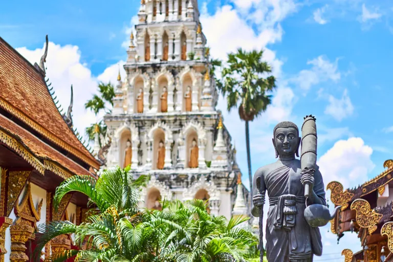
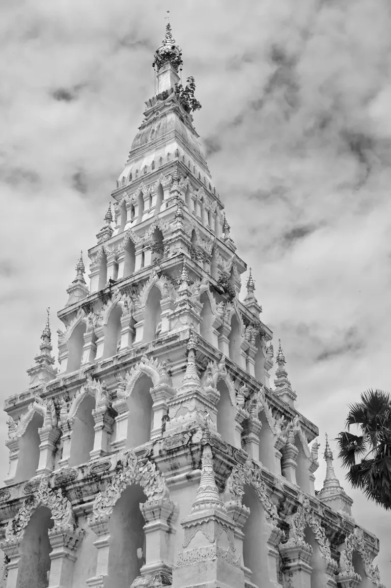
Wat Chedi LiamFive-tier chedi with 60 niches, the city's first temple
Ancient city · King Mangrai era
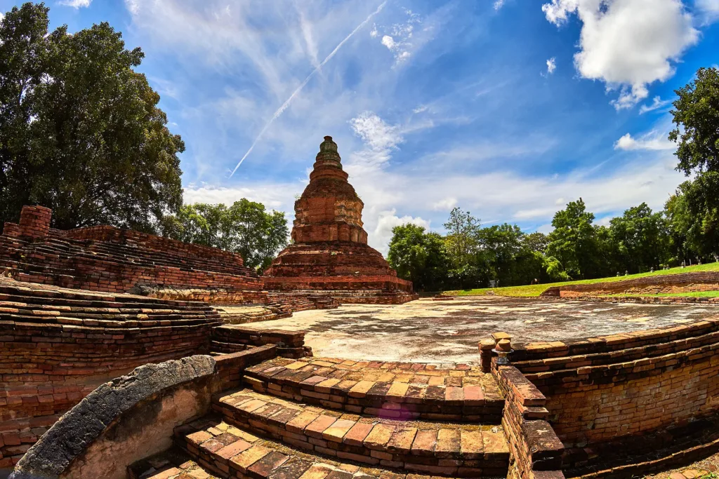
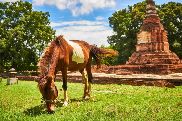
An ancient city King Mangrai built before Chiang Mai, buried for centuries under Ping River flood sand and rediscovered in 1984. With 29 registered monuments, it is best explored by horse cart, tram or bicycle.
Holiday / event — crowded · Hot (Afternoon) feels like 38°C
Information Center about 08:30–17:00 · carts and trams about 08:00–16:00
1–3 hours
Wat Chedi Liam — Five-tier chedi in evening light
Free
01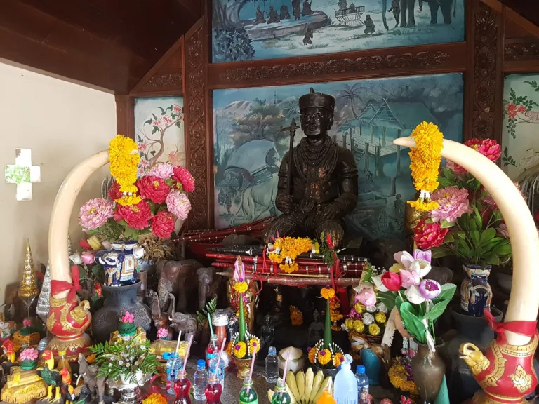 02
 03
 04
Tap a day card to see that day’s weather, rain, haze and hourly forecast
Best time to go Fine all day little rain through the day
Holiday — traffic on the way up and parking fills fast; leave early
Green band = hours used for the score
Best time to go Fine all day little rain through the day
Holiday — traffic on the way up and parking fills fast; leave early
Green band = hours used for the score
Best time to go Fine all day little rain through the day
Holiday — traffic on the way up and parking fills fast; leave early
Green band = hours used for the score
Best time to go Best window 06:00–15:00 Little rain · light drizzle possible at times
No warnings today — normal road and weather conditions
Green band = hours used for the score
Best time to go Best window 07:00–17:00 Little rain · light drizzle possible at times
No warnings today — normal road and weather conditions
Green band = hours used for the score
Best time to go Fine all day little rain through the day
No warnings today — normal road and weather conditions
Green band = hours used for the score
Best time to go Fine all day little rain through the day
No warnings today — normal road and weather conditions
Green band = hours used for the score
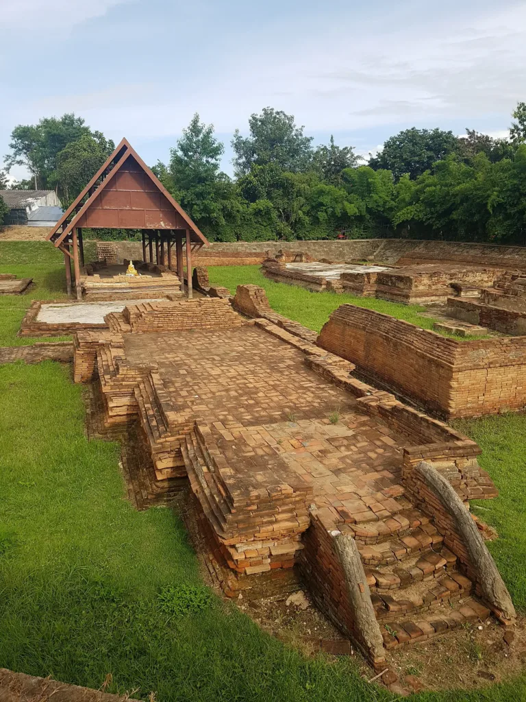
Wiang Kum Kam, Saraphi, Chiang Mai — King Mangrai's ancient city buried by Ping River sediment.
Arrive Before 10:00 or after 15:00 to avoid the strongest sun
Photos from Wikimedia Commons and contributors · full credits inClassic page
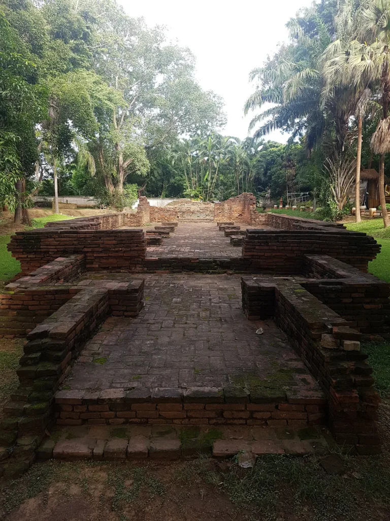
The ruins are brick in mud mortar and fragile
Little shade; bring a hat and water
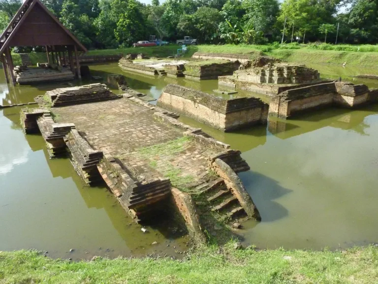
Late Sep–Oct the sunken sites may hold water
Wat Chedi Liam and Wat Chang Kham are active temples; dress modestly
Adults 0 THB · Time needed 1–3 hours
Evening festivals, light-ups and cool-season holidays
| Horse cart (2–5 people, about 1 h) optional | 300 ฿/vehicle |
| Chartered tram (about 20 seats) optional | 400 ฿/vehicle |
| Bicycle hire optional | 20 ฿/person |
| Grab from town optional | 100 ฿/person |
Horse carts and trams are cash · Prices may change by season — check with the venue
Aew Kum Kam Yam Laeng (Fine Arts Department evening festival, Dec or Feb–Mar in some years)
Tap a month on the wheel to see weather, rain, haze and crowds from 10 years of records
Best time · Nov–Feb is cool for outdoor sightseeing; go early or late for the best light
Watch out · April is very hot with little shade · late Sep–Oct brings flood risk to the ruins
Oct by the records 23–30°C · avg rain 184 mm (18 rainy days) · clear 7 days · avg PM2.5 15
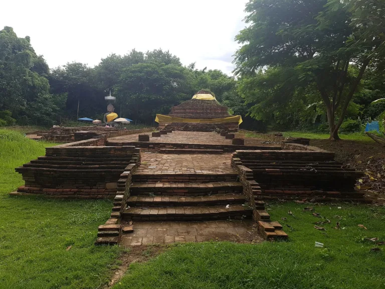
Wiang Kum Kam is a Lanna-era ancient city in Tha Wang Tan subdistrict, Saraphi district, about 5 km southeast of Chiang Mai. Its trapezoidal plan measures about 600 m by 850 m on the Ping River floodplain at about 306 m above sea level. Today 29 monuments are registered — 24 inside the walls and 5 outside — and there are over 40 sites in and around the city, which is why it is nicknamed "the underground ancient city".
Before King Mangrai arrived, a Hariphunchai (Mon) community already lived here, around the 12th–13th centuries CE. Under the viharn of Wat Kan Thom (Wat Chang Kham), archaeologists found Hariphunchai terracotta votive tablets beneath the Mangrai-era building layer, along with a jar of cremated remains with Hariphunchai incised decoration and a gilded bronze Hariphunchai Buddha with a tiered crown. The Chronicle of the Fifteen Dynasties also records a community at Wat Kan Thom before the city was founded.
Mangrai of Ngoenyang founded Chiang Rai around 1262 and then took Hariphunchai from King Yiba. Sources disagree widely on the date of that conquest: Thai chronicles imply about 1281, proponents of a later chronology say 1292, and English Wikipedia gives 1291. After the conquest Mangrai first lived at Hariphunchai and had a canal dug at Mae Chaeo, where boat traffic was so heavy that boats often collided and sank.
Every chronicle agrees that Mangrai founded Wiang Kum Kam after taking Hariphunchai, digging moats on all four sides, filling them from the Ping and adding palisades. The year is still unresolved. The Chiang Mai Chronicle, the Fifteen Dynasties chronicle and the Yonok chronicle give CS 648, or 1286–87 CE. The Jinakalamali, which Silpa Wattanatham considers the oldest written source, gives CS 665, or 1303–04. Some modern scholars propose 1294, based on Yuan Chinese records showing Hariphunchai still sending tribute in 1291.
The Mulasasana chronicle says Mangrai organised Kum Kam into three quarters — Ban Klang, Ban Lum and Ban Maen — and made its market the main trading centre of the Ping basin in place of Hariphunchai. Silpa suggests the layout copied Hariphunchai's riverside towns, and that Mangrai brought the Ku Kut idea from Lamphun to build Ku Kham.
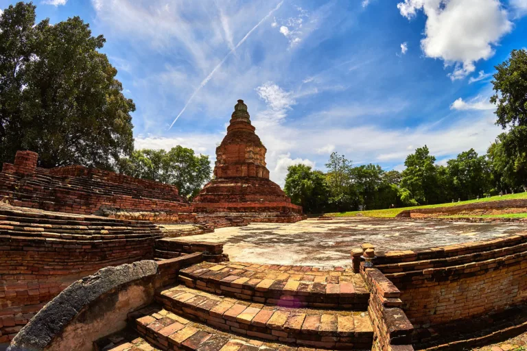
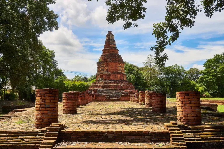
Wat Ku Kham, or Wat Chedi Liam, was the city's first temple. The Yonok chronicle dates it to 1288; the Chiang Mai Chronicle says the clay for its bricks came from Nong Tang pond; the Jinakalamali says it held 60 Buddha images; and the Nirat Hariphunchai poem says Mangrai built it for the ashes of one of his queens. Its square five-tier chedi copies the Ku Kut (Suwan Changkot) chedi at Wat Chamadevi in Lamphun.
At Wat Kan Thom, or Wat Chang Kham, Mangrai built a palace and a temple near a sacred fig. The Yonok chronicle says it was finished in CS 652 (1290), with five Buddha images cast to the king's size, three seated and two standing. The viharn was built by the craftsman Kan Thom; one tradition makes him Mangrai's grandson Muen Chetra, who prefabricated a teak viharn in Chiang Saen and assembled it at Kum Kam. The chedi was ordered in 1291, with four seated Buddhas below and one standing above. The Mangrai spirit shrine and a bodhi tree said to come from Lankan seed are still venerated today.
In 1290 Mangrai campaigned against Pagan/Ava. The king of Ava gave him the princess Usapaygo and skilled craftsmen — goldsmiths, casters and blacksmiths — whom Mangrai settled at Kum Kam, Wiang Roi and Chiang Tung, making Kum Kam a craft centre of the early Mangrai dynasty.
But Wiang Kum Kam sat on a low levee and flooded again and again; one chronicle describes the rainy-season damage. Mangrai consulted his allies Phra Ruang (Ramkhamhaeng) of Sukhothai and Ngam Mueang of Phayao, then founded Nopburi Si Nakhon Ping Chiang Mai on higher ground at the foot of Doi Suthep in 1296. Kum Kam was not abandoned; it remained a satellite town, market and religious centre for about another 250 years.
Wat Kan Thom yielded five red-sandstone inscription fragments in three scripts: old Mon, from about 1207–1307; a transitional Mon–Thai script; and Sukhothai and early Fak Kham script from about 1397. Epigraphist Dr Hans Penth thought they were probably one series inscribed at different times, and the Mon–Thai fragments matter for understanding how Tai scripts developed in Lanna. A 1499 inscription from the reign of Phra Mueang Kaeo records Nang Bunyuang's gift of a bronze Buddha to Wat Kan Thom.
On 8 December 1996, during restoration of Wat Chedi Liam, a small fragment of Thai-language inscription in Sukhothai script was found outside the western boundary wall. Matichon dates it to about 1292–1357 and calls it the oldest type of Thai script found in Lanna. The oldest dated document naming "Kum Kam" is the Wat Phra Yuen inscription in Lamphun, of 1370, which records people from Hariphunchai, Kum Kam and Chiang Mai welcoming the monk Sumana, invited by King Kue Na.
In 1310 an ailing Mangrai came to stay at Kum Kam. Queen Chit Kham, wife of King Saen Phu, visited so often that the Chip Kham bridge was built over the Mae Tho, and King Saen Mueang's son Thao Yi Kum Kam was born here. Under King Kue Na the Lankavong school of Buddhism arrived; in 1422 the monk Yan Khamphir was sent to Wat Ban Lan at Kum Kam, and in 1432 Lankavong monks were re-ordained at the Kum Kam landing.
In 1438 King Sam Fang Kaen built Wiang Chet Lin and Kum Kam's role shrank, though people still lived there; men named Han Si Phan Kum Kam and Muen Chang Kum Kam appear in war and diplomacy under King Tilokaraj. Excavations behind Wat Phra Chao Ong Dam, Wat Phaya Mangrai and Wat Nan Chang revealed an earthen dyke against the Ping built after 1455, showing that the people of Kum Kam fought the floods all along.
Science answers part of the question. In a 2015 paper in Natural Hazards, Serene Ng, Spencer Wood and Alan Ziegler interpreted a long mound on the floodplain as a dyke built after about 1411 CE, and radiocarbon-dated charcoal in the flood sand to after about 1477–1512 CE, concluding that the city was abandoned after that great flood. They called Wiang Kum Kam "the Atlantis of Lanna". The date only tells us the flood came after that window, so it is still compatible with a flood in the Burmese period. One chronicle puts it simply: "in the middle of the rains, the floods brought great ruin."
The reign of Phra Mueang Kaeo was Kum Kam's golden age. In 1517 the Phra Maha Phutthaphim image was ritually bathed at Wat Ko Kum Kam; in 1519 a large bronze Buddha was installed at Wat Kum Kam Thipharam; and in 1523 a great royal viharn was built at Wat Ku Kham. At Wat Ku Pa Dom, excavations in 2003 uncovered a Chinese-style stucco of a makara spitting a dragon on the viharn balustrade — the first such motif known in Lanna art, reflecting contact with Ming China.
After Phra Mueang Kaeo, Lanna fell into turmoil, with kings changing rapidly — Phaya Ket Chettharat, Queen Chiraprapha and Setthathirath of Lan Xang among them — until Bayinnaung took Chiang Mai in 1558 and Kum Kam slowly faded from the records. Excavations at Wat Nan Chang on 25 and 28 October 2003 found a brown-glazed jar sealed with bronze and bricks under 1.3–1.5 m of sand, holding 55 ceramic and bronze pieces; one plate bears the Wanli mark 大明萬曆年製 (1573–1619). Silpa interprets it as treasure hidden during the unrest of the Burmese period.
When the great flood buried the city is still debated. The Chiang Saen chronicle records a great flood in CS 1019 (1657), while Silpa places it in the Burmese period (1558–1774). The sand is 1.5–2 m deep — about 1.8 m at Wat Nan Chang — but only 0.5–1 m in places, suggesting some temples stayed in use afterwards. After Suliwarit died in 1759, Kum Kam no longer appears in the chronicle's list of towns. The Ping then shifted west, leaving the old channel known as Ping Hang.
In 1774 Kawila and King Taksin drove out the Burmese, and early chronicles of the Chet Ton dynasty mention Tha Wang Tan as a river port. People resettled as Ban Chang Kham, on a city abandoned for more than 200 years. Around 1908, under King Rama V, Luang Yonakan Phichit (also known as Mong Panyo or Phaya Taka), a Burmese-subject teak merchant, brought five Burmese craftsmen to restore Chedi Liam in Burmese style, adding stucco, lions, a hti and four large niches at the base, each with a different Buddha posture: meditation, seated with legs down, crowned and earth-touching.
Under King Rama VI, land deeds were issued to villagers, so many monuments ended up on private land and took their owners' names — such as Ku Pa Dom, "Aunt Dom's ku". Wat Chedi Liam was registered in the Royal Gazette as a monument on 14 March 1980. Names like Wat Pu Pia, Wat I-Khang and Wat That Khao are villagers' names: I-Khang after the langurs that once lived there, That Khao after a chedi once whitewashed with lime.
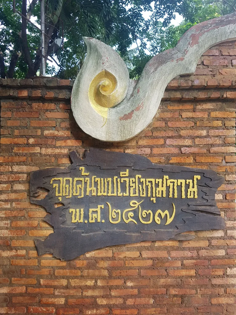
In 1984 the Fine Arts Department's Unit 4 found Hariphunchai votive tablets and the remains of the Kan Thom viharn under the lawn of Wat Chang Kham School. The survey that followed recorded 25 temple ruins, revealing the "underground city". Excavations came in rounds: in 1985–86 at Wat Chang Kham, Wat That Noi, Wat Kum Kam, Wat I-Khang, Wat Pu Pia and Wat That Khao, and in 1988–89 at Wat Ku Khao, Wat Ku Mai Song, Wat Phra Chao Ong Dam, Wat Phaya Mangrai and Wat Hua Nong.
Scholarly study began almost at once. On 11 July 1985 Dr Hans Penth and Prof. Piriya Krairiksh lectured at the Siam Society on new Lanna evidence for the development of early Thai script, using the Wat Kan Thom inscription. Around 1986 Prof. Saraswadee Ongsakul of Chiang Mai University began researching Wiang Kum Kam; her book on the ancient community, first published in 1994, reached its seventh edition in 2018 and is the standard work.
In 1996–97 Chedi Liam was conserved with foreign loan funds; work uncovered a funerary urn, pottery from many kilns, Chinese porcelain and a Hariphunchai-style Buddha face. Excavations in 1999–2000 showed that the ditch long thought to be the west wall was actually a later farm canal. Wat Chang Kham was registered as a monument on 21 December 2001, and much restoration and landscaping took place in 1999–2005, summarised in the Fine Arts Department's book "Three Decades of Archaeology at Wiang Kum Kam" (2005).
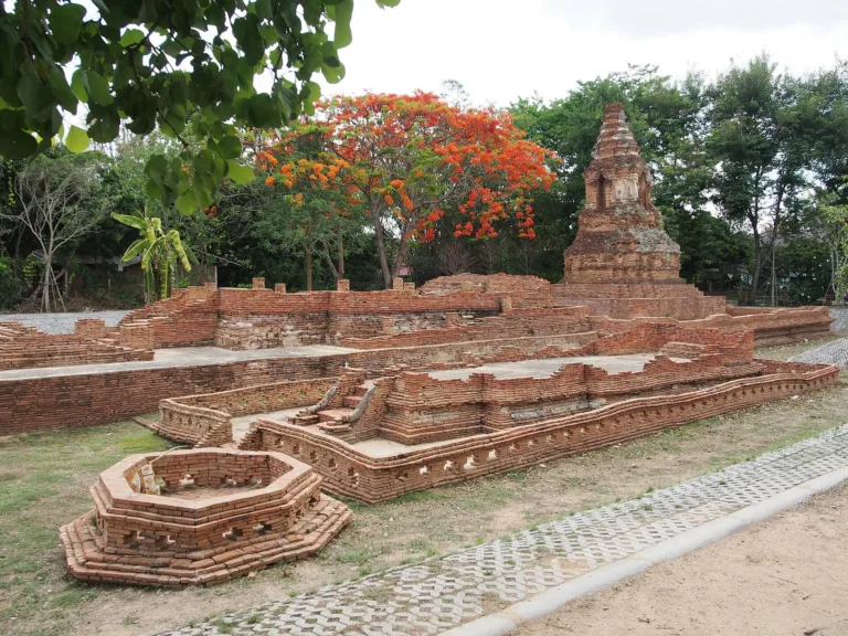
In October 2002 the "Sustainable Conservation and Development: Wiang Kum Kam – Lanna Heritage" project spent about 39.5 million baht on restoration. Excavations at Wat Nan Chang in 2002–03 found two buildings of different periods stacked one on the other — unique at the site — with stucco makara, qilin, hemaraja and lions, and in 2003 Wat I-Khang's enclosure wall was uncovered. Wat Hua Nong is the largest site, about the size of a football field, with stucco elephants around the chedi base, an archway Saraswadee attributes to royal craftsmen of Lanna's golden age, and a passage between two brick walls that may have been the north gate. Wat Ku Khao keeps only half of its square-based chedi beside the Chiang Mai–Lamphun road and its century-old yang trees.
In 2003 the Tourism Authority of Thailand included Wiang Kum Kam in its "Unseen in Thailand" campaign, and villagers began running horse carts and trams. The information centre counted 24,697 Thai visitors in 2010. Water remains the big challenge: in 2005 the Ping burst its banks three times, and in 2011 floods inundated more than 26 sites for one to two months, with a long-term fix estimated at over 2 billion baht.
Caring for an ancient city on private land is not easy: the Fine Arts Department has legal authority over the monuments, but the surrounding land belongs to villagers, so community participation is essential. Charnnarong Srisuwan's 2011 PhD thesis in Italy proposed master-plan guidelines for the site, and a 2023 survey of 383 residents of Nong Phueng found their participation in tourism management only moderate.
In October 2022 floods reached about 20 sites; Ku Pa Dom, Wat Nan Chang, Wat That Khao and the Kan Thom viharn lie below ground level and flood regularly. October 2024 brought the worst flood on record: Ku Pa Dom stood under more than 2 m of water for nearly a month, and the makara-dragon stucco was protected with cloth wraps and lime-mortar injections. The Fine Arts Department began pumping on 16 October and pumped slowly, because the walls are brick laid in mud mortar and the water pressure was helping to hold them up.
The ancient city is finding new life. On 1–2 December 2023 the Fine Arts Department held the first "Aew Kum Kam Yam Laeng" evening festival, with night horse-cart rides, khon masked dance and a night market. On 6–8 April 2024 3D projections lit up Chedi Liam for Songkran; the second festival, "Moon and Me", followed on 21–22 December 2024, and the third on 27 February–1 March 2026 at the Wat I-Khang–Wat Nan Chang grounds.
Arrived? Check in, collect a stamp and tell others what it is like right now
Check your location first, so you do not fill in the form for nothing
Location must be on and within 1.5 km · One check-in per place per day · come back on other days to check in again
Post photos from anywhere — no need to be here · Up to 20 photos at a time · JPG / PNG / WebP · GPS location data is removed automatically
From town · About 100 baht
Via the Middle Ring Road · Fuel
Agree the fare and a return pickup · Negotiable
The Wiang Kum Kam Information Center is on the Middle Ring Road east of the Ping; or turn off the Chiang Mai–Lamphun road at Wat Si Bun Ruang
At the Information Center and at Wat Chedi Liam and Wat Chang Kham
Strong 4G throughout
Information Center about 08:30–17:00 · carts and trams about 08:00–16:00
around 5 km fromChiang Mai city
Wiang Kum Kam
0 THB
Approx. nightly price for 2 adults (next week) · final price depends on your dates
Answers travellers want before they go — a one-minute read
The city Mangrai built after taking Hariphunchai and before Chiang Mai; later buried by Ping sediment and rediscovered in 1984
Yes — founded around 1286–1294, before Chiang Mai (1296), and inhabited for about 250 years after
Repeated floods, then a great flood in the Burmese period buried it under 1.5–2 m of sand
Walking is free; some listings mention 10 baht; carts and trams cost extra
About 300 baht per cart for 2–5 people, about an hour
No; the brick is set in mud mortar and very fragile
Best day this week: Thursday 29 Oct · Check in when you arrive to collect a stamp