 01
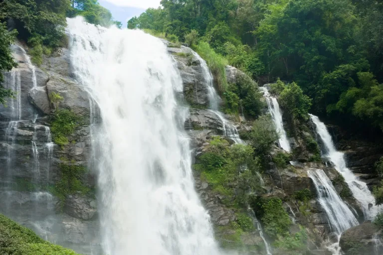
The main fallDrops 70–80 m off a granite cliff
Waterfall · Doi Inthanon National Park
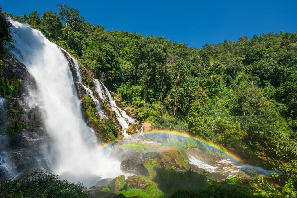
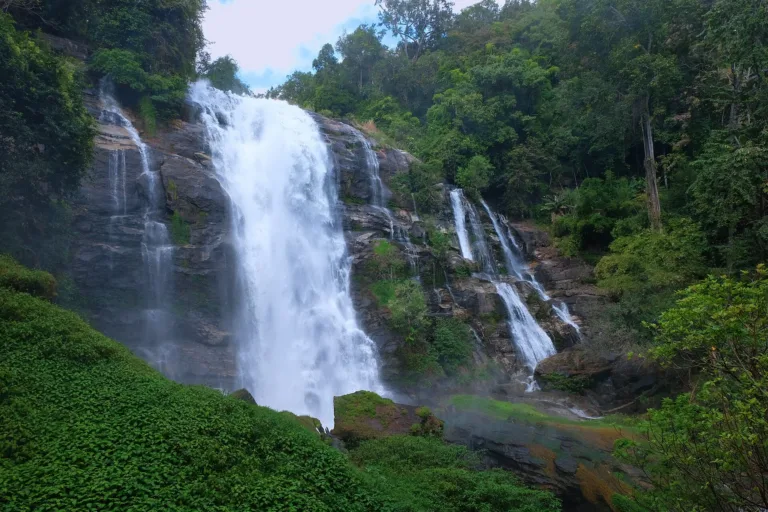
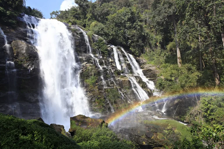
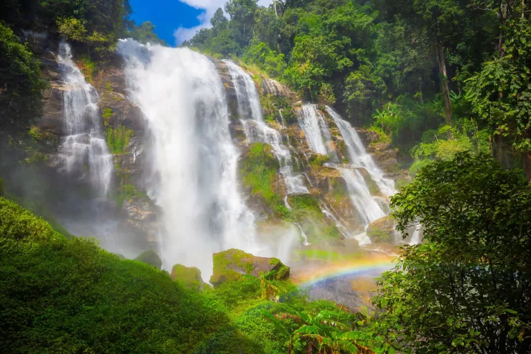
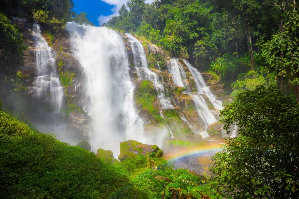
A 70–80 m waterfall on the Mae Klang stream at km 21 of the Doi Inthanon road, once called Tat Khong Yong. Park close, walk a short way, and expect heavy spray and frequent rainbows on sunny mornings.
Holiday / event — crowded
most waterfalls and parks close around 16:30
Jun – Sep (wettest)
No swimming — Entering the water is banned all year
Falls 06:00–17:00 · park gate about 05:00–18:00
30–60 minutes
01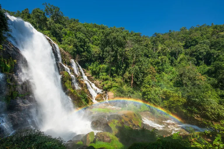 02
 03
 04
Tap a day card to see that day’s weather, rain, haze and hourly forecast
Best time to go Fine all day little rain through the day · light drizzle possible at times
Holiday — traffic on the way up and parking fills fast; leave early
Green band = hours used for the score
Best time to go Best window 06:00–14:00 Little rain · light drizzle possible at times
Holiday — traffic on the way up and parking fills fast; leave early
Green band = hours used for the score
Best time to go Fine all day little rain through the day · light drizzle possible at times
Holiday — traffic on the way up and parking fills fast; leave early
Green band = hours used for the score
Best time to go Best window 06:00–14:00 Little rain · light drizzle possible at times
No warnings today — normal road and weather conditions
Green band = hours used for the score
Best time to go Best window 06:00–14:00 Little rain · light drizzle possible at times
Thick morning fog with visibility under 1 km — use headlights and drive slowly
Green band = hours used for the score
Best time to go Best window 11:00–19:00 Little rain · light drizzle possible at times
No warnings today — normal road and weather conditions
Green band = hours used for the score
Wachirathan Waterfall, Doi Inthanon National Park, Chom Thong, Chiang Mai — a big fall on the Mae Klang stream, once known as Tat Khong Yong.
Arrive Before 10:30, ahead of the tour vans
Photos from Wikimedia Commons and contributors · full credits inClassic page
Entering the water is banned all year
Paths, steps and the wooden bridge are very slippery
Heavy rain upstream raises the water fast; follow park notices
Cameras and phones get soaked; bring a dry bag
Adults 60 THB · Car 30 THB · Time needed 30–60 minutes
Weekends Nov–Feb and New Year; tour vans arrive 10:30–12:00
| Park entry, Thai adult optional | 60 ฿/person |
| Park entry, Thai child optional | 30 ฿/person |
| Park entry, foreign adult optional | 300 ฿/person |
| Park entry, foreign child optional | 150 ฿/person |
| Car optional | 30 ฿/vehicle |
| Motorbike optional | 20 ฿/vehicle |
| Chartered songthaew from Chom Thong optional | 200 ฿/person |
Park entry in cash at the gate; most stalls accept transfers · Prices may change by season — check with the venue
Tap a month on the wheel to see weather, rain, haze and crowds from 10 years of records
Best time · Jul–Oct has the strongest flow, clouds of spray and frequent rainbows · Nov–Jan still has plenty of water and cool air
Watch out · Feb–Apr has lower flow and haze · may close temporarily after heavy rain
Oct by the records 20–26°C · avg rain 203 mm (22 rainy days) · clear 6 days · avg PM2.5 8
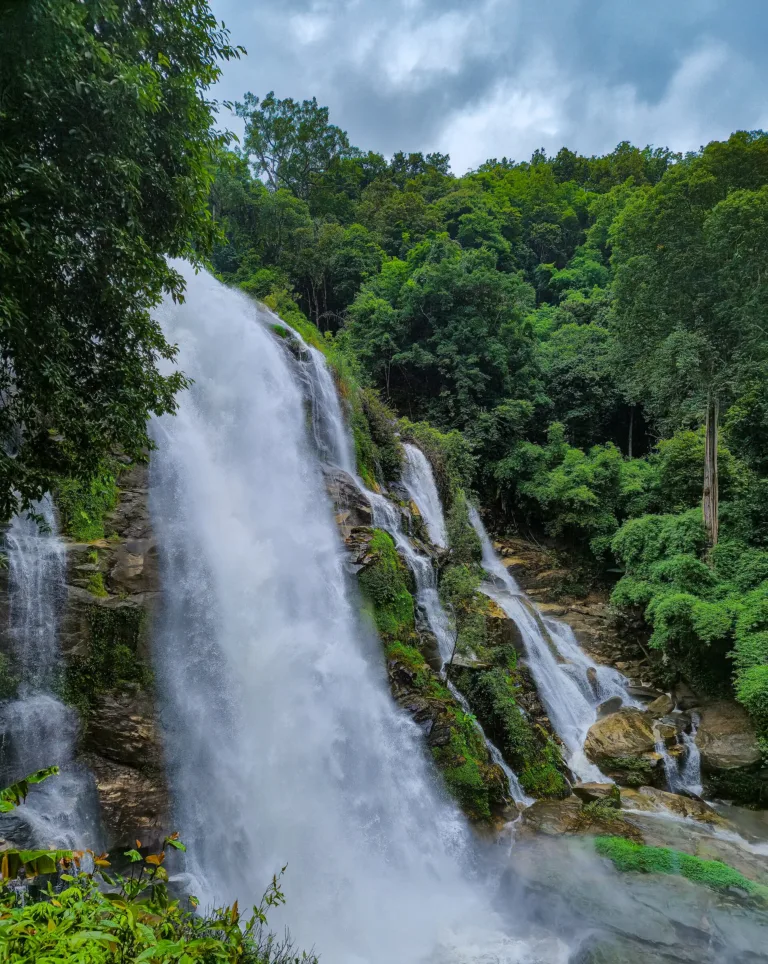
Wachirathan Waterfall lies in Doi Inthanon National Park, Ban Luang subdistrict, Chom Thong district, beside Highway 1009 (Chom Thong–Doi Inthanon summit) at about km 21. It is fed by the Mae Klang stream flowing down from the summit and drops off a granite escarpment in one big fall. Most Thai sources put its height at about 70 m, while English Wikipedia and many foreign sites say about 80 m. The falls sit at about 750 m above sea level.
The waterfall's old name was Tat Khong Yong. "Tat" in northern Thai and Lao means a waterfall over a rock shelf; no source explains "khong yong". One 2007 online record calls it "Mueang Yong", probably a mishearing. It was later renamed Wachirathan after the royal name of the then Crown Prince, now King Vajiralongkorn: "wachira" means diamond or thunderbolt and "than" means stream.
No document states the year of the renaming. He held the title of Crown Prince from 28 December 1972 until his accession in 2016, so the renaming must fall in that period, most likely after the national park was declared in late 1972. Claims that the old name was "Lao Lue" are wrong: Lao Lue was the old name of Siriphum Waterfall, after a nearby Hmong village.
The waterfall's story is tied to the mountain above it. Doi Inthanon was once called Doi Luang or Doi Ang Ka. Manager Online explains Ang Ka as a pond near the summit where crows came to bathe, while Matichon Weekly suggests it is a Pgaz K'nyau (Karen) word for "big mountain". Neither explanation is settled.
King Inthawichayanon, seventh ruler of Chiang Mai of the Chet Ton dynasty and father of Princess Dara Rasmi, cared about the northern forests and wished his remains to be kept on Doi Luang. After he died on 23 November 1897 the mountain became known as Doi Inthanon, and a reliquary stupa stands on the summit to this day.
Historian Somrit Luechai, writing in Silpa Wattanatham in 2025, argued that the story of Dara Rasmi carrying his ashes to the summit comes from only two later books, while three accounts by people close to her say only that she stayed two nights on the summit and left a marker. He suggests the ashes may have stayed with her, so the question remains open.
Becoming a national park took almost 20 years. On 7 October 1959 the Cabinet named the Doi Inthanon forest one of the first 14 forests to become national parks. In 1965 the Royal Forest Department sent Niphon Buntharom to survey it, and in 1972 Udom Thananchayanon surveyed it by helicopter. English sites that give 1954 as the founding year are confusing it with a forest-protection law of that year.
On 2 October 1972, Revolutionary Council Announcement No. 223 under Field Marshal Thanom Kittikachorn declared Doi Inthanon Thailand's sixth national park, about 270 km². On 16 January 1974 King Bhumibol and Queen Sirikit visited Doi Khun Klang and asked for the park to be expanded to protect the watershed, leading to the Royal Project Inthanon.
The park kept growing. On 27 February 1974 the Cabinet allowed the Air Force to build a radar station on the summit, and the summit road was cut by military units, though no source gives the year Highway 1009 was built. In 1975 the Inthanon, Chom Thong and Mae Chaem forest reserves were merged, and a royal decree of 13 June 1978 set the park at 301,500 rai, about 482 km².
The road is what opened Wachirathan to ordinary visitors. Highway 1009 enters the park at km 8 and climbs another 48 km to the summit; an older traveller's account says the Army cut it in the 1970s to reach the summit radar station. The exact year is still unknown, but before the road, few outsiders ever saw this waterfall deep in the forest.
Wachirathan belongs to a group of royally named falls on Doi Inthanon. Just upstream on the Mae Klang is Sirithan, formerly Pa Kha, about 50 m high. Siriphum Waterfall at Khun Klang, formerly Lao Lue, was renamed in honour of King Bhumibol and Queen Sirikit. Downstream is Mae Klang Waterfall near the park entrance, and all of these waters flow into the Ping River.
Pgaz K'nyau (Karen) communities lived on the slopes around the falls before the park existed. English Wikipedia places the falls near Ban Sop Had, and at about km 26 is Ban Mae Klang Luang, a village of rice terraces and coffee with homestays. A 2021 Chulalongkorn study looked at how community tourism reshaped Karen identity there and how villagers negotiated with the park boundaries. Hmong villages lie higher up near Khun Klang. No Karen or Hmong name for the falls has been found.
The Mae Klang stream that feeds Wachirathan is also a lifeline for communities. Ban Mae Klang Luang upstream has several founding stories, from 1787 and 1870 to its formal founding in 1934. In the 1980s and early 1990s lowland farmers in Chom Thong downstream clashed with mountain villages over water use and chemicals from cabbage fields, and a Chulalongkorn thesis records water conflicts in the Mae Klang basin in 1996–1999. The "diamond stream" matters to people both on the mountain and on the plain.
No royal visit to Wachirathan itself has been found, though there is a photo of Queen Sirikit at Sirithan Waterfall just upstream, and Bangkok Biz News notes that members of the royal family visited almost every part of Doi Inthanon. A fresh exact-phrase search for "Tat Khong Yong" turned up no older documents at all, so the old name survives only in travel articles, and the meaning of "khong yong" remains a puzzle — perhaps the booming sound of water like a hanging gong, though there is no evidence for this.
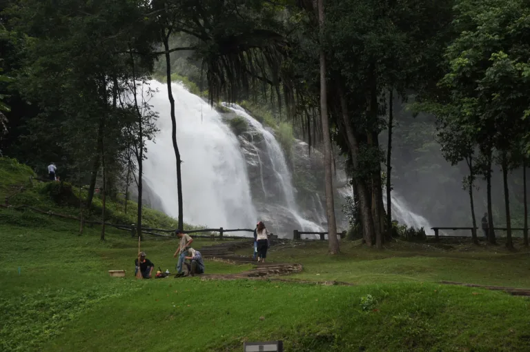
As Doi Inthanon grew popular, Wachirathan became the most-visited waterfall on the summit road because you can park close and walk only a short way. A 2009 traveller recorded a steep side road of about 800 m, a car park by a ranger post, a 100 m walk, a small bridge toward the water, a restaurant and toilets; park entry was then 40 baht.
In 2017 THE STANDARD described a wooden bridge reaching toward the cliff, with the best view from its end but wet and slippery in high water. Today there are two viewpoints — in front of the falls, and an upper path looking down where rainbows show clearly — and a loop walk of about 30 minutes. Across the gorge is a cliff known as Pha Mon Kaeo or Pha Waen Kaeo. The car park has restaurants, coffee and grilled corn.
The Mae Klang stream drains the country's highest mountain, so after heavy rain upstream the water rises fast and can turn red-brown within hours. The park has closed falls on this system many times: on 14 September 2016 during Tropical Storm Rai, Mae Klang and Mae Ya falls were closed and the Mae Klang flooded villages in Ban Luang; on 24 October 2017 a flash flood closed Mae Klang Waterfall; and on 17 September 2023 the park banned swimming at all waterfalls.
Over Songkran, 10–16 April 2021, Wachirathan was among the sites closed to control COVID-19. In September 2026 about 200 mm of rain fell near the summit; the park closed several waterfalls and asked visitors to avoid water activities, and Thairath later reported that Mae Ya, Wachirathan and Pha Dok Siew had reopened as normal. Swimming at Wachirathan is banned all year.
Since 7 June 2022, Doi Inthanon has been in fee group 3: Thai adults 60 baht, children 30; foreigners 300 and 150; cars 30, motorbikes 20. One ticket covers every site in the park, including Wachirathan. In 2025 the park department began pushing for Doi Inthanon to become an ASEAN Heritage Park; the Cabinet approved the nomination on 15 September 2026, aiming for recognition by 2027.
The nomination dossier describes 296,922 rai of park, about 89.5% natural forest, more than 1,271 plant species, and a headwater of the Ping River supplying over 540 million m³ of water a year. The water passing over Wachirathan is part of what feeds the Chiang Mai–Lamphun plain and flows on to the Chao Phraya.
To see the falls at their most powerful, come from July to October, when the spray soaks you through. On sunny mornings around 09:00–11:00 rainbows often hang in the mist. For an easier visit, November to January still has plenty of water and cool air, while February to April the flow drops but never dries up.
Arrived? Check in, collect a stamp and tell others what it is like right now
Check your location first, so you do not fill in the form for nothing
Location must be on and within 3 km · One check-in per place per day · come back on other days to check in again
Post photos from anywhere — no need to be here · Up to 20 photos at a time · JPG / PNG / WebP · GPS location data is removed automatically
Highway 1009 is steep and winding; use headlights and low ge…
Highway 108 then 1009 to km 21 · Fuel
Rent in town; 150cc or more · 250–450 baht/day
Yellow songthaew to Chom Thong, then charter a red one at Wat Phra That Si Chom Thong · 200–300 baht/person (charter)
Several Doi Inthanon stops · 1,200–1,800 baht/person
Highway 108 (Chiang Mai–Hot) to km 58, right onto Highway 1009 up Doi Inthanon; at about km 20.7–21 a 250–500 m side road leads down to the falls
Free car park by the falls, plus a second car park about 1 km higher (351 m walk down)
Fill up in Chom Thong before Highway 1009
4G at the car park, weaker near the falls
Falls 06:00–17:00 · park gate about 05:00–18:00
around 85 km fromChiang Mai city
Wachirathan Waterfall
300 THB
Approx. nightly price for 2 adults (next week) · final price depends on your dates
Answers travellers want before they go — a one-minute read
Tat Khong Yong
The royal name of the then Crown Prince; wachira means diamond and than means stream
About 70 m in Thai sources, about 80 m in foreign ones
No, the Doi Inthanon park ticket covers it
No, entering the water is banned all year
July to October
Best day this week: Sunday 25 Oct · Check in when you arrive to collect a stamp