 01
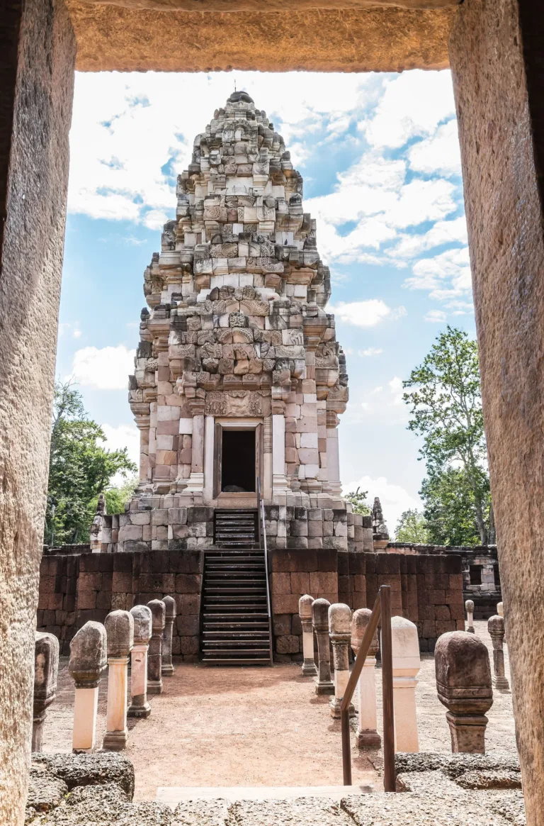
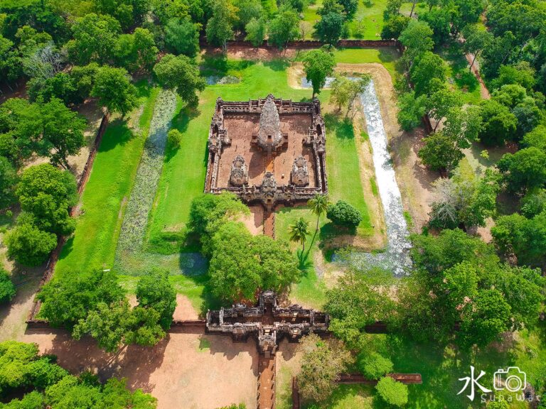
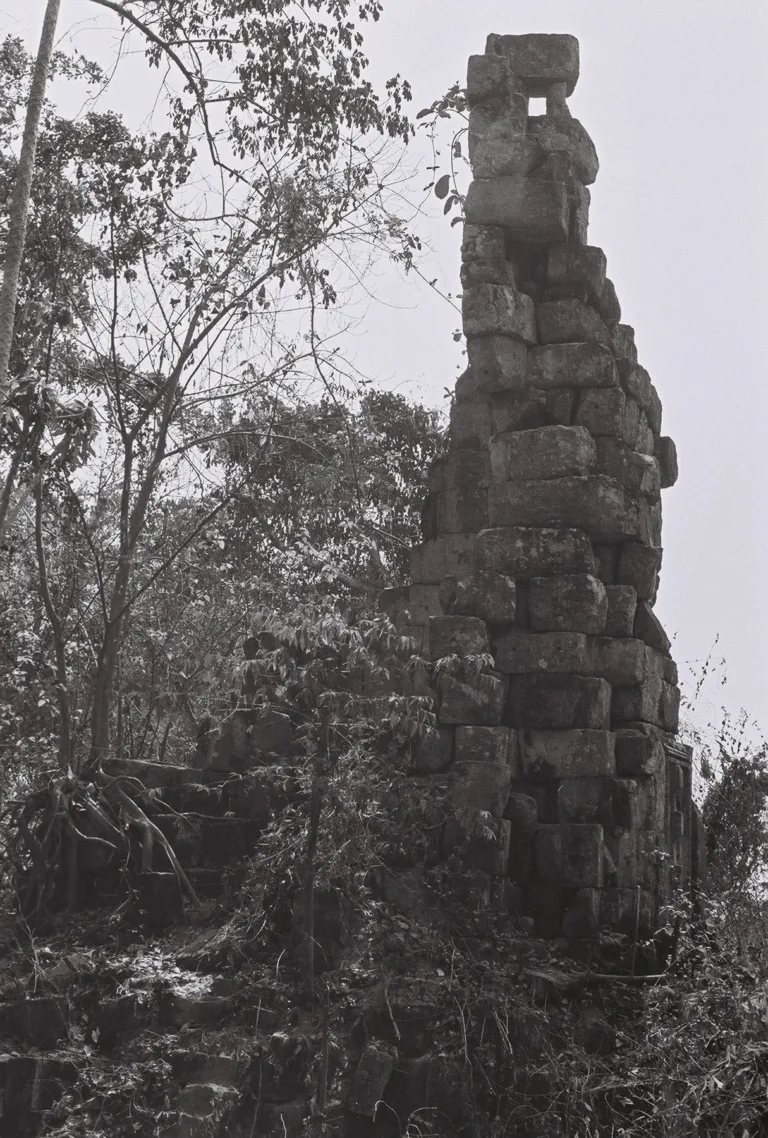
Central towerSandstone tower reassembled by anastylosis
SA KAEO · KHOK SUNG
An 11th-century Khmer Shiva temple in Sa Kaeo, source of the famous Sdok Kok Thom inscription on the devaraja cult, rebuilt stone by stone in 1995–2010, about 1 km from the border.
Holiday / event — crowded · Hot (Afternoon) feels like 40°C
Daily 09:00–16:00 (information centre)
1–2 hours
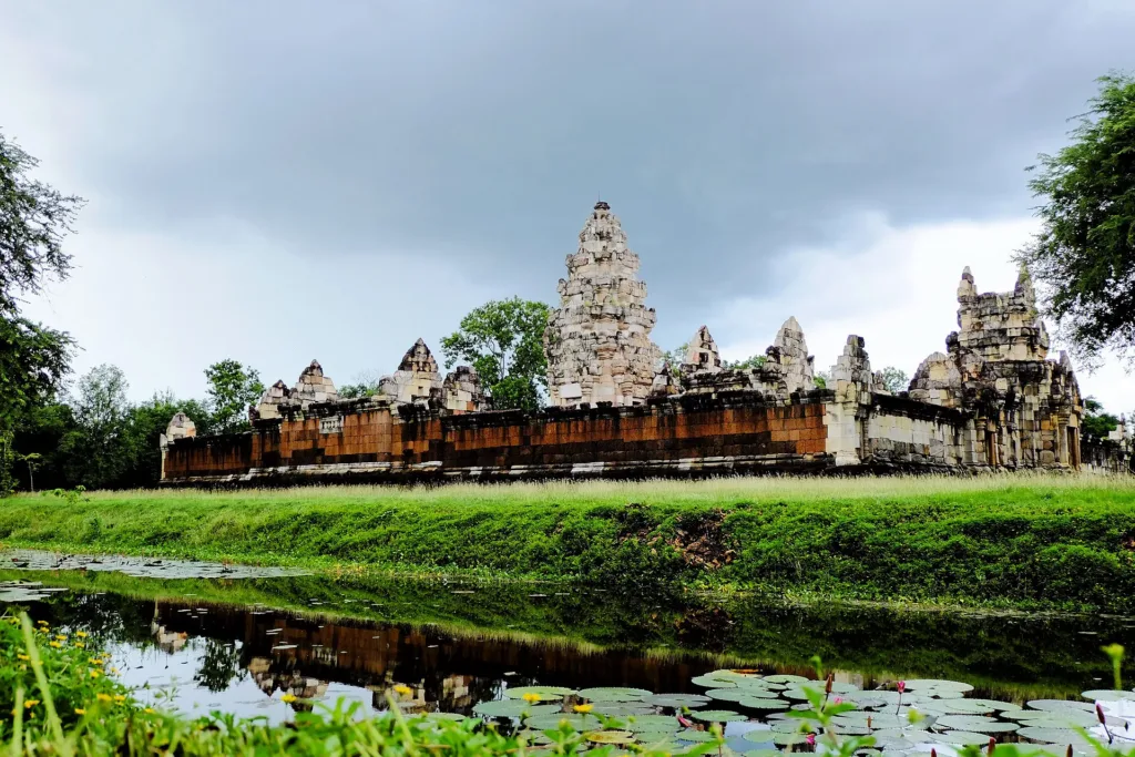
East moat — Temple reflections
01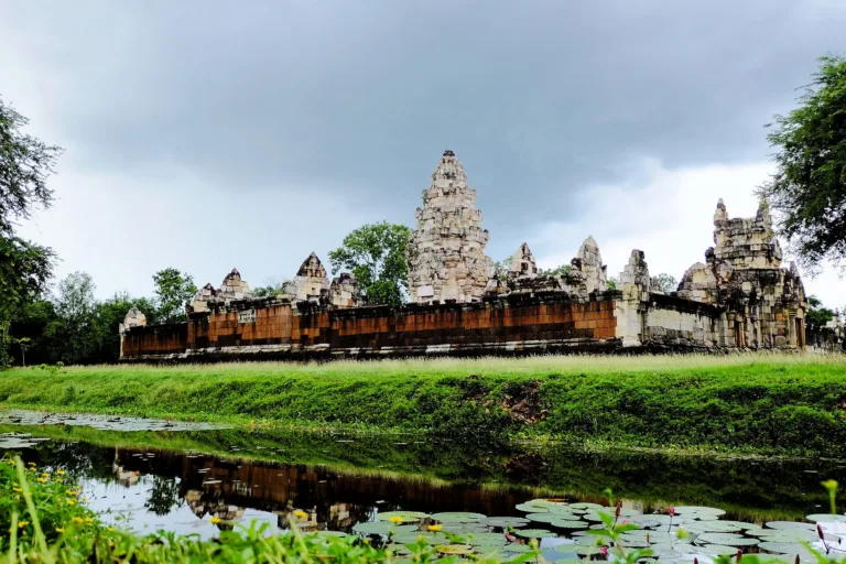 02
 03
 04
Tap a day card to see that day’s weather, rain, haze and hourly forecast
Best time to go Fine all day little rain through the day
Holiday — traffic on the way up and parking fills fast; leave early
Green band = hours used for the score
Best time to go Fine all day little rain through the day
Holiday — traffic on the way up and parking fills fast; leave early
Green band = hours used for the score
Best time to go Fine all day little rain through the day
Holiday — traffic on the way up and parking fills fast; leave early
Green band = hours used for the score
Best time to go Best window 06:00–17:00 Little rain · light drizzle possible at times
No warnings today — normal road and weather conditions
Green band = hours used for the score
Best time to go Best window 06:00–16:00 Little rain · light drizzle possible at times
No warnings today — normal road and weather conditions
Green band = hours used for the score
Best time to go Fine all day little rain through the day · light drizzle possible at times
No warnings today — normal road and weather conditions
Green band = hours used for the score
Best time to go Fine all day little rain through the day
No warnings today — normal road and weather conditions
Green band = hours used for the score
Prasat Sdok Kok Thom in Khok Sung, Sa Kaeo, is eastern Thailand’s most important Khmer temple: the source of the K.235 inscription on the devaraja cult, a former refugee-camp site and a model anastylosis restoration.
Arrive Come before 10:00 or after 15:00 for nicer light and less heat
Photos from Wikimedia Commons and contributors · full credits inClassic page
Check opening announcements before travelling and stay on marked paths
Do not leave designated areas
The temple courts have no shade
- · Time needed 1–2 hours
Long weekends in the cool season
Annual community Kathin ceremony around the temple (about Oct – Nov)
Tap a month on the wheel to see weather, rain, haze and crowds from 10 years of records
Best time · Nov – Feb is cool and clear, with lovely reflections in the moats.
Watch out · Mar – May is very hot on the shadeless stone courts; paths can be slippery in the rains.
Oct by the records 24–30°C · avg rain 209 mm (22 rainy days) · clear 2 days · avg PM2.5 8
Prasat Sdok Kok Thom is an 11th-century Khmer Hindu temple dedicated to Shiva, at Ban Nong Ya Kaeo, Khok Sung, Sa Kaeo, about 34–35 km northeast of Aranyaprathet and about 1 km from the Thai–Cambodian border. Now Sdok Kok Thom Historical Park under the Fine Arts Department, it is the largest and most important Khmer temple in eastern Thailand.
Its original name was Prasat Mueang Phrao. “Sdok Kok Thom” is a Khmer name that came into use after Cambodians settled in the area. A Krungthep Turakij columnist explains that it roughly means “overgrown with large reeds”, probably referring to reeds in the great baray beside the temple.
The temple was completed under King Udayadityavarman II around 1052. The king granted the land to a family of royal Brahmin priests who performed coronations, and they built the temple, dug the baray, raised dikes and laid out fields to enshrine a Shiva linga, supported by surrounding rice-farming villages. A Thai PBS World article says construction may have begun as early as 937 under Jayavarman IV.
As Sujit Wongthes reads the inscription, the temple was the main sanctuary of the town of “Bhadraniketana”, meaning a peaceful, happy dwelling. King Udayadityavarman II, son of Suryavarman I who built Preah Vihear, had it built as a guru-dakshina, a thank-offering to the Brahmin Sadashiva, who left the priesthood to become royal preceptor under the name Jayendravarman. Sujit gives the completion date as 1042, whereas other sources say 1052–1053.
Its greatest treasure is the Sdok Kok Thom inscription (K.235), carved on a 1.51-m grey sandstone stele that stood in the northeast corner of the courtyard. Its 340 lines in Sanskrit and Old Khmer are dated to 8 February 1053. It records some 250 years of service to the Khmer court by the founding priestly family, through twelve kings, including the founding of the devaraja cult and the moving of the capital, making it one of the key sources for Khmer history.
Two inscriptions were found at the temple. Inscription 1, dated Mahasakkarat 859 (937 CE), sets out duties for tending the images and the linga, offerings of rice and oil throughout the year, and bans officials from embezzling supplies or using temple slaves for other work; it is probably the source for the idea that building began in 937. Inscription 2 is the great K.235, carved on four faces. The first praises the gods and Udayadityavarman II and names the family founder, the Brahmin Shivakaivalya; the second and fourth trace the priestly lineage from Shivakaivalya to Sadashiva; the third lists gifts to the Bhadraniketana sanctuary and land donated by the royal preceptor Jayendravarman. THE STANDARD reported in 2021 that both inscriptions are displayed at the Prachin Buri National Museum.
The devaraja cult it describes held that the king was linked to a god and merged with that god after death, with Brahmin priests performing the rites. Sujit Wongthes explains that the cult appeared at the Cambodian court around the 10th century and passed to the courts of Lavo and Ayutthaya.
Historians most often cite the passage saying that Parameshvara, the posthumous name of Jayavarman II, “came from Java” to rule at Indrapura, with Shivakaivalya as his chaplain. The king later invited the Brahmin Hiranyadama to perform a rite on Mount Mahendraparvata (Phnom Kulen) to free Cambodia from dependence on “Java” and consecrate him as universal monarch, an event historians treat as the founding of the Angkorian empire around 802. The inscription also names the capitals Indrapura, Amarendrapura, Hariharalaya and Mahendraparvata. Because it was written some 200 years after that reign, scholars still debate whether “Java” meant the island of Java, the Malay Peninsula, Champa or a later myth. French scholars relied on it heavily to reconstruct Khmer history, and in 2013 a team led by Damian Evans and Jean-Baptiste Chevance used airborne laser scanning (lidar) to confirm the site of Mahendraparvata on the Kulen hills.
The French explorer Étienne Aymonier reported the inscription in 1884. In the 1920s it was moved to the National Museum in Bangkok. A fire on 9 November 1960 badly damaged it, but staff reassembled most of it, and rubbings made earlier preserved the text.
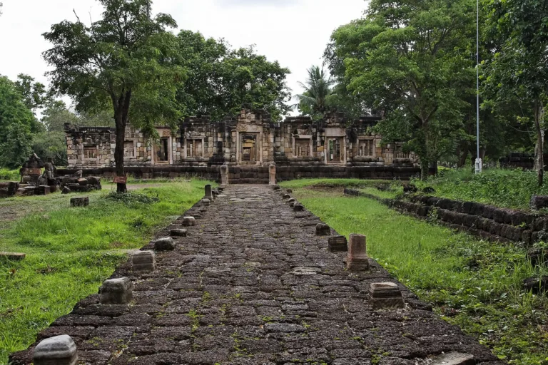
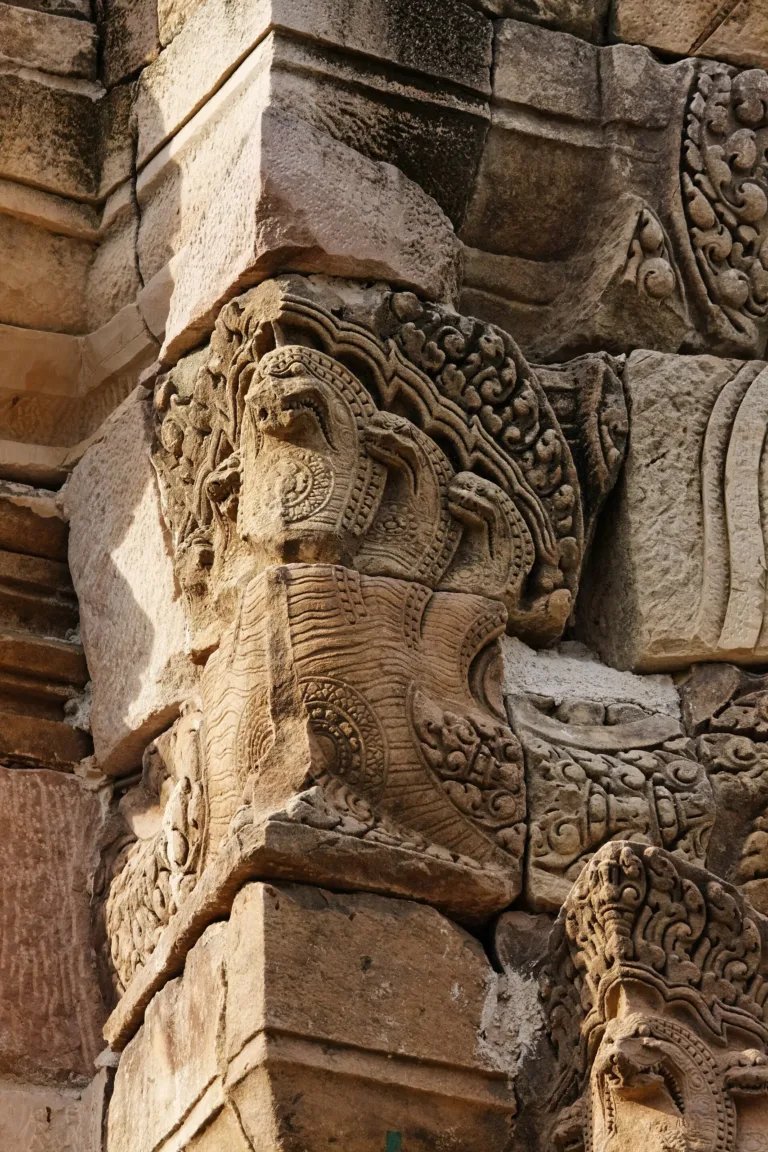
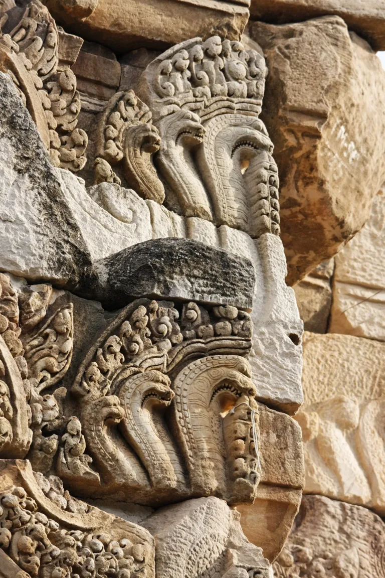
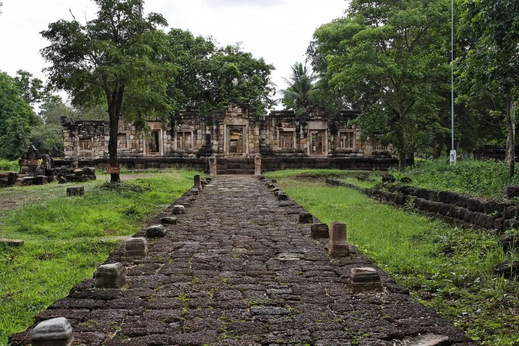
The temple is a scaled-down version of the great Angkor temples, mixing Bakheng and Baphuon styles. The central tower and two libraries to the northeast and southeast are sandstone; the bases and walls are laterite. The tower has a real door on the east and false doors elsewhere. Around it runs a gallery of about 42 × 36 m with an east gopura, then moats and a 2.5-m laterite wall measuring 126 × 120 m. About 200 m east, a laterite avenue leads to a baray of about 200 × 370 m. The temple faces east, unlike Angkor Wat, which faces west.
As Hinduism declined in the Khmer Empire from the 12th century, the temple was used for Buddhist worship for a time, then abandoned, decayed and was plundered by art thieves.
Sujit Wongthes argues that the “Dan Phra Charuek” of the royal chronicles was Sdok Kok Thom. During unrest in Thonburi, Chao Phraya Chakri marched back from Siem Reap and waited here for news; Luang Sorawichit (Hon) secretly brought word from Thonburi before Chakri entered the capital and founded Rattanakosin in 1782. This is the author’s interpretation.
Sujit adds that the Sdok Kok Thom area linked the Khorat Plateau (the Mun and Chi basins) with the Tonle Sap and Chao Phraya lowlands via passes in the Dangrek range. Nearby, Prasat Khao Noi, Prasat Khao Lon and Prasat Thap Siam lie on the same route, and a Thala Borivat-style lintel at Wat Thong Thua in Chanthaburi suggests it reached the eastern coast. When Ayutthaya rose, the area lost importance and became known collectively as “Dan Phra Charuek”, a name of uncertain meaning tied to legends such as Phra Ruang sending water tribute to Cambodia.
In modern times Luang Chan Nikhom of the border patrol police found the temple on patrol in 1920. The Fine Arts Department registered it as an ancient monument in 1935, covering 641 rai 2 ngan 82 square wa; the area was then overgrown and little known.
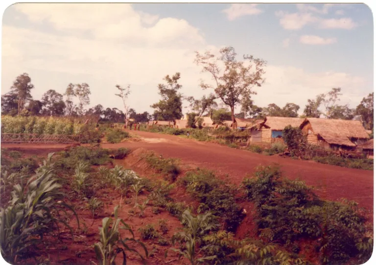
During the Cambodian wars of 1975–1983 the temple area served as a temporary shelter under the UNHCR. After Vietnam invaded Cambodia and the Khmer Rouge fell in 1978–1979, the forest around it became the vast Nong Samet (Rithysen) refugee camp, controlled by the anti-communist Khmer Serei and a base for the Khmer People’s National Liberation Front. Villagers recall temple stones being pried away for bunkers and cooking stoves, landmines laid around the site, and refugees digging hundreds of holes in the baray for water, which is why it no longer holds water. Khao-I-Dang, the largest camp in the area, closed in 1993.
Nong Samet camp formed near Ban Nong Samet in May 1979 and received its first food aid on 11 October 1979. First called Chumrum Thmei (“New Camp”), it was nicknamed “007” for its intrigues and renamed Rithysen after a Khmer folk hero in August 1980. In late May 1980 it moved beside the temple ruins, a site with poor drainage and leftover mines. Population estimates ranged from 48,000 to over 100,000 in 1979 and 45,000–70,000 in 1984, plus some 8,000 KPNLF troops. The American Refugee Committee ran a 100-bed hospital and trained 150 Khmer medical workers, and a border black market used gold and gems as currency. On 25 December 1984 Vietnamese forces attacked with artillery and tanks and destroyed the camp, killing 55 resistance fighters and 63 civilians. Survivors were moved to Site 7 near Khao-I-Dang in January 1985 and to Site Two at Ta Phraya on 29 September 1985. Khanchai Bunpan recalls that after Vietnam toppled the Khmer Rouge on 7 January 1979 Thailand closed the border, yet by October that year about 91,000 Cambodians had crossed.
Demining began in 1995 and was completed in 2004 by the Thailand Mine Action Center with Japan’s JAHDS and the Chatichai Choonhavan Foundation. Wikipedia says 76 mines and other ordnance were removed in 2002–2004.
The Fine Arts Department surveyed the ruins in 1993 and restored them in 1995–2010 by anastylosis: fallen stones were numbered and test-fitted back into place like a jigsaw, with new stone used only where needed for stability and no carving invented, so the missing east lintel was not recreated. Old photographs helped show what had been lost. The work ended in 2010 with the reassembly of the main tower’s spire, and in 2009 the department received 14 million baht to landscape the surroundings.
Because the temple lies so close to the border, Cambodia reportedly claimed in 2003 that it was on Cambodian soil, but Thailand maintains it is Thai territory and has always administered and restored it. In 2008 the then Fine Arts Department director-general, Kriangkrai Sampatchalit, said it lay inside Thailand, with a watercourse marking the boundary.
Another relic of the area’s border history is Thai–Cambodian boundary marker No. 50, set up in the reign of King Chulalongkorn. It was removed in 1941; the heirs of General Mangkon Phromyothi later gave it to the National Museum, which passed it to the Prachin Buri National Museum for display in 2021.
The Fine Arts Department declared Sdok Kok Thom Historical Park in 2019, and on 15 May 2022 Princess Maha Chakri Sirindhorn opened its new information centre. Its three sections are a reception hall, a video room and an exhibition on Khmer architecture, the Sdok Kok Thom inscription and conservation, with 3D models and architectural fragments from excavations.
During the 2025 Thai–Cambodian border clashes, on 11 August 2025 the park shared the temple’s story as a refugee shelter fifty years earlier. On 21 September 2025 it was reported closed temporarily, as it lay in a risk zone and had been affected by the fighting. Manager Online reported that it officially reopened on 30 October 2025 after more than a month, as villagers of Nong Ya Kaeo and Nong Chan held their annual Kathin ceremony.
The information centre opens daily 09:00–16:00 (Thai PBS World gives 08:30–16:30), with a small admission fee; call 0 3755 0454 or see the park’s Facebook page. As the site is on the border, always check the situation and opening announcements before travelling, and stay on marked paths.
Arrived? Check in, collect a stamp and tell others what it is like right now
Check your location first, so you do not fill in the form for nothing
Location must be on and within 1.5 km · One check-in per place per day · come back on other days to check in again
Post photos from anywhere — no need to be here · Up to 20 photos at a time · JPG / PNG / WebP · GPS location data is removed automatically
Paved roads all the way; there may be military checkpoints n…
Highway 33 to Aranyaprathet, then Khok Sung · Fuel
Then a hired car or taxi for about 35 km · Varies
From Bangkok take Highway 33 to Aranyaprathet, then head north to Khok Sung district and follow signs to Ban Nong Ya Kaeo, about 35 km.
Car park by the information centre
Petrol stations in Aranyaprathet and Khok Sung town
Usable mobile signal, though phones may pick up Cambodian networks near the border
Daily 09:00–16:00 (information centre)
around 290 km fromBangkok
Sdok Kok Thom Historical Park
Approx. nightly price for 2 adults (next week) · final price depends on your dates
Answers travellers want before they go — a one-minute read
Completed around 1052 under King Udayadityavarman II
Its 340 lines record a Brahmin family’s 250 years of service to Khmer kings and the devaraja cult
It closed during the September 2025 clashes and reopened on 30 October 2025; check the park’s page before going
About 1 km
Best day this week: Thursday 29 Oct · Check in when you arrive to collect a stamp