 01
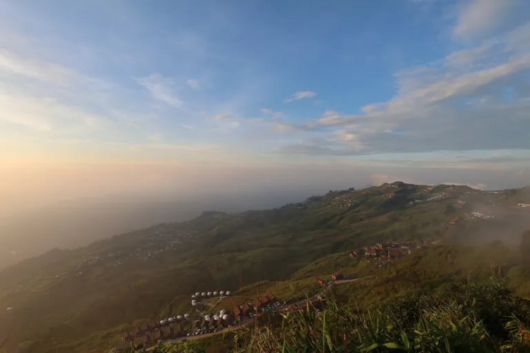
Morning sea of mistMist filling the valleys at the end of the rains and start of winter
PHETCHABUN · LOM KAO
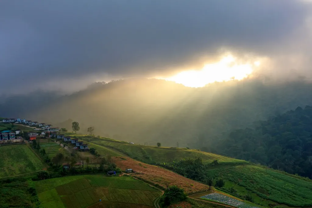
Phetchabun's highest peak at about 1,768 m: a Hmong village, terraced cabbage fields, a morning sea of mist from late rains to early winter, and cool air almost all year.
Holiday / event — crowded · Possible thunder 16:00–17:00 · Low cloud at eye level may block the view at times · Chance of a sea of mist 4/10
sea-of-mist places: morning matters most
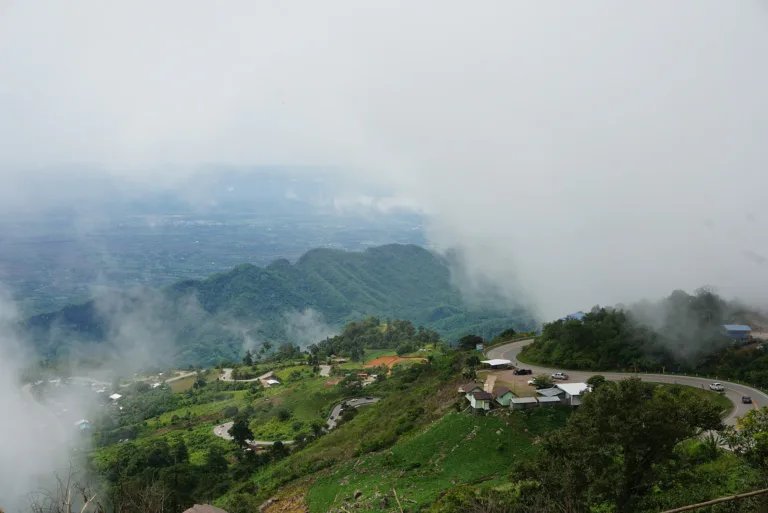
The sea of mist is most frequent at the end of the rains and start of the cool season (Oct – Jan), and in the rainy season after a wet night. It is clearest around 5:30–8:00, before the sun gets strong; Pha Hua Sing and the ridge-side viewpoints are the favourite spots.
Before 6:00 for the sea of mist and sunrise
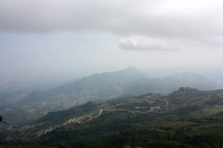
From Lom Sak, take Highway 203 towards Lom Kao for about 13 km, then turn onto Highways 2011 and 2331 and climb towards Phu Hin Rong Kla for about 40 km until the turn-off to Ban Thap Boek. The climb is steep with continuous hairpin bends. From Bangkok, take Highways 1 and 21 via Saraburi and Phetchabun to Lom Sak — about 6–7 hours in all. From Phitsanulok, take Highway 12 to Lom Sak first. No scheduled bus reaches the top. Take a bus from Mo Chit 2 to Phetchabun or Lom Sak, then a songthaew or a hired vehicle up the mountain.
Mobile signal works in the village; it may drop on some bends on the way up
01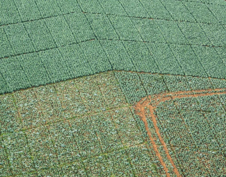 02
 03
 04
 05
Tap a day card to see that day’s weather, rain, haze and hourly forecast
Best time to go Best window 06:00–14:00 Little rain · light drizzle possible at times
Holiday — traffic on the way up and parking fills fast; leave early
Green band = hours used for the score
Best time to go Best window 06:00–13:00 Little rain · light drizzle possible at times
Holiday — traffic on the way up and parking fills fast; leave early
Green band = hours used for the score
Best time to go Fine all day little rain through the day · light drizzle possible at times
Holiday — traffic on the way up and parking fills fast; leave early
Green band = hours used for the score
Best time to go Best window 08:00–11:00 Little rain · light drizzle possible at times
Thick morning fog with visibility under 1 km — use headlights and drive slowly
Green band = hours used for the score
Best time to go Best window 06:00–14:00 Little rain · light drizzle possible at times
Thick morning fog with visibility under 1 km — use headlights and drive slowly
Green band = hours used for the score
Best time to go Fine all day little rain through the day
No warnings today — normal road and weather conditions
Green band = hours used for the score
Best time to go Fine all day little rain through the day
No warnings today — normal road and weather conditions
Green band = hours used for the score
Scored from cloud cover at every level and tonight’s moonlight — the darker the sky, the clearer the Milky Way · tap another night below for the next 7 nights
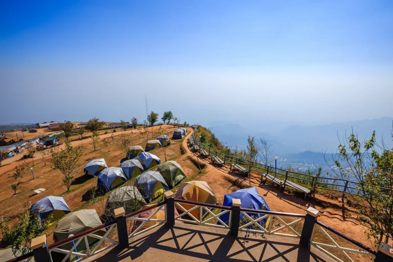
Phu Thap Boek is the highest peak in Phetchabun, about 1,768 m above sea level, in Wang Ban and Ban Noen subdistricts of Lom Kao district, on the Loei border next to Phu Hin Rong Kla National Park. A Hmong village has stood on the mountain since around 1932.
Its draws are the morning sea of mist filling the valleys, terraced cabbage fields that turn the slopes green in the rainy season, and cool air almost all year; in the cool season the Himalayan cherry trees bloom.
Phu Thap Boek is a village, not a national park, so there is no entry fee — but the road up is steep and winding. Use a low gear, and check road conditions in the rainy season.
The sea of mist is most frequent at the end of the rains and start of the cool season (Oct – Jan), and in the rainy season after a wet night. It is clearest around 5:30–8:00, before the sun gets strong; Pha Hua Sing and the ridge-side viewpoints are the favourite spots.
Photos from Wikimedia Commons and contributors · full credits inClassic page
The road up is steep with hairpin bends and buses cannot climb it. Use a low gear both ways; the S-bends are an accident black spot
Heavy rain makes the road slippery and has caused landslides that closed it — check notices before going up
The cabbage plots are working farms — don't walk into them or pick vegetables for photos without asking
Cool-season mornings are very cold — bring a jacket, gloves and a hat
Adults 0 THB · Time needed Half a day – 1 night
Weekends and long holidays in Nov – Jan; heavy jams on the way down in late morning
| Campsite (own tent) optional | 40 ฿/person/night |
| Tent hire for 2, with bedding optional | 350 ฿/tent/night |
| Tent hire for 4, with bedding optional | 650 ฿/tent/night |
| Mookata grill set optional | 300 ฿/set |
Mostly cash; some shops and lodgings take bank transfer · Prices may change by season — check with the venue
Hmong New Year ("Noj Peb Caug"), Dec – Jan after the harvest, held for 5, 7 or 9 days (dates set by the community)
Tap a month on the wheel to see weather, rain, haze and crowds from 10 years of records
Best time · October–January, at the end of the rains and start of the cool season, brings the thickest and most frequent sea of mist, clear skies after rain and cool to cold air; Himalayan cherry blossoms in Dec–Jan. Be at a viewpoint before 6:00.
Watch out · March–April brings smoke haze from burning, so views are hazy. August–September is the wettest: slippery roads, thick fog, and the road up has had landslides.
Oct by the records 14–20°C · avg rain 177 mm (22 rainy days) · clear 5 days · avg PM2.5 9
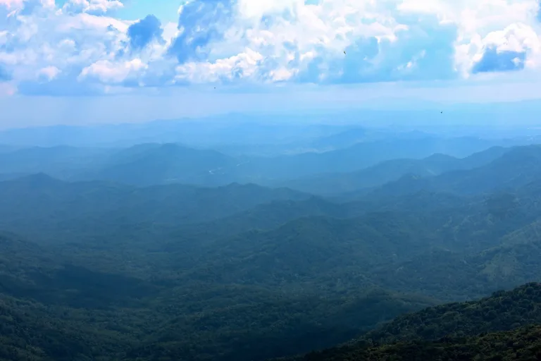
Phu Thap Boek is the highest peak in Phetchabun province, in Wang Ban and Ban Noen subdistricts of Lom Kao district, bordering Loei, Phu Hin Rong Kla National Park and Khao Kho National Park. The most widely quoted height is about 1,768 m above sea level, at the observatory and temperature-reading point on the summit; some sources give 1,794 m, while the "Thap Boek unit" sign on the way up reads 1,667 m. It is a sandstone mountain in the Phetchabun range, covered in mixed montane evergreen forest, and forms the western headwaters of the Pa Sak River.
The village's official name is Ban Thap Boek. According to the Wang Ban subdistrict administration, it was first called "Ban Tham Boek" after a cave villagers held sacred: anyone passing had to ask permission of the spirit in the cave first — to "boek thang", or open the way — or risk harm. The cave lay about 1 km east of the forest checkpoint at the village turn-off; a landslide has since buried its mouth, and the name became Thap Boek. Some old documents call it "Thap Pao". "Thap" in Thai means a hut or temporary shelter.
Hmong people have lived in these mountains for more than a century. Research cited in a Naresuan University thesis records that around 1932 a Hmong man named Keng Sae Tho founded the village of Thap Pao, or Thap Boek, with about 800 people in some 100 households. The pioneers came from five main clans — Sae Thao, Sae Song, Sae Yang, Sae Lo and Sae Li. The Sae Song, the largest, took the land closest to the village, while the other clans got plots further out — the very area that is now the resort and viewpoint zone. Early livelihoods were upland rice, maize and, above all, opium.
On 9 December 1958 Field Marshal Sarit Thanarat's Revolutionary Council Announcement No. 37 abruptly banned growing and trading opium nationwide, hitting Hmong families who relied on it hard. In 1959 the state set up the Phu Lom Lo Self-Help and Hill Tribe Welfare Settlement to oversee the Hmong in the area. At the same time the communist movement was spreading from the northeast into the borderlands of Phetchabun, Loei and Phitsanulok, and poor, remote mountain communities became targets for recruitment. On 20 June 1965 the village got its first school, the Ban Thap Boek Hill Tribe Welfare School — a temporary two-room building put up by settlement workers and villagers.
On 18 January 1966 the cabinet made Phu Thap Boek a self-help settlement for hill-tribe people, under the Public Welfare Department (later the Department of Social Development and Welfare). Foreign media report that some 3,500 Hmong families were given the right to live in the settlement. But no royal decree ever recognised it — the root of the land disputes that would follow decades later.
In 1968 the conflict turned into open fighting, with the Communist Party of Thailand based on neighbouring Phu Hin Rong Kla. On 20 November 1968 an attack on the Hmong village of Huai Sai Nuea in Nakhon Thai district became known locally as "the day the guns broke out", and on 20 December 1968 a clash between officials and armed insurgents inside Ban Thap Boek saw the school — given a permanent building only in 1967 — burned and closed. Many Phu Thap Boek Hmong fled into the forest and lived in hiding for around 15 years; after the massacre of 6 October 1976, some students also fled into the Phu Hin Rong Kla forests.
In 1980 the government of General Prem Tinsulanonda issued Prime Minister's Office Order 66/2523, offering those in the forest land to farm and no prosecution if they came out. The Hmong gradually surrendered, and in late 1982 the Third Army brought them back to rebuild on the old village site, each family allotted no more than 2 ngan (800 m²) for a house and 15 rai (2.4 ha) to farm. That year the Phetchabun Hill Tribe Development and Welfare Centre was set up with five staff posts — a unit head, a health worker, a teacher, a Hmong interpreter and an agricultural officer. Phu Hin Rong Kla became a national park on 26 July 1984, and around 1985 a reforestation project on the summit had saplings flown up by helicopter.
In 1983–84 the village gained a health station; on 9 April 1984 the school reopened as Ban Thap Boek Ruam Jai School, later expanding up to the final year of secondary school. A road was built from Phu Thap Boek down to Lom Kao so villagers could sell surplus maize and ginger in the lowlands.
In 1987 the Hmong began growing cabbage. The year-round cool climate let the fields spread to more than 10,000 rai, making Phu Thap Boek one of Thailand's largest sources of cabbage and Chinese cabbage — some studies say the largest — and later of factory potatoes, carrots, persimmons, macadamia and strawberries. As the population grew, Ban Thap Boek Mai (Moo 16) was split off from Ban Thap Boek (Moo 14) in 1993.
In 1995 a cabinet resolution on watershed classes placed Phu Thap Boek in headwater classes 1A and 1B, and the Royal Forest Department began reclaiming some farmland — the start of a community–state land dispute that continues today. That same year 50 heads of household were settled to clear Ban Na Sa-ung (Moo 17). From 1999 the villages came under the Wang Ban Subdistrict Administrative Organisation, and on 9 September 1999 water from the Ban Thap Boek monastery was used to make holy water for King Bhumibol's sixth-cycle (72nd) birthday ceremony.
On 11 August 2001 flash floods and mudslides struck Nam Ko and Nam Chun subdistricts in Lom Sak, killing 136 people; deforestation of headwater forests was found to be one cause, prompting a province-wide survey of land use. The same year Governor Direk Thueng-fang declared Phu Thap Boek a new tourist destination for Phetchabun. On 19 February 2002 the cabinet agreed that, of the original settlement of about 175,000 rai, 47,121 rai (33,674 in Khao Kho and 13,447 in Lom Kao) would stay with residents for homes and farms — close to the 47,021 rai figure quoted by foreign media — and the remaining 127,879 rai would return to the Royal Forest Department as headwater forest.
From then on, Phu Thap Boek changed fast. The mist, the cabbage fields and the cold, plus the slogan "Sleep one night in Phetchabun, live one year longer", drew a steady stream of visitors. Farmland along the road into the village, once divided among children, steadily became resorts, restaurants and souvenir shops — some run by owners, some leased to outsiders. The first resorts opened around 2009. In 2012 the Administrative Court in Phitsanulok ruled the land was still forest under the 1941 Forest Act, since no royal decree recognised the settlement. A 2013 survey found 187 occupants holding 258 plots, about 1,051 rai in all, and by 2015 there were about 62 resorts, with 27 cases pursued by the Royal Forest Department.
By early 2016 there were more than 90 resorts; the Royal Forest Department said only about 30 belonged to original hill-tribe residents. The government launched the "Phu Thap Boek operation" and issued NCPO head order 35/2016. On 8 July 2016 notices gave 18 businesses with court rulings against them 30 days to demolish. On 19–20 August the provincial governor led several hundred officials in starting demolitions; around 100 Hmong gathered to block them, the road to the village was closed and tourists were stranded, until talks let owners demolish their own buildings. Officials said about 111 resorts lay in the zone to be managed, and 32 had been removed by the end of the year. On 25 July 2017 the cabinet approved a 2017–2022 master plan covering six areas, from land administration, housing and farmland to forest. In 2018 media reported that of 103 resorts inspected, 50 Hmong-owned ones could stay while 53 were classed as outsiders' and ordered demolished.
The road has its own stories. There are two ways up: Highway 2331 from Lom Kao, and a road from Nakhon Thai through Phu Hin Rong Kla National Park. Highway 2331's climb has S-bends that are an accident black spot. In late July 2018 heavy rain caused a landslide that dropped the road between km 9+300 and km 10+650 by about 1.5–1.8 m, and police banned all vehicles until it was repaired. Today the road is paved throughout but still steep and winding, and buses cannot get up.
The land issue keeps returning. On 10 July 2020 the Royal Forest Department found resorts and campsites being rebuilt on previously cleared plots near Pha Hua Sing and arrested 20 workers. During Covid-19 in 2021, Hmong community leaders closed the village to outsiders for a time, before tourism recovered.
When the tourists came back, so did the resorts. Research found resorts spreading most at 1,000–1,400 m, close to the road. In 2022 security officials reported more than 300 newly built resorts, and more than 300 operators had registered as non-hotel lodging with Lom Kao district. On 12 September 2022 operators — mostly Hmong — blocked the road for over eight hours in protest at new seizures, arguing that the boundary between the hill-tribe settlement and forest land was unclear; officials agreed to take the issue to ministers. No area-wide settlement has been found to date.
Today the Phu Thap Boek community spans four villages — Ban Thap Boek (Moo 14), Ban Thap Boek Mai (Moo 16) and Ban Na Sa-ung (Moo 17) in Wang Ban, plus Ban Nam Phiang Din in Ban Noen — on about 13,447 rai. Ban Thap Boek alone has about 1,384 people in 355 households. Most are Hmong who still honour ancestral spirits, though some are Christian or Buddhist. Villagers still turn to the "ua neng" (shaman) for soul-calling rites and hang a "jai" — a woven bamboo charm tied with red cloth — by the door to keep evil away. The biggest event of the year is Hmong New Year, "Noj Peb Caug", held in December–January after the harvest for 5, 7 or 9 days (odd numbers are lucky), with ball-tossing courtship games, top spinning, khaen pipes and dancing.
Tourism has brought income, but also strain. In the dry season tap water runs short and muddy, and villagers buy water from the village boreholes; power often dips at busy times, and businesses must deal with their own rubbish. Visitors can help by staying out of the vegetable plots, buying produce directly from villagers, using water sparingly, taking rubbish down the mountain, choosing licensed lodging and driving the mountain road with care.
Arrived? Check in, collect a stamp and tell others what it is like right now
Check your location first, so you do not fill in the form for nothing
Location must be on and within 3 km · One check-in per place per day · come back on other days to check in again
Post photos from anywhere — no need to be here · Up to 20 photos at a time · JPG / PNG / WebP · GPS location data is removed automatically
From Lom Sak, take Highway 203 towards Lom Kao for about 13 …
Highway 203, then 2011 and 2331, about 50 km · Fuel
Highways 1 and 21 via Saraburi, Phetchabun and Lom Sak · Fuel
Mo Chit 2 to Phetchabun or Lom Sak, then a songthaew or hired vehicle up · By distance
From Lom Sak or Lom Kao · As agreed
Highway 203, then 2011 and 2331, paved throughout; the climb is steep with hairpin bends, and buses cannot get up
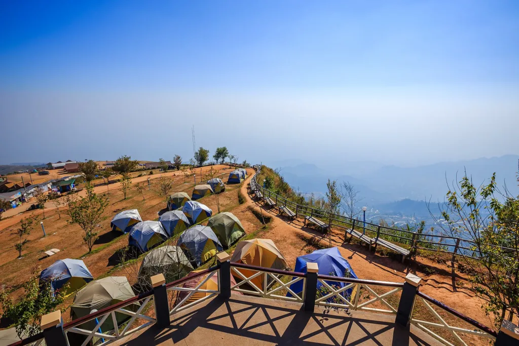
Park at resorts, cafés and the designated viewpoints; some charge a small fee
Petrol stations in Lom Sak and Lom Kao — fill up before the climb
Mobile signal works in the village; it may drop on some bends on the way up
Open all day (it is a village, with no entry checkpoint)
around 50 km fromLom Sak district
Phu Thap Boek, Lom Kao, Phetchabun
0 THB
Approx. nightly price for 2 adults (next week) · final price depends on your dates
Answers travellers want before they go — a one-minute read
It was first Ban Tham Boek, after a sacred cave whose spirit passers-by had to ask to "open the way"; a landslide has since buried the cave mouth
For over a century in these mountains; the village was founded around 1932, and the state made it a hill-tribe settlement on 18 January 1966
Best day this week: Thursday 29 Oct · Check in when you arrive to collect a stamp