 01
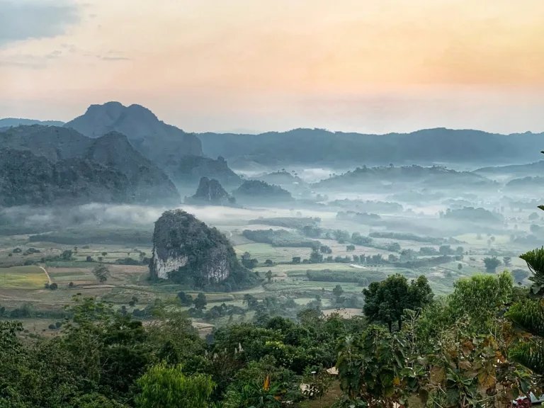
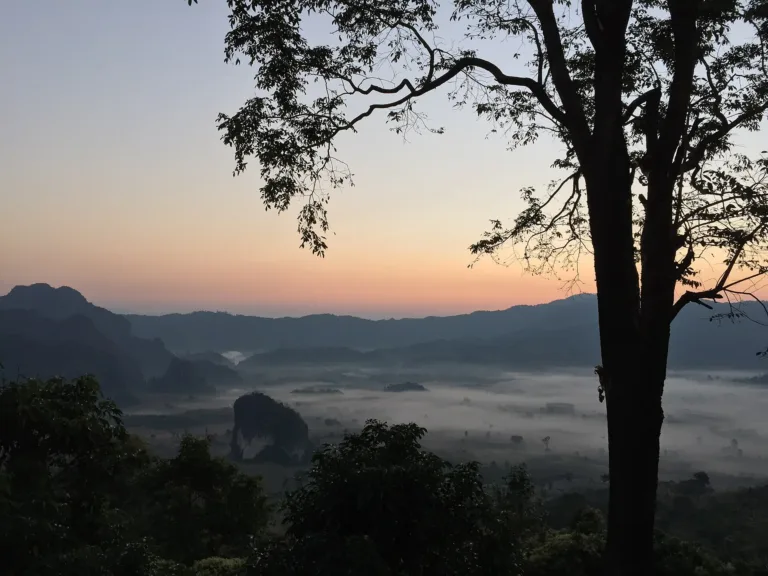
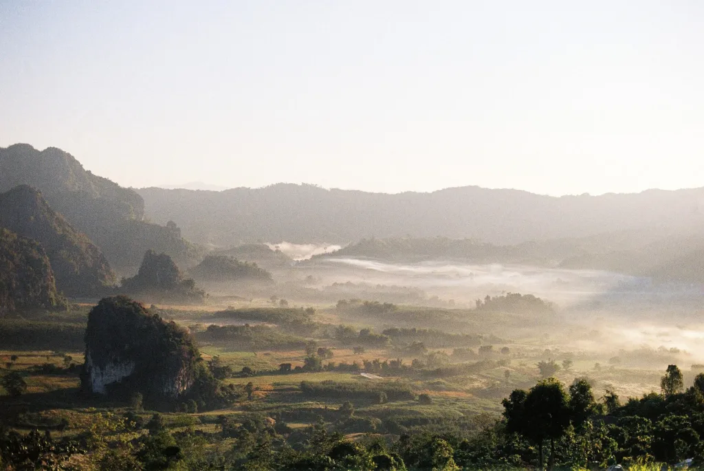
Sea of mistMist filling the basin
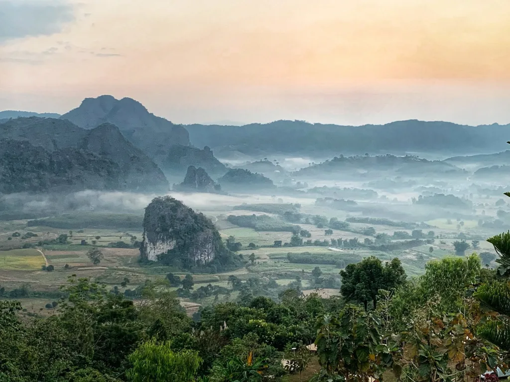
Phayao's sea of mist · Pong
A forest park on the Thai–Lao watershed in Pha Chang Noi, Pong, Phayao, rising to about 1,720 m at the source of the Yom River, famous for what is called Phayao's only sea of mist. Declared in 2002 — not the Phu Langka in Bueng Kan.
Holiday / event — crowded · Chance of a sea of mist 4/10
sea-of-mist places: morning matters most
Morning sea of mist Nov–Feb and after rain
05:30 for the mist
Highway 1148 is winding and steep; the summit track is red earth
Patchy
01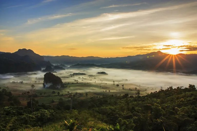 02
 03
 04
Tap a day card to see that day’s weather, rain, haze and hourly forecast
Best time to go Fine all day little rain through the day
Holiday — traffic on the way up and parking fills fast; leave early
Green band = hours used for the score
Best time to go Fine all day little rain through the day
Holiday — traffic on the way up and parking fills fast; leave early
Green band = hours used for the score
Best time to go Best window 06:00–13:00 Little rain · light drizzle possible at times
Holiday — traffic on the way up and parking fills fast; leave early
Green band = hours used for the score
Best time to go Best window 06:00–14:00 Little rain · light drizzle possible at times
No warnings today — normal road and weather conditions
Green band = hours used for the score
Best time to go Best window 06:00–14:00 Little rain · light drizzle possible at times
Thick morning fog with visibility under 1 km — use headlights and drive slowly
Green band = hours used for the score
Best time to go Fine all day little rain through the day · light drizzle possible at times
No warnings today — normal road and weather conditions
Green band = hours used for the score
Scored from cloud cover at every level and tonight’s moonlight — the darker the sky, the clearer the Milky Way · tap another night below for the next 7 nights
Phu Langka Forest Park, Pha Chang Noi, Pong, Phayao.
Arrive 05:30 for the mist
Morning sea of mist Nov–Feb and after rain
Photos from Wikimedia Commons and contributors · full credits inClassic page
The last 4 km needs a 4x4
Bring a torch
Nights in Dec–Jan
Adults 20 THB · Time needed One night
Long weekends, Dec–Jan
| Adult entry optional | 20 ฿/person |
| Child entry optional | 10 ฿/person |
| 4x4 to the summit optional | Pay as you like |
| Pang Kha Tai homestay (2019 price) optional | 300 ฿/person |
Cash · Prices may change by season — check with the venue
Mien New Year (around Chinese New Year) · Hmong New Year (Jan) at Pang Kha
Tap a month on the wheel to see weather, rain, haze and crowds from 10 years of records
Best time · Nov–Feb brings morning mist and cold
Watch out · Mar–Apr haze · in the rains the red-earth track is slippery
Oct by the records 16–22°C · avg rain 187 mm (23 rainy days) · clear 6 days · avg PM2.5 8
Phu Langka Forest Park is in Pha Chang Noi subdistrict, Pong district, Phayao, its forest straddling Pong and Chiang Kham districts on an east–west watershed ridge near the Lao border, about 120 km from Phayao town. It covers about 7,800 rai and rises from about 900 m to a summit of about 1,720 m. It is a different place from Phu Langka National Park in Bueng Kan, home of Naga Cave.
Phu Langka is a steep ridge continuous with Doi Pha Chang Noi and a source of the Yom River, fed by streams such as the Mae Kha, Huai Nam Tom, Mae Ru and Huai Khae Naeng. Its lesser peaks include Phu Lom with a 360° view, Doi Hua Ling for sunsets and Phu Nom, a grassy knoll; the highest point is sometimes called Phu Thewada. Daily News in 2026 said the Yao call the summit "Fin Ja Bo", the home of the gods.
The forest is about 63% hill evergreen and riparian forest, 21% pine–oak and 16% grassland, with over 200 bird species and over 100 other wildlife species, rare plants such as chomphu phuphan and niam daeng, and fields of khlong khleng (Malabar melastome) that flower from July to December.
The upper slopes were once opium fields of hill communities and are now regenerating as forest. A foreign forum account says the Yao village at Phu Langka had stood for about 50 years by 1968 and grew opium — an unconfirmed detail.
In the late 1960s and 1970s the Pha Chang and Phu Pha Chi area of Pong was part of the Communist Party of Thailand's zone. Academic work by Prasit Leepreecha (2025) lists CPT Zone 7, Phayao, as covering Phu Pha Chi and Phu Pha Chang, and dates the start of fighting in the north to 8 May 1967 at Ban Khun Huai Chomphu. Khaosod's Technology Chaoban reported that in December 1967 fighting broke out between communists and Hmong near Phu Langka, and the district moved the Mien living on Phu Langka down to Ban Pang Kha Tai and the Hmong to Ban Sip Song Phatthana.
The forum account adds that a 1968 military operation bombed and burned Phu Langka village and that Doi Pha Chi became a communist stronghold until about 1982. These dates still need checking against academic work, but Lovethailand says shelters, trenches and bomb craters from that era are still visible in the park.
Order 66/1980 opened the way for those in the forest to return to society, and many came out in the early 1980s. On 28 August 1977 Phayao province was split from Chiang Rai, making Pong and Chiang Kham part of Phayao.
In 1987 the Pang Kha Royal Project centre began, with the Land Development Department levelling land, installing soil and water conservation and allocating farmland to hill-tribe families across about 3,500 rai at 400–1,200 m. The centre is about 5 km from the forest park. A Royal Project master plan for 2007–2011 counted 5 village groups, 457 households and 2,439 people over 56 km², while Khaosod in 2019 gave about 4,950 people in seven villages around Pang Kha, mostly Mien and Hmong; the Mien New Year coincides with Chinese New Year and the Hmong New Year falls in January.
On 8 May 2002 the Royal Forest Department declared about 7,800 rai as Phu Langka Forest Park (part of Wikipedia gives 5 May). It is now managed by the national parks department through Protected Area Regional Office 15 in Chiang Rai and remains a forest park, not part of Doi Phu Nang National Park.
Park staff also watch for disasters, measuring rainfall around the clock and warning Pong and Chiang Kham when it exceeds 120 mm. MGR Online reported in 2012 that about five years earlier a landslide at Doi Phu Nom had been forecast in time, so no one died, and in July 2012, during Storm Vicente, the park issued rain and landslide warnings.
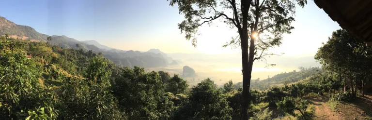
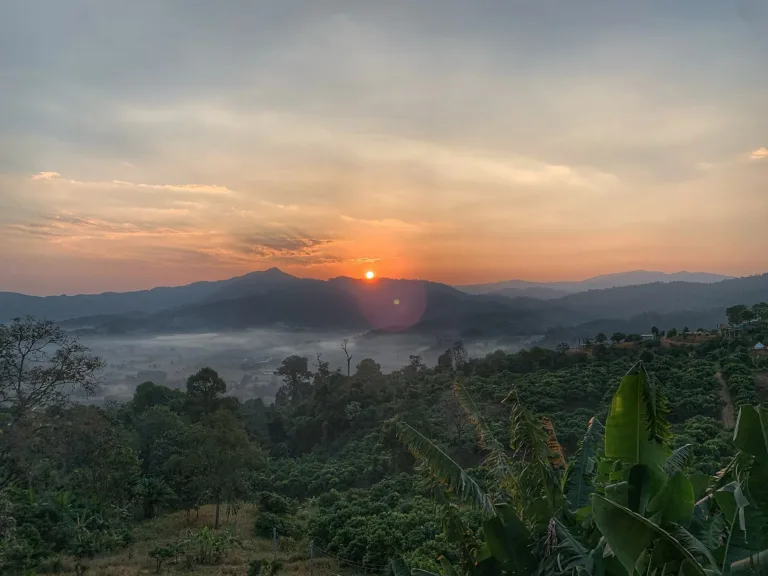
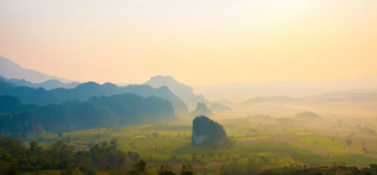
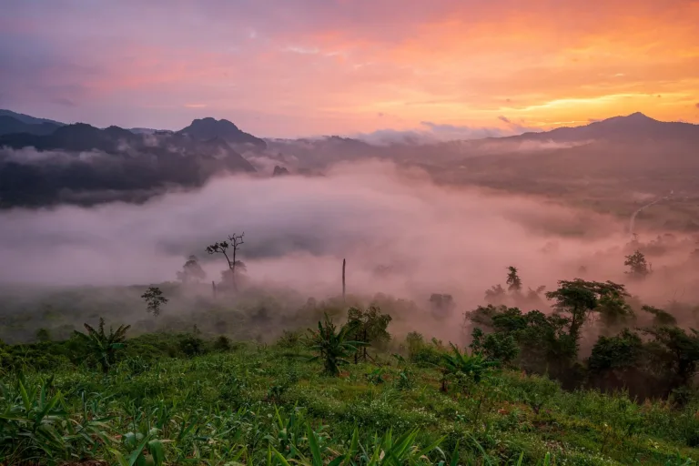
The sea of mist filling the basin made Phu Langka famous. MGR Online in 2016 called it a symbol of Phayao as cafés and resorts sprang up around Pha Chang Noi, and Daily News in 2026 called it Phayao's only sea of mist and told of a legend of white light over the summit on full-moon nights.
Communities around Phu Langka have turned to tourism too: in 2019 Ban Pang Kha Tai homestays took about 20 guests a day at 300 baht each with breakfast, putting 10% of income into a village fund.
A nature trail of about 3 km runs from the nature classroom through ancient oak forest and khlong khleng fields to the two-tier Phu Langka waterfall, about 30 m and 20 m, best in the rains, with a detour of about 100 m to the "million-year rock" terrace; along the way is Hin Yaeng Fa, an upright rock pillar.
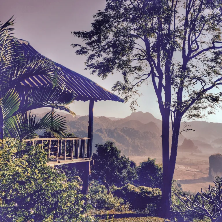
Ordinary cars can reach the campsite and nature classroom, but the last 4 km or so to the summit needs a 4x4 or a walk, and the red-earth track is slippery after rain. Some areas have no electricity, so bring a torch and warm clothes.
Today Phu Langka draws campers, photographers and birdwatchers. November to February is the busiest time, while the end of the rains brings post-rain mist and full waterfalls.
Arrived? Check in, collect a stamp and tell others what it is like right now
Check your location first, so you do not fill in the form for nothing
Location must be on and within 3 km · One check-in per place per day · come back on other days to check in again
Post photos from anywhere — no need to be here · Up to 20 photos at a time · JPG / PNG / WebP · GPS location data is removed automatically
Highway 1148 is winding and steep; the summit track is red e…
From Phayao via 1021 and 1148 · Fuel
From Chiang Rai via Thoeng and Chiang Kham · Fuel
From Nan via 1148 · Fuel
From Phayao take Highway 1021 via Dok Khamtai, Chun and Chiang Kham, then Highway 1148 to Pha Chang Noi
Parking at the campsite
Chiang Kham or Pong
Patchy
About 05:00–18:00
around 120 km fromPhayao town
Phu Langka Forest Park
Approx. nightly price for 2 adults (next week) · final price depends on your dates
Answers travellers want before they go — a one-minute read
No; Naga Cave is in Phu Langka National Park, Bueng Kan
No, still a forest park, not part of Doi Phu Nang National Park
The summit is about 1,720 m
Nov–Feb at dawn, and after rain in Sep–Oct
Ordinary cars reach the campsite; the last 4 km needs a 4x4
Adults 20, children 10 baht
Yes; space is limited, so contact the park ahead
Best day this week: Friday 23 Oct · Check in when you arrive to collect a stamp