 01
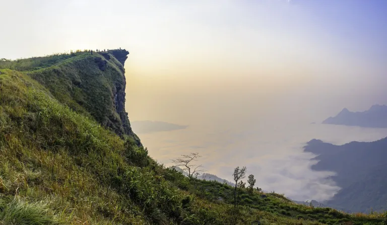
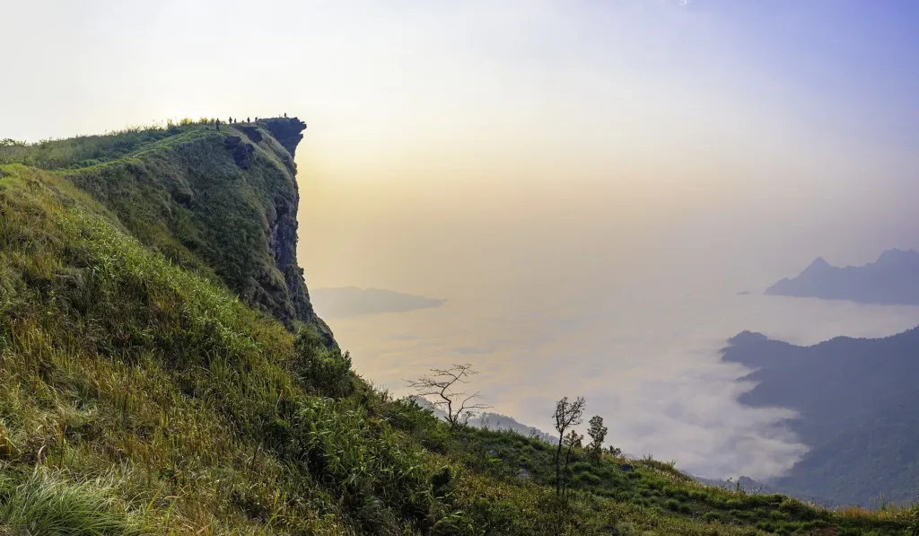
Phu Chi Fa cliff tipThe cliff pointing out over the Lao valley
Thai–Lao border cliff · Chiang Rai
A 1,628-metre cliff on the Thai–Lao border in Thoeng, Chiang Rai, famous for sunrise over a sea of mist — and a former battlefield of the Doi Yao–Doi Pha Mon ridges until 1982.
Holiday / event — crowded · Chance of a sea of mist 4/10
sea-of-mist places: morning matters most
Oct–Feb mist fills the Lao valley most mornings; after fresh rain and on clear nights it is usually thickest
05:30 to walk up in time for first light
From Chiang Rai take Route 1020 to Thoeng, then Route 1155 up to Ban Rom Fa Thong and the park car park; the last stretch is steep and winding
AIS works best on the ridge
01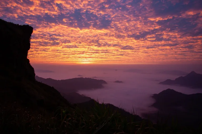 02
 03
 04
Tap a day card to see that day’s weather, rain, haze and hourly forecast
Best time to go Fine all day little rain through the day
Holiday — traffic on the way up and parking fills fast; leave early
Green band = hours used for the score
Best time to go Fine all day little rain through the day
Holiday — traffic on the way up and parking fills fast; leave early
Green band = hours used for the score
Best time to go Fine all day little rain through the day
Holiday — traffic on the way up and parking fills fast; leave early
Green band = hours used for the score
Best time to go Best window 06:00–15:00 Little rain · light drizzle possible at times
No warnings today — normal road and weather conditions
Green band = hours used for the score
Best time to go Best window 08:00–17:00 Little rain · light drizzle possible at times
No warnings today — normal road and weather conditions
Green band = hours used for the score
Best time to go Fine all day little rain through the day
Thick morning fog with visibility under 1 km — use headlights and drive slowly
Green band = hours used for the score
Scored from cloud cover at every level and tonight’s moonlight — the darker the sky, the clearer the Milky Way · tap another night below for the next 7 nights
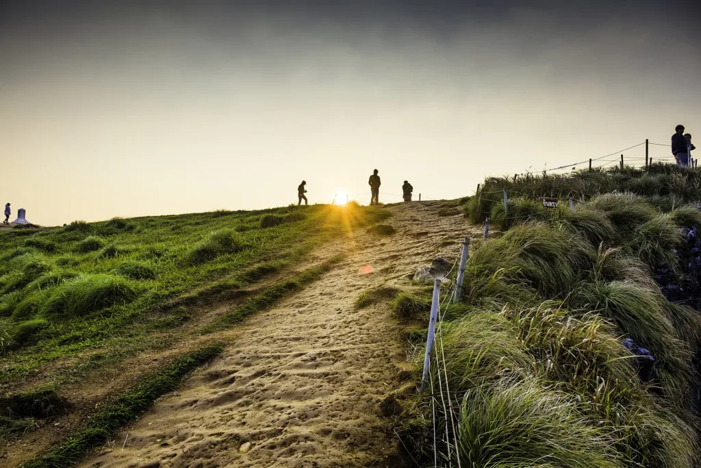
Phu Chi Fa, Thoeng district, Chiang Rai: the border cliff that points at the sky above a Lao valley full of mist.
Arrive 05:30 to walk up in time for first light
Oct–Feb mist fills the Lao valley most mornings; after fresh rain and on clear nights it is usually thickest
Photos from Wikimedia Commons and contributors · full credits inClassic page
The tip has no railing and the Lao side drops sheer; keep back, especially in wind
Before dawn in winter it can drop below 10°C with strong wind
You walk up in the dark; bring a torch and shoes with grip
- · Time needed Half a day (best with one night)
Dec–Jan, especially long weekends and New Year, 05:30–08:00
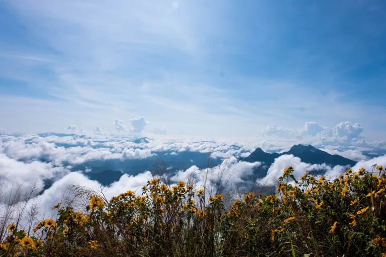
White bauhinia blooms around Feb · wild cherry along the road to Doi Pha Tang Dec–Feb
Tap a month on the wheel to see weather, rain, haze and crowds from 10 years of records
Best time · Nov–Feb clear skies with mist most mornings; Dec–Jan very cold; white bauhinia blooms in Feb
Watch out · Mar–Apr forest-fire haze hides the view · Jun–Sep heavy rain, cloud often blocks the view and the path is slippery
Oct by the records 15–21°C · avg rain 185 mm (23 rainy days) · clear 6 days · avg PM2.5 8
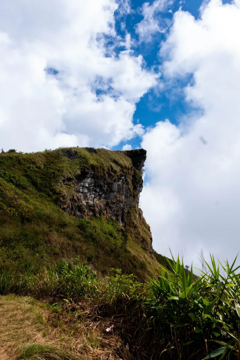
Phu Chi Fa is a cliff on the ridge of the Thai–Lao border in Tap Tao subdistrict, Thoeng district, Chiang Rai. The area rises from about 1,200 to 1,628 metres; the 1,628-metre top is the highest point of the Doi Pha Mon range, at the north-eastern end of the Phi Pan Nam Range. The western side is grassland sloping into Thailand, while the eastern side drops as a sheer rock face into a Lao valley where the village of Chiang Tong sits. On cold mornings mist fills that valley, creating the sea of cloud that made Phu Chi Fa famous.
The name, "the mountain pointing at the sky", comes from the cliff itself: its tip juts out like a finger raised skywards, most obvious when seen from the Lao side, so locals called this part of the ridge "Chi Fa". The tip reaches beyond the border line, so it is unclear which country it belongs to; a Thai flag was once planted on the summit and a Lao flag appeared beside it the next day. The whole path up lies on the Thai side.
The summit is about 300 rai of ridge-top grassland mixed with oak and cinnamon forest, grasses, ferns and mosses. The signature tree is the white-flowered bauhinia, which blooms around February, and from December to February the wild Himalayan cherry trees along the road between Phu Chi Fa and Doi Pha Tang turn pink. The forest is home to barking deer, wild boar, civets, porcupines, flying squirrels and many birds, including hornbills, owls and pheasants.
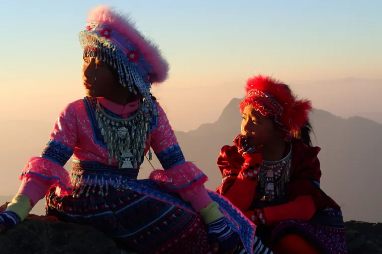
Hmong families have lived on the Doi Yao–Doi Pha Mon ridges that include Phu Chi Fa for more than a century. Their ancestors came from southern China; uprisings there in the mid-19th century drove Hmong south, and they began entering northern Lanna in the 1800s. The remembered route runs from Yunnan through Mueang La in Sipsongpanna and Udomxai in Laos, then across the Mekong up onto Doi Pha Mon, above 1,000 metres. Community records in Por subdistrict say households were already settled on these ridges in 1889. The villages nearest the viewpoint today, Ban Rom Fa Thong and Ban Rom Fa Thai, are Hmong communities.
During the transition from Lanna to Siamese rule, the ruler of Chiang Khong appointed Hmong leaders over the two ridges: "Phraya Phiphak" over Doi Yao and "Phraya Lao-u" over Doi Pha Mon — the later name Doi Phaya Phiphak comes from this title. The posts were abolished in 1932 and replaced by Thai subdistrict and village heads. Opium was the Hmong's main cash crop for generations; while the trade was legal, mountain families grew and sold it to opium dens in Chiang Rai and Luang Prabang.
Tension built up from the early 1960s. Hmong on the ridges faced extortion by officials, discrimination, livestock killed without compensation, exclusion from citizenship and a lack of basic services; community accounts say that in 1966 officials demanded 5,000 baht and pork from each household. Meanwhile the Communist Party of Thailand (CPT) began sending cadres into Doi Yao–Doi Pha Mon from around 1963. A Hmong recruiter, Jong Teng Vang, who had gone to Laos around 1960, returned in 1963 promising an end to discrimination, and when police arrested the headman of Doi Pha Daeng, about 10 km from Huai Chomphu, on communist charges, his nephew joined the CPT.
The day the guns first fired on these ridges was 8 May 1967 at Ban Huai Chomphu in Thoeng (now Khun Tan) district. Officials and Border Patrol Police came to fine four Hmong families for swidden farming in a restricted area; the villagers fled and a firefight broke out, wounding one Hmong man and killing one policeman. Days later the police returned in force, killed the livestock and burned almost every house, and the homeless villagers joined the CPT. That same year Field Marshal Thanom Kittikachorn's government sent troops in. Fighting on these ridges lasted about 14 years, and the area was classed as one of the most dangerous "red zones", a gateway linking Thailand, Laos and Vietnam.
Between late 1970 and early 1971, former Chinese Nationalist soldiers from Doi Mae Salong and the Border Patrol Police launched an operation to clear strongholds along Doi Yao–Doi Pha Mon. The Doi Pha Mon base fell on 3 January 1971, but fighting on these ridges went on for years. The dense forest and cliffs made it hard for soldiers to climb the mountain, while the Hmong, who knew every ridge, could not come down either.
The whole Doi Yao–Doi Pha Mon area became the CPT's "Zone 8", covering Thoeng and Wiang Kaen districts; six of its nine zone committee members were Hmong. About 5 km inside Laos near Phu Chi Fa stood the "October 6 School", where new recruits took a three-month course. After the massacre of 6 October 1976 many student activists joined the CPT in the Chiang Rai zone, which included Phu Chi Fa; one who arrived in October 1977 recalled how isolated it was, on the Lao border a full day's walk from anywhere.
China backed the CPT with ideas and supplies sent through Laos. The party's Kunming-based radio called on the Hmong to take up arms on 30 August 1969, and Hmong members were sent to study in Yunnan, Beijing and North Vietnam. But in January 1979 Laos ordered the CPT out within a month, and on 10 July 1979 the Voice of the People of Thailand announced it would stop broadcasting. Chinese supplies dried up and the border bases began to weaken.
The turning point came with Prime Ministerial Order 66/2523 (1980), which put politics ahead of military force. In 1981 the 473rd Infantry Battalion under Lt. Col. Viroj Thongmit launched the operation to seize Hill 1188 on Doi Phaya Phiphak, on the Doi Yao ridge. It ended the fighting in the area, but at the cost of many soldiers' lives.
Ceasefire talks were held in October 1981, and in 1981–1982 about 1,600 Hmong on Doi Yao–Doi Pha Mon laid down their arms and became "participants in Thai national development". The agreement covered security, Thai citizenship, roads, 15 rai of farmland per family, schools and health services. Villagers received temporary ID cards in December 1981 and road building began in January 1982. The amnesty was repeated in 1982, and by the end of that year every CPT stronghold in the north had collapsed.
On 27 February 1982 King Bhumibol Adulyadej, with Queen Sirikit and members of the royal family, visited the Phaya Phiphak base on Doi Yao and, at the soldiers' request, pressed his footprints into a plaster slab. The footprints are now kept at the Royal Footprint Pavilion in Mengrai Maharat Camp, Mueang Chiang Rai. After the visit the army declared Doi Yao–Doi Pha Mon a security development zone.
Once the area was peaceful, a road was cut along the Thai–Lao border from Ban Pha Tang past Phu Chi Fa to Chiang Kham district, opening the ridge to outsiders for the first time. Visitors began coming for the sea of mist in 1991, and Phu Chi Fa soon became one of the best-known sunrise viewpoints in the north.
On 6 February 1998 the Royal Forest Department ordered the creation of Phu Chi Fa Forest Park, covering about 2,500 rai inside a national forest reserve, with an average slope of about 40%. Today the area is managed as Phu Chi Fa National Park (in preparation), which covers a far larger area than the original forest park.
Tourism and conservation have also brought land disputes. In 2000 forestry officials arrested villagers farming within the security development zone, leading to disputes that needed mediation. Many families say they received only about 10 rai of farmland rather than the 15 rai agreed, and many still lack land documents. Since 2005 the communities have organised as a network proposing community forest management; on 24 July 2008 the Por Subdistrict Community Organisations Council was formed, covering Por, Tap Tao and Yang Hom with about 4,367 households and 15,674 people, and in 2010 the communities applied for a community land title. The planned national park in 2018–2019 left villagers worried about their homes, guesthouses and fields, and some Hmong responded by setting aside sacred forest and growing coffee and cocoa.
Memories of the war years remain. There is a memorial to former CPT members in Thoeng district, and many former Hmong members say the compensation promised after the 1980 and 1982 amnesties was never fully paid; some have tried to return to old fields that now lie inside national parks or protected areas.
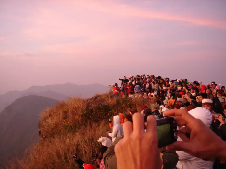
Today Phu Chi Fa receives about 250,000–300,000 visitors a year, with the peak from December to February. Overnight stays on the summit are not allowed for safety, so most visitors sleep in Ban Rom Fa Thong or the designated campground and walk up before dawn; many Hmong families run guesthouses and shops. The ridge grass turns gold in the cool and hot seasons and green again in the rains.
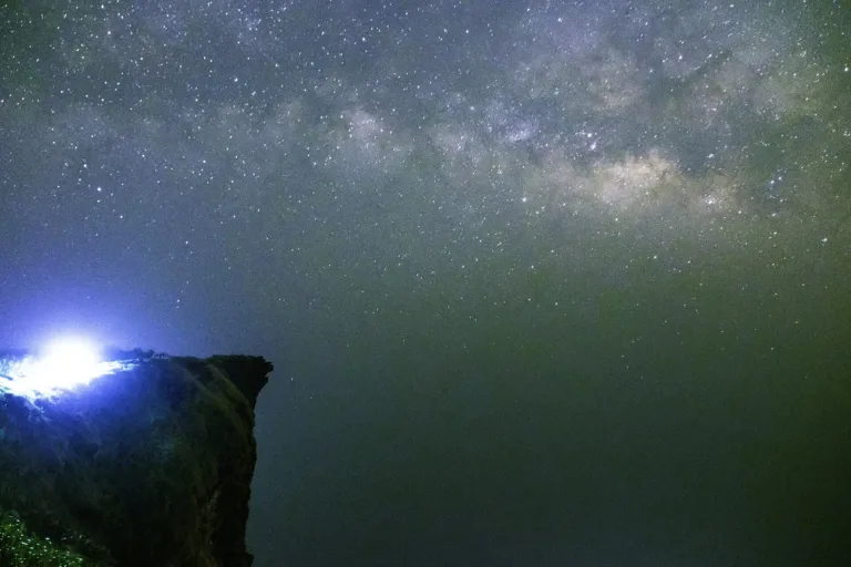
From the top you can follow the ridge all the way to Doi Pha Tang, another sea-of-mist viewpoint on the same border, and on clear early-year nights Phu Chi Fa is a favourite spot for photographing the Milky Way, far from big-city lights.
Arrived? Check in, collect a stamp and tell others what it is like right now
Check your location first, so you do not fill in the form for nothing
Location must be on and within 3 km · One check-in per place per day · come back on other days to check in again
Post photos from anywhere — no need to be here · Up to 20 photos at a time · JPG / PNG / WebP · GPS location data is removed automatically
From Chiang Rai take Route 1020 to Thoeng, then Route 1155 u…
Chiang Rai–Thoeng (1020) then Route 1155 · Fuel
Bus to Thoeng, then hire a songthaew or taxi up the mountain · Varies
Bangkok–Mae Fah Luang Chiang Rai Airport, then a rental car · Varies
Route 1020 Chiang Rai–Thoeng, then Route 1155 up to Phu Chi Fa (or Route 1093 from Doi Pha Tang/Chiang Kham)
Park car park and in Ban Rom Fa Thong
Fill up in Thoeng before the climb
AIS works best on the ridge
Viewpoint opens before sunrise (check with the park)
around 115 km fromChiang Rai city
Phu Chi Fa
Approx. nightly price for 2 adults (next week) · final price depends on your dates
Answers travellers want before they go — a one-minute read
About 1,628 m, the highest point of the Doi Pha Mon range
About 750 m from the park car park or about 400 m from the Ban Rom Fa side, 15–30 minutes
No, overnight stays on the summit are banned; use the campground or the village
Best Nov–Feb, with chances from late October
The sharp cliff tip juts out like a finger pointing at the sky, clearest from the Lao side
Yes, the Doi Yao–Doi Pha Mon ridges saw fighting with the CPT until early 1982
Best day this week: Friday 23 Oct · Check in when you arrive to collect a stamp