Mon Jam
A mountain viewpoint about 1,350 m up in the Nong Hoi Royal Project, Mae Rim: temperate flower and vegetable fields, strawberry farms, early-morning seas of mist in the cool season, and a Hmong community that switched from opium to highland farming.
Before you goWhich of the next 7 days is best Best dayTuesday 20- Severe weatherNone
- EarthquakesNone in 48 h
- Major disastersNone
- Site noticesNone
About
Overview · highlights · who it suits
Mon Jam is a mountain viewpoint in Ban Nong Hoi, Mae Raem subdistrict, Mae Rim district, about 40–50 km from Chiang Mai city and roughly 1,350 m above sea level. It lies within the Nong Hoi Royal Project Development Centre, which helped Hmong farmers switch from opium to temperate vegetables, fruit and flowers.
Up top you'll find layered mountain views, flower gardens, strawberry farms, restaurants, cafés and all kinds of places to stay. The best time is the cool season, Nov – Feb; to see a sea of mist, stay overnight and get up before sunrise. The road up is steep and winding — drive in low gear.
Don't-miss highlights

Mon Jam summit viewpoint
Layer upon layer of mountains from about 1,350 m
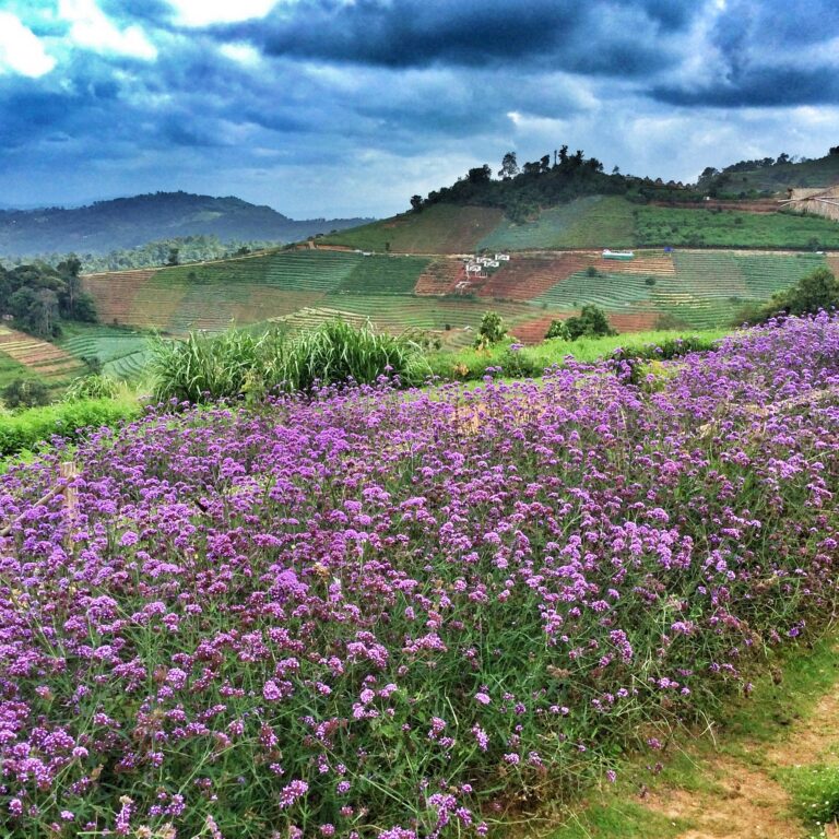
Temperate flower fields
Verbena and cool-climate flowers covering the slopes
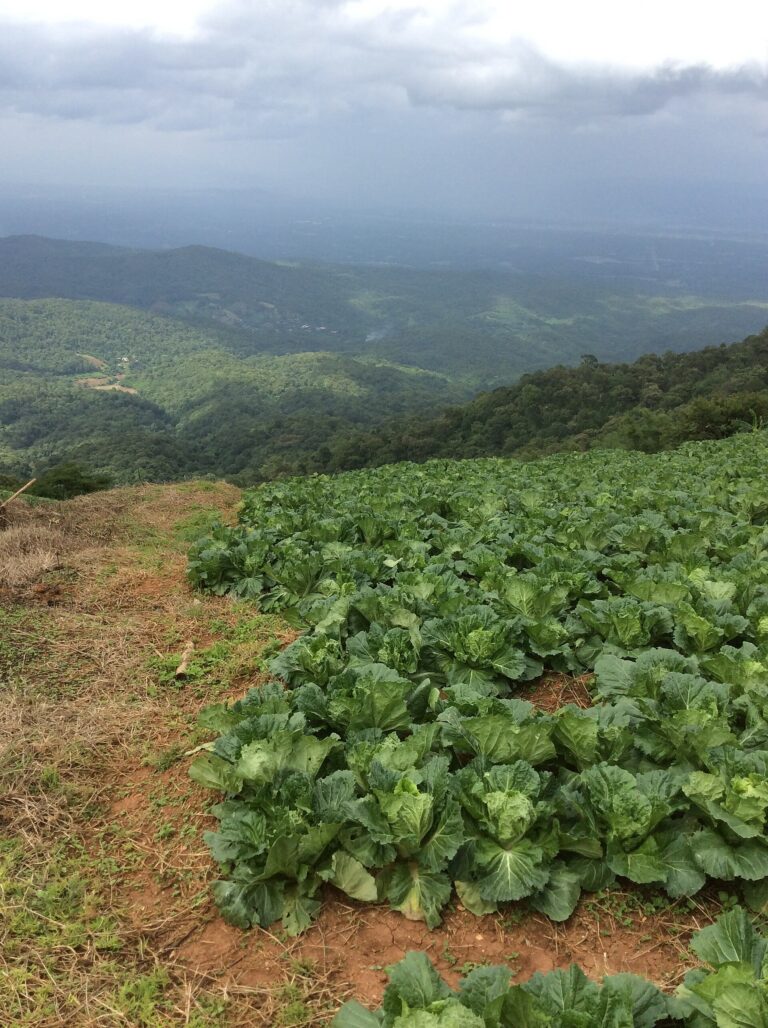
Royal Project farm plots
Temperate vegetables and fruit grown in place of opium
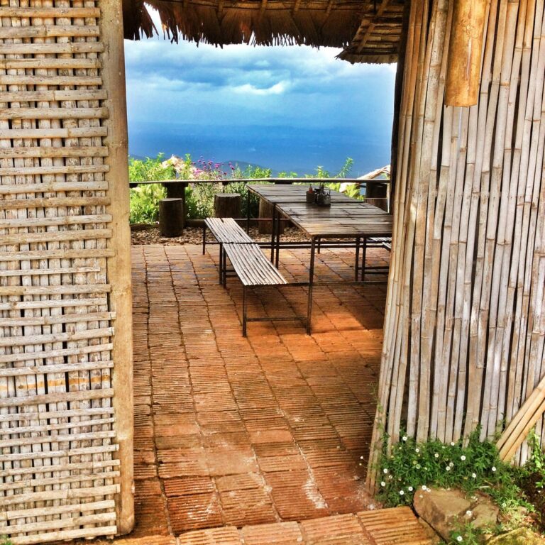
Restaurants and view cafés
Coffee on a terrace overlooking the valleys
Morning sea of mist
In early cool season, mist often fills the valleys
Before you go
Gallery
Get a feel for the place · tap a photo to enlarge
Flower field and mountainsWide view of farm plots and lodgings on Mon Jam · Photo: Supanut Arunoprayote (CC BY 4.0)Wide view of Mon JamLayered mountains seen from Mon Jam · Photo: Supanut Arunoprayote (CC BY 4.0)Layered mountainsRestaurant terrace with a view on Mon Jam · Photo: UT (Panoramio) (CC BY-SA 3.0)Restaurant terraceFlower garden and viewpoint on the Mon Jam summit · Photo: UT (Panoramio) (CC BY-SA 3.0)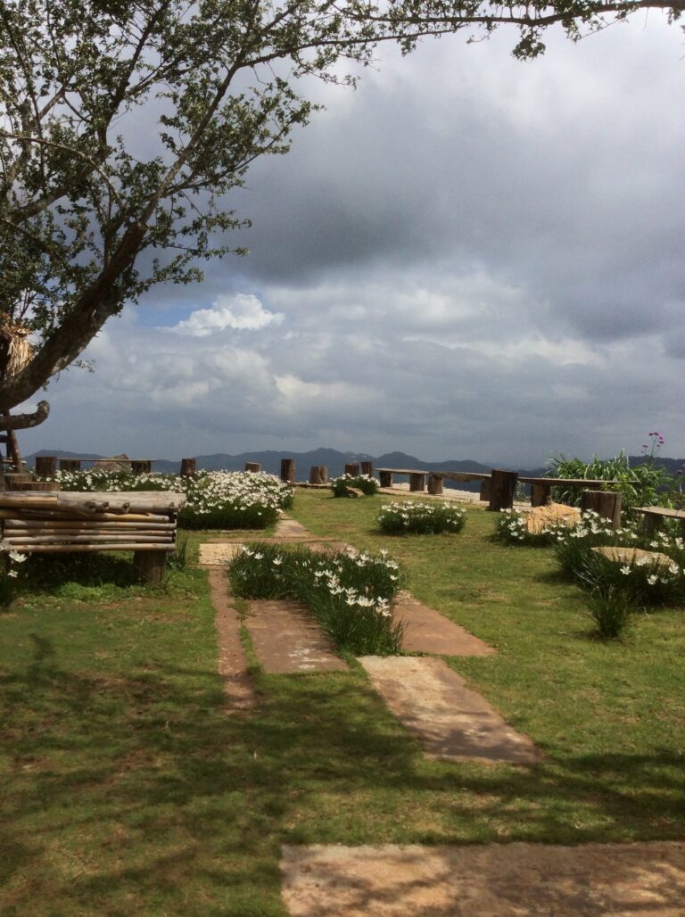 Summit gardenPurple verbena on Mon Jam · Photo: UT (Panoramio) (CC BY-SA 3.0)
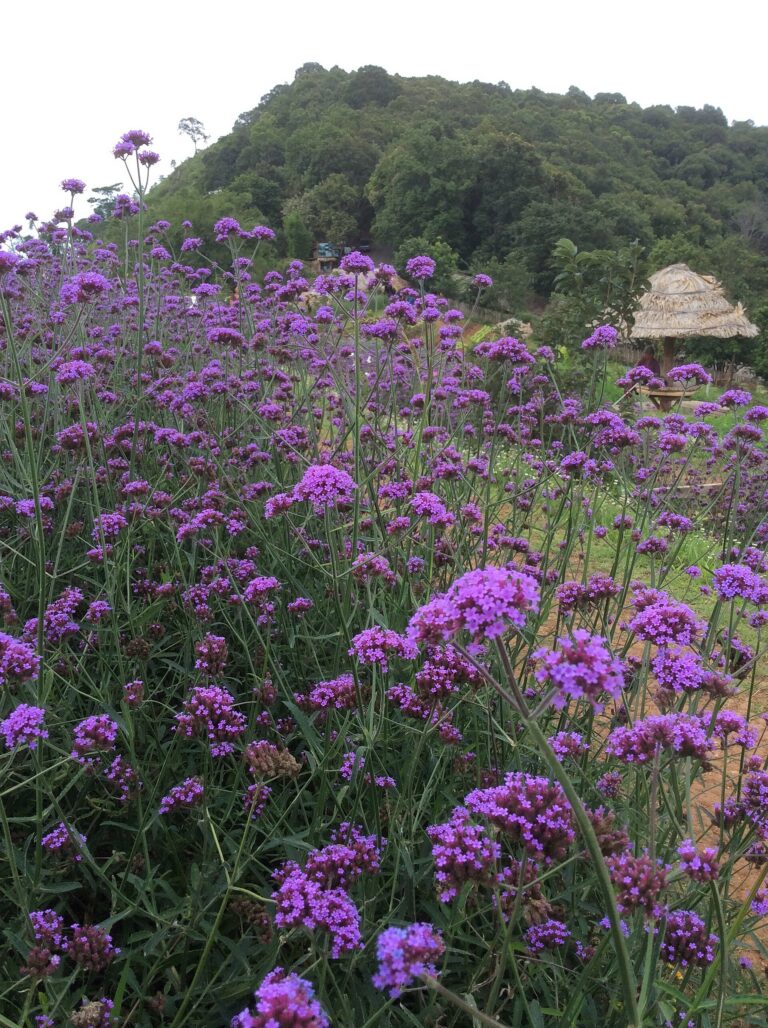 VerbenaTemperate vegetable plots on the mountain · Photo: UT (Panoramio) (CC BY-SA 3.0)Temperate vegetable plots
Photo credits7 photos from Wikimedia Commons
 Flower field on Mon Jam with mountain viewsPhoto: UT (Panoramio) CC BY-SA 3.0
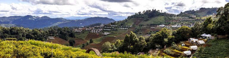
 Wide view of farm plots and lodgings on Mon JamPhoto: Supanut Arunoprayote CC BY 4.0
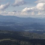 Layered mountains seen from Mon JamPhoto: Supanut Arunoprayote CC BY 4.0
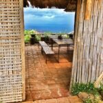 Restaurant terrace with a view on Mon JamPhoto: UT (Panoramio) CC BY-SA 3.0
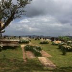 Flower garden and viewpoint on the Mon Jam summitPhoto: UT (Panoramio) CC BY-SA 3.0
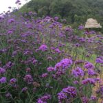 Purple verbena on Mon JamPhoto: UT (Panoramio) CC BY-SA 3.0
 Temperate vegetable plots on the mountainPhoto: UT (Panoramio) CC BY-SA 3.0
Before you go
Weather, haze and crowds before you set off
Best time of day — hourly
MoreWhat to bring · costs · crowds · travel warnings · detailed weather
What to bring —
Estimated costs
Crowds — estimate
Travel warnings
Best months
Tap a month to see weather, rain, haze and crowds
The cool season brings crisp cold air, temperate flowers in bloom, strawberries in season (Oct – Feb) and the best chance of a sea of mist at dawn. To see the mist, stay overnight on the mountain.
Late Feb – Apr often brings forest-fire haze (PM2.5) that blurs the mountain views. In the rainy season the road up is steep and slippery. On cool-season long weekends the road up jams and car parks fill.
- Weather
- Rain
- Haze
- Crowds
See 10 years of real weather dataMonthly temperature, rainy days, clear days and haze
Past weather records
Check-ins & visitor photos
Location must be on and within 2 km · you can check in on every visit
History & stories
Legend · history · architecture
Mon Jam is a mountain viewpoint about 1,350 m above sea level in Ban Nong Hoi, Mae Raem subdistrict, Mae Rim district, roughly 40–50 km from Chiang Mai city. Before it was known as Mon Jam, locals called this spot "Kiw Suea" (Tiger Pass).
The first Hmong settlers arrived at the old Nong Hoi village in 1904, and the village had its first official headman in 1941. The community was here before the area was declared a national forest reserve in 1964. In the past villagers practised shifting cultivation and grew opium, leaving many slopes with little forest cover.
King Bhumibol (Rama IX) first visited the villagers of Ban Nong Hoi in 1969 to see the problems for himself: opium growing, forest cleared for fields, and damaged headwaters. Being so close to Chiang Mai city, the village was both a drug and a security concern. He returned many times, and the Hmong of Nong Hoi still fondly call him "Pho Chao Luang" (Royal Father).
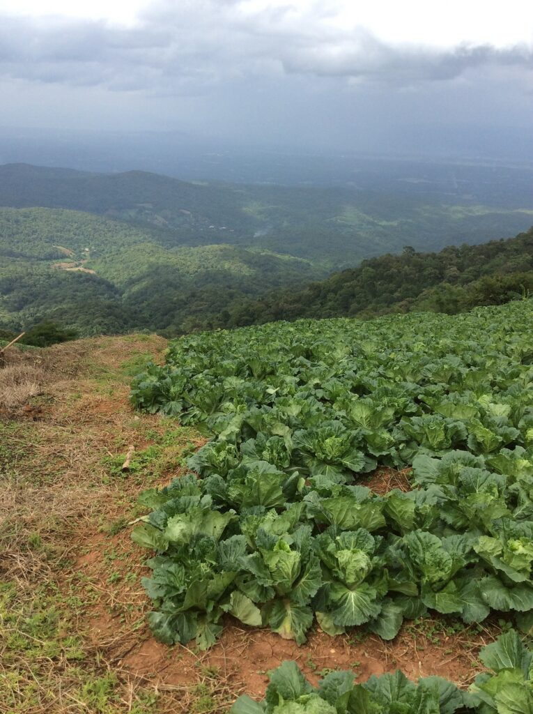 Temperate vegetable plots grown in place of opium under the Royal Project · Photo: UT (Panoramio)
Read more history 11 more paragraphs
On another visit in 1984 King Bhumibol Adulyadej (Rama IX) came to Ban Nong Hoi and found villagers still growing opium and living in poverty. Prince Bhisadej Rajani then set up the Nong Hoi Royal Project Development Centre, encouraging farmers — including the Hmong — to grow temperate vegetables, fruit and flowers instead of opium, alongside restoring the forest and improving livelihoods.
The Nong Hoi Royal Project area ranges from 850 to 1,460 m with an average temperature of about 21°C, ideal for cool-climate crops. Today it grows strawberries, artichokes, plums, seedless grapes, tomatoes and herbs such as lemon thyme, mint, chamomile and rosemary; visitors can walk the plots and taste fresh produce.
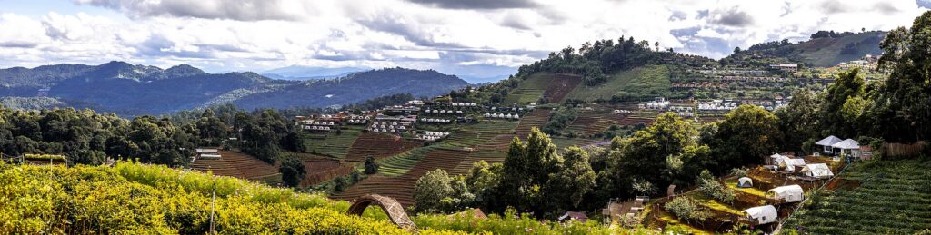 Lodgings and farm plots on Mon Jam today · Photo: Supanut Arunoprayote
Around 1997–1998 the Nong Hoi Royal Project requested land inside the Mae Rim National Forest Reserve for villagers to farm. The reserve is a class-1A headwater forest of more than 140,000 rai (about 22,400 ha); the farming allocation was roughly 2,000 rai for over 600 people on more than 900 plots. 30 June 1998 became the key cut-off date for proving farming rights, and a Cabinet resolution of 11 May 1999 on northern farmland disputes is still cited by villagers today.
Tourism began in 2002, when the Royal Project started promoting the area's tourism potential, followed by homestays and agritourism. In late 2009 the Royal Project developed the Kiw Suea site for visitors, led by a grandson of Prince Bhisadej, and named it "Mon Jam" because it sounded pleasant and matched nearby Doi Mon Long. In 2014 the community registered as a community enterprise.
Nearby Doi Mon Long, about 1,450–1,460 m, is the highest viewpoint in Mae Rim. Local legend says it is the burial place of Khun Luang Wilangka, a legendary ruler of the Lawa people; the name "Mon Khwam Long" (Overturned Coffin Hill) comes from the story of his coffin tipping over during the funeral procession.
Popularity kept climbing. For the October 2019–January 2020 high season, operators estimated 2,000–3,000 overnight visitors a day and around 1.5 million baht spent daily. Plots inside the project began changing hands, and homestays, campsites and cafés spread along the whole ridge and into Mae Raem and Pong Yaeng subdistricts.
Fast tourism growth raised concerns about forest clearing, waste and unpermitted buildings. In January 2020 the Director-General of the Royal Forest Department invoked Section 25 of the National Forest Reserve Act to halt construction of lodgings in the reserve. A first survey found 53 operators using about 229 rai: 38 had farming rights, 12 had rights but had expanded beyond them, and 3 had sold to outsiders and were prosecuted. In August 2020 officials reported 113 resort and lodging operators using land against the Royal Project's purposes; 30 faced stronger legal action and some structures began to be demolished.
In November 2020 the Chief Ombudsman visited the area. His review counted about 113 plots turned into resorts and lodgings: 31 operators had been prosecuted, while 82 were original landholders who had gone into business and would need to prove their rights against 2002 aerial photos and a 2009 boundary survey, and return to highland farming within the law. He recommended a Mon Jam master plan drawn up by the province, agencies and residents, plus a community enterprise for farming and agritourism; villagers farming within the original boundaries were not to be affected.
On 29 August 2022 more than 500 Hmong residents blocked access to the area after over 100 forestry officers prepared to demolish homes and homestays in a class-1 watershed zone, while villagers insisted theirs is an original community more than a century old.
Chiang Mai's environment office inspected 122 lodgings and found 36 with changed holders, nominee arrangements or transfers to investors. By then 10 cases had been prosecuted and demolished — 5 by the owners themselves and 5 by officials. On 31 August 2022 the National Human Rights Commission asked the governor to delay demolitions; on 4 September officials spent a whole day trying to demolish but were stopped by villagers, and on 6 September residents' representatives petitioned the Natural Resources Minister in Bangkok. About 3,800 villagers hold some 2,500 rai in total — under one rai each on average. The government maintains that Doi Mon Jam is not private land, cannot be bought or sold, and that only those without rights will be prosecuted.
Today the community enterprise is working on rules for sustainable tourism — visitors can help by staying with licensed operators and taking their rubbish back down the mountain.
Location & getting there
Map · how to get there · costs
Directions use live traffic to estimate travel time
- Travel timeAbout 1–1.5 hrs from Chiang Mai city
- RoadSteep, winding mountain road after the Pong Yaeng junction
- ParkingSeveral car parks on the mountain; full early on cool-season holidays
- FuelFuel stations in Mae Rim town before the climb
Suggested route
From Chiang Mai take the Chiang Mai–Fang road (Highway 107) to Mae Rim, then turn onto the Mae Rim–Samoeng road (Highway 1096), past the Queen Sirikit Botanic Garden, to the Pong Yaeng junction, and turn up the mountain to Ban Nong Hoi — about 40–50 km in total.
After Pong Yaeng the road climbs steeply with many bends; small cars should use low gear both up and down. It gets slippery in the rainy season.
Without a car, charter a songthaew from Mae Rim market or from Chiang Mai, or book a half-day Mae Rim–Mon Jam tour.
4 ways to get there
Highway 107 → 1096 to the Pong Yaeng junction, then up the mountain; steep and winding — use low gear
Needs enough power and a rider used to mountain roads; very cold wind in the cool season
Charter from Mae Rim market or Chiang Mai city; agree the fare and waiting time clearly
Mae Rim–Mon Jam tours often add the botanic garden and a strawberry farm
Prices and times are estimates and vary with season and traffic
Food nearby
Popular places within 5–10 km
Nearby next stops
Stops on the same route