 01
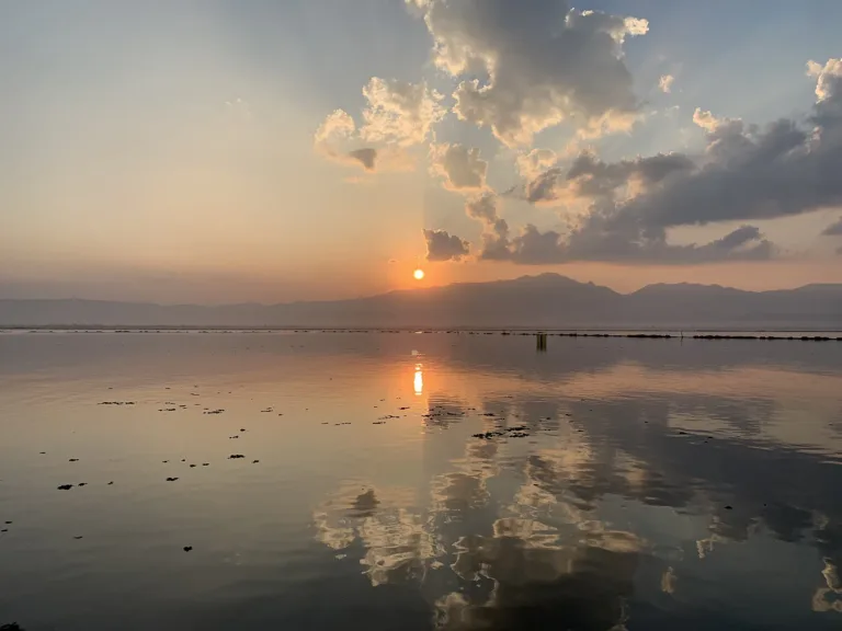
Sunset over the lakeThe last light behind the mountains on the water
PHAYAO · KWAN PHAYAO
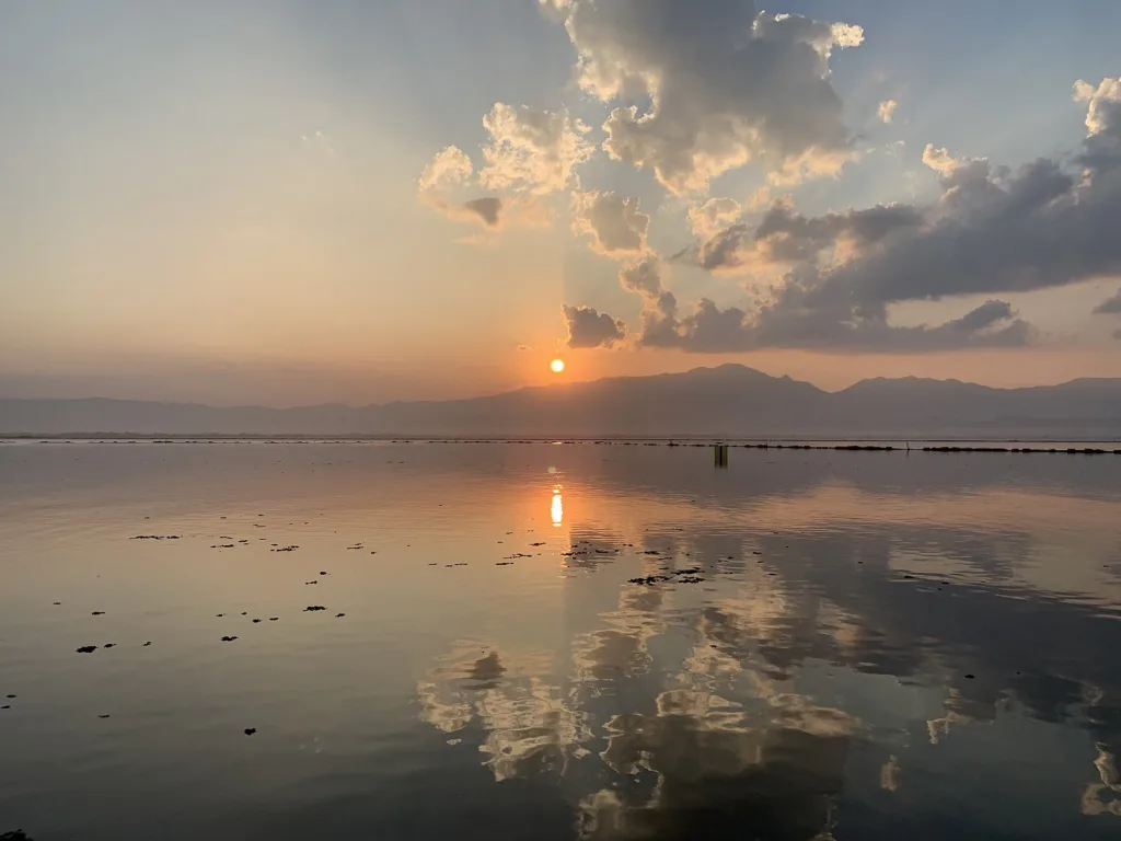
Northern Thailand's largest freshwater lake, on the edge of Phayao town — sunsets over the water, the 500-year-old Wat Tilokaram submerged in the lake, and candlelit boat processions.
Holiday / event — crowded · หมอกหนาช่วงเช้า ทัศนวิสัยต่ำ · Chance of a sea of mist 9/10
sea-of-mist places: morning matters most
May – Sep
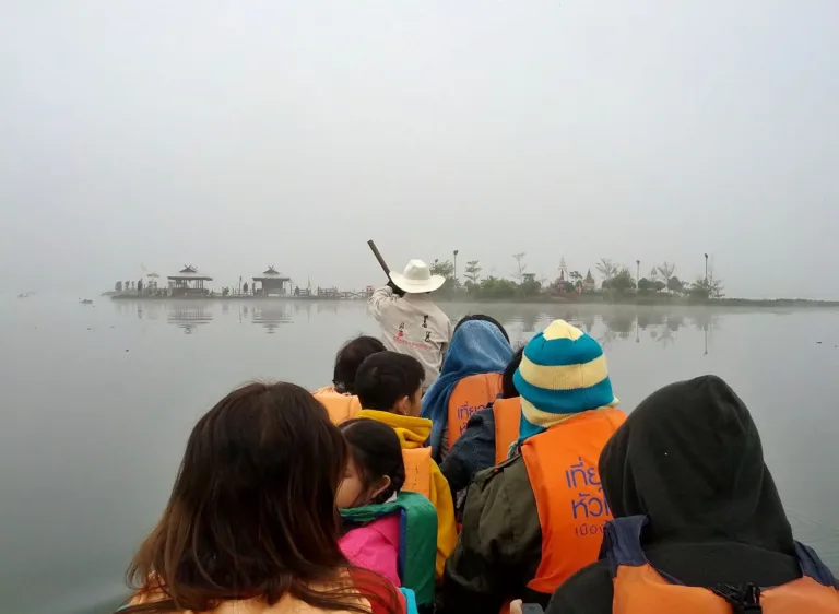
Boats — Always wear a life jacket on the boat to Wat Tilokaram, and stay seated
2–3 hours
Excellent mobile signal — it is in town
01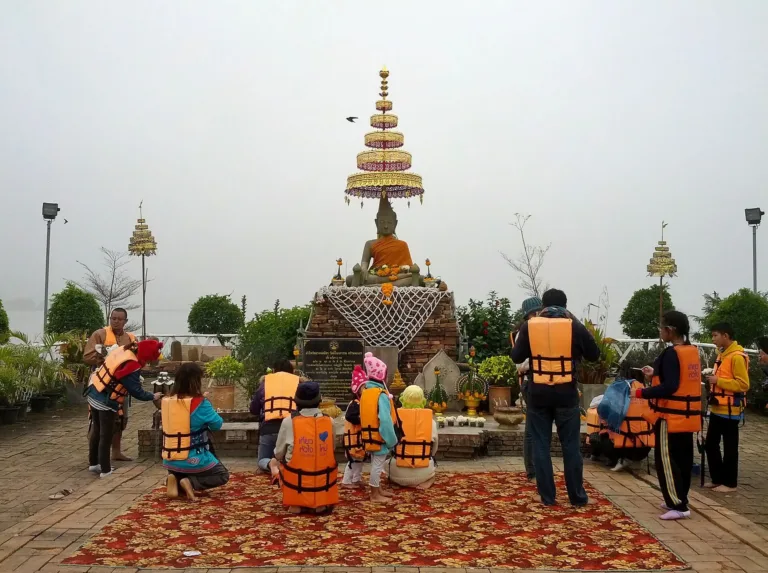 02
 03
 04
 05
Tap a day card to see that day’s weather, rain, haze and hourly forecast
Best time to go Fine all day little rain through the day
Thick morning fog with visibility under 1 km — use headlights and drive slowly
Holiday — traffic on the way up and parking fills fast; leave early
Green band = hours used for the score
Best time to go Fine all day little rain through the day
Thick morning fog with visibility under 1 km — use headlights and drive slowly
Holiday — traffic on the way up and parking fills fast; leave early
Green band = hours used for the score
Best time to go Fine all day little rain through the day
Thick morning fog with visibility under 1 km — use headlights and drive slowly
Holiday — traffic on the way up and parking fills fast; leave early
Green band = hours used for the score
Best time to go Best window 06:00–14:00 Little rain · light drizzle possible at times
Thick morning fog with visibility under 1 km — use headlights and drive slowly
Green band = hours used for the score
Best time to go Best window 08:00–13:00 Little rain · light drizzle possible at times
No warnings today — normal road and weather conditions
Green band = hours used for the score
Best time to go Fine all day little rain through the day · light drizzle possible at times
No warnings today — normal road and weather conditions
Green band = hours used for the score
Best time to go Fine all day little rain through the day
Thick morning fog with visibility under 1 km — use headlights and drive slowly
Green band = hours used for the score
Scored from cloud cover at every level and tonight’s moonlight — the darker the sky, the clearer the Milky Way · tap another night below for the next 7 nights
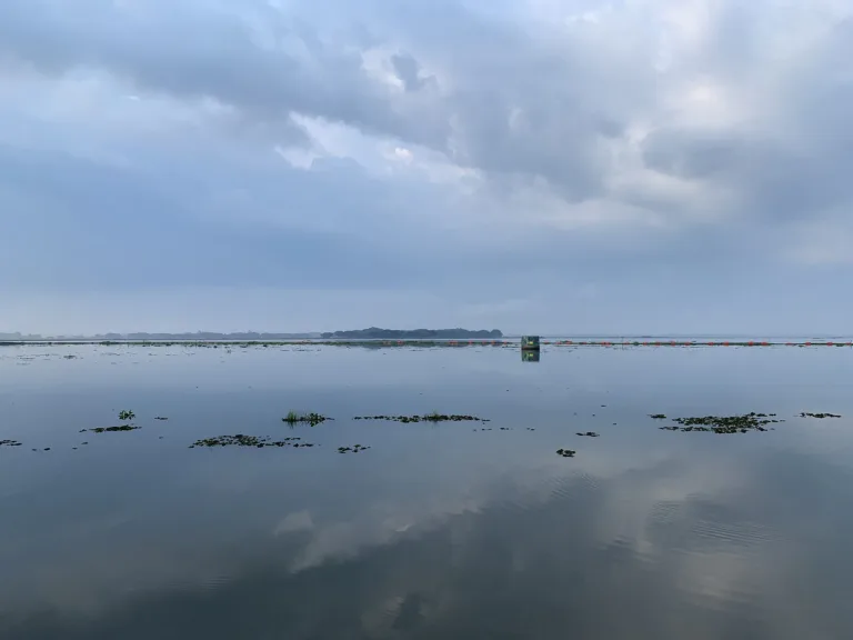
Kwan Phayao (Phayao Lake) is the largest body of fresh water in northern Thailand, right beside Phayao town with the Doi Luang range behind it. It was once lowland and marshes such as "Nong Iang" along the Ing River, until a Fisheries Department sluice gate finished in 1941 flooded it into today's lake.
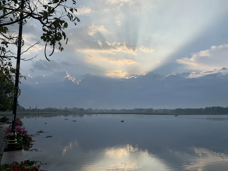
Its draws are sunsets over the water, the long lakeside promenade, Wat Tilokaram — a 500-year-old temple submerged in the lake that you can reach by boat — and candlelit processions on the water on major Buddhist holy days.
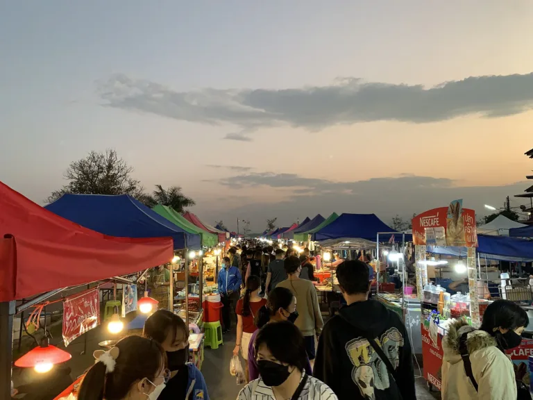
The lakeside is public and free. Evenings are best for a stroll, the last light, and grilled fish or "pla som" (fermented fish), Phayao's famous speciality.
On cool-season mornings (Nov – Jan) light mist often lies on the water, clearest around 6:30–8:00. In the evening, year-round, the sun sets behind the mountains on the lake's western side.
Photos from Wikimedia Commons and contributors · full credits inClassic page
Always wear a life jacket on the boat to Wat Tilokaram, and stay seated
Some lakeside railings are low — keep a close eye on small children
Plenty of insects at dusk — bring repellent
Late in the dry season the shore turns to mud and water hyacinth — don't walk out on it
Adults 0 THB · Time needed 2–3 hours
Friday–Sunday evenings, the cool season and year-end festivals
| Boat to Wat Tilokaram (2015 price; may have changed) optional | 30 ฿/person |
Cash and bank transfer; most lakeside shops take transfer · Prices may change by season — check with the venue
Candlelit boat processions at Wat Tilokaram on Makha, Visakha and Asalha Bucha days · year-end lakeside festivals (vary by year)
Tap a month on the wheel to see weather, rain, haze and crowds from 10 years of records
Best time · November–February is cool with clear skies and light morning mist on the water; sunsets behind the mountains are at their finest, and the lakeside promenade is pleasant for walking.
Watch out · March–April brings smoke haze from burning — hazy skies, dull sunsets and heat. Late in the dry season the water level drops, exposing silt and water hyacinth.
Oct by the records 22–29°C · avg rain 144 mm (18 rainy days) · clear 7 days · avg PM2.5 8
Kwan Phayao, in Mueang Phayao district, is the largest body of fresh water in northern Thailand and the third or fourth largest in the country, after Nong Han in Sakon Nakhon and Bueng Boraphet in Nakhon Sawan. Area figures vary with the source and water level, from about 10,915 rai (17.55 km² on average) to 12,831 rai (about 20.5 km²). It averages about 1.5 m deep, up to about 4 m, with its surface some 393 m above sea level. It is fed by the Ing River and 13–18 tributary streams, holds about 31–34 million m³ of water, and is backed to the west by Doi Luang in the Phi Pan Nam range.
"Kwan" is a Lanna word found only in Phayao, meaning a large marsh or lake. An article in Silpa Wattanatham suggests it derives from "kwan" in the Tai–Lao languages, meaning to gather — also used for a village hall, meeting house, guardian-spirit shrine or a ruling official's title.
Before 1941 there was no lake here, but low-lying land in a valley along the Ing River, threaded with channels linking ponds large and small ("nong" and "buak"). The most important was "Nong Iang". In the rainy season, roughly July to November, floodwater merged them into two basins, Kwan Noi in the west and Kwan Luang in the east, while in the dry season they shrank back to ponds and paddy. Maps surveyed in 1919–1921 still show these ponds. This fertile land had been settled since ancient times. The marsh was originally called "Nong Nok Iang". On 17 January 1919 the Phayao district agricultural officer surveyed it at roughly 50 by 50 sen (about 2 km each way), about a cubit deep at the edges in September and about 1 wa 3 sok (some 3.5 m) in the middle, ringed by bamboo forest, with the nearest village about 4 sen (160 m) away. Kwan Noi and Kwan Luang were joined by a channel called "Mae Rong Noi Hang", and another, "Rong Hia", ran from Kwan Luang to the Ing.
Drought was a key driver behind the lake. Around 1904, as Phayao's population grew, water ran desperately short. Officials proposed moving the town to Ban Mae Tam Lai Ing, but residents — still wary after the Shan ("Ngiao") rebellion of 1902 — refused, and the plan collapsed. In the dry season villagers dug wells in the middle of the marsh and carted water into town by ox cart to sell, making water-selling a trade, while people from the far bank carted rice and lac across the lowland to market.
Phayao's chronicles say Khun Chom Tham, ancestor of King Ngam Mueang, founded a settlement on the Ing plain known as "Nong Iang at the foot of Phu Yao", which became Phayao. Ngam Mueang, the first Phayao king attested by evidence, was born in 1238, studied at Lavo alongside King Ram Khamhaeng, took the throne around 1258 and allied with King Mangrai and the Phra Ruang kings of Sukhothai. After his death (1298 by some sources, 1318 by others), Phayao was absorbed into the Lanna kingdom.
In the Lanna era a major temple stood beside Nong Iang: Wat Tilokaram, known locally as "San That Buak Si Chaeng", built in 1476–1486 to honour King Tilokarat, ninth Lanna king of the Mangrai dynasty, who funded it; some sources say it was built by Chao Hua Saen on the king's orders. The temple and its surrounding community stood on dry land for centuries.
The turning point came from state fisheries. From 1901 a water-fee law required anyone fishing in ponds and marshes to obtain a licence and pay a levy. In 1923 a team led by Dr Hugh McCormick Smith, the American fisheries expert who later became the first director of the Fisheries Conservation Department (forerunner of the Department of Fisheries), surveyed Nong Iang and proposed making it a fish breeding and conservation site. After planning in 1934–35, the Fisheries Department set up the Phayao freshwater fisheries station on the Ing River, and in 1939 began building a sluice gate across the Ing, with a royal decree reserving about 16,225 rai — to keep water for the dry season and slow floods that swamped farms downstream. When the gate was finished in 1941, water spread across some 17–18 km², holding about 33.84 million m³, and the new lake was named Kwan Phayao.
The lake came at a price: paddy fields, houses, temples and archaeological sites on the old lowland disappeared under water, Wat Tilokaram among them. The October 1941 issue of "Mueang Thai" magazine still shows villagers drawing water from wells in the middle of the kwan to sell in town — a snapshot of the moment before the fields became a permanent lake. The water-fee system that burdened fishermen ended with the Fisheries Act of 1947. Tap water drawn from the lake reached the town in 1958, supplied by the waterworks authority.
The lakeside community hit hardest was Ban Rong Hai on the southern shore. It was founded around 1915 by people from Ban Tha Kwan in the old town, later joined by settlers from Ban Kat Mek in Lampang who brought knife-forging with them. Its name comes from a channel where elephants dragged logs down to the Ing, lined with banyan trees ("hai" in northern Thai). When the sluice gate was finished, water flooded the village's fields, houses and temple, and many families moved to higher ground; in 1961 rising water swamped the cemetery, so villagers switched from burial to cremation, and in 1973 the village flooded again when water could not drain. At least 14 spots along this shore hold chedi ruins and artefacts, and villagers call a line of 8–9 ruins running out into the lake "San That" (the relic ridge). Excavations at the abandoned temple of Ban Rong Hai in 2002–2004 and 2018 found an octagonal chedi, a vihara, a boundary wall and Sukhothai-style sandstone walking Buddhas about 150–160 cm tall, dating to the 15th–16th centuries.
Kwan Phayao then became the heart of northern fisheries. In 1949 the Fisheries Department declared it a plant and fish conservation area. In 1958 King Bhumibol and Queen Sirikit made their first visit to Phayao, releasing fish into the Ing River and visiting the Kwan Phayao fisheries station. In 1971 the department built the Kwan Phayao royal residence for the Princess Mother and Princess Galyani Vadhana, and in 1989–1993 it added a hatchery, laboratories, a freshwater fisheries research centre and an aquarium.
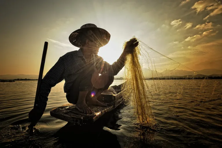
The lake holds about 45–50 freshwater fish species in 17 families — iridescent shark, common carp, Nile tilapia, climbing perch, striped snakehead, bagrid catfish, walking catfish, snakeskin gourami and moonlight gourami among them — and about 36 aquatic plants. Its rich fish stocks made Phayao a major producer of "pla som", fermented fish, now the province's signature product, and local fishermen still go out at dawn to cast their nets.
Wat Tilokaram, beneath the water, was gradually rediscovered. In 1983 a sandstone Buddha in the subduing-Mara posture, in the Phayao school of art and 105 cm across the lap, was found; known as "Luang Pho Sila", it was taken to Wat Si Umong Kham. Boat surveys followed in 2006–07, and on 9 February 2007 a stone inscription in Fak Kham script was found, recording the temple's history, patrons, builders and rituals; it is now kept at the National Archives in Phayao. That year Luang Pho Sila returned to a pavilion at the old temple, and on 24 March 2008 the Fine Arts Department's underwater archaeology unit and navy divers surveyed more than 11 rai, finding nine hexagonal boundary stones, pillar bases, a chedi base, an ordination hall, a preaching hall, a pond and a wall. Today the temple holds candlelit processions on the water three times a year — on Makha, Visakha and Asalha Bucha days — with worshippers in rowing boats circling the brick terrace and chedi, whose tip shows above the surface in the dry season.
Growing popularity and water use took their toll. In 2000 the cabinet designated Kwan Phayao a wetland of national importance, yet by 2009 it was shallow, choked with weeds and silt, with fewer fish and water hyacinth covering about a third of its surface. The Hydro and Agro Informatics Institute and other agencies built sediment-trapping dikes, harvested weeds for animal feed, restocked native fish and added about 370,000 m³ of storage. The lake supplies some 16,500 families and about 43,785 rai of farmland. In 2023 its conservation zone was revised under the 2015 Fisheries Royal Ordinance, and in 2024 the Royal Irrigation Department planned to dredge around the lake and enlarge Nong Leng Sai, at the head of the Ing in Mae Chai, from 9 to about 23.7 million m³ — Phayao's tap-water supply still falls about 720,000 m³ a year short. On governance, the lake falls under the laws and remits of 13 state agencies that do not fully align. Phayao's 2005 comprehensive town plan expired in 2012; that year King Prajadhipok's Institute held dialogues that identified shared problems in ecology, management and public awareness, the Phayao health assembly later reached a joint agreement on caring for the lake, and the Chaipattana Foundation backed five sustainable-development programmes. Ongoing issues include encroachment, wastewater from homes and restaurants, farm chemicals, and illegal fishing with poison, explosives or electricity, while no-fishing zones cut into some fishing communities' incomes.
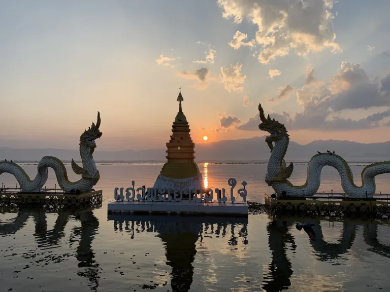
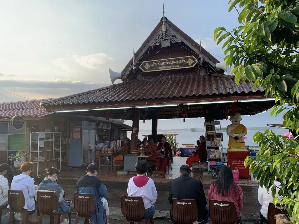
The eastern shore is lined by Chai Kwan Road, a long lakeside promenade that serves as Phayao's living room. Along it are the King Ngam Mueang monument plaza, a twin-naga sculpture with a chedi in the water linked to the legend of the naga king Thumasikhi, and the landing for boats to Wat Tilokaram — 30 baht a person and about 10 minutes in 2015. In the morning people offer sticky rice to monks at the landing around 7:00; in the evening there are markets and grilled-fish stalls, and some years a musical fountain or year-end festival, such as the Fisheries Department's agriculture and tourism fair from 25 December 2023 to 3 January 2024. Lake lovers have also voiced concern that high-rise buildings on the shore could spoil the view.
Visitors can help the lake simply: no litter or food scraps in the water, a life jacket on every boat ride, modest dress on Wat Tilokaram's island, no climbing on the submerged ruins, and buying fish and food from local fishermen.
Arrived? Check in, collect a stamp and tell others what it is like right now
Check your location first, so you do not fill in the form for nothing
Location must be on and within 4 km · One check-in per place per day · come back on other days to check in again
Post photos from anywhere — no need to be here · Up to 20 photos at a time · JPG / PNG / WebP · GPS location data is removed automatically
From Chiang Rai, take Highway 1 (Phahonyothin) south for abo…
Highway 1 south, about 90 km · Fuel
Highways 118 and 120 via Mae Chai, about 150 km · Fuel
To Phayao bus station, then songthaew or walk · By route
Phahonyothin Road (Highway 1) into Phayao town, then Chai Kwan Road; flat all the way
Along Chai Kwan Road and around the King Ngam Mueang plaza; fills fast on weekend evenings
Petrol stations in Phayao town on Highway 1
Excellent mobile signal — it is in town
The lakeside is public and open all day; boats to Wat Tilokaram run during the day
around 94 km fromChiang Rai town
Kwan Phayao, Chai Kwan Road, Phayao
0 THB
Approx. nightly price for 2 adults (next week) · final price depends on your dates
Best day this week: Thursday 29 Oct · Check in when you arrive to collect a stamp