 01
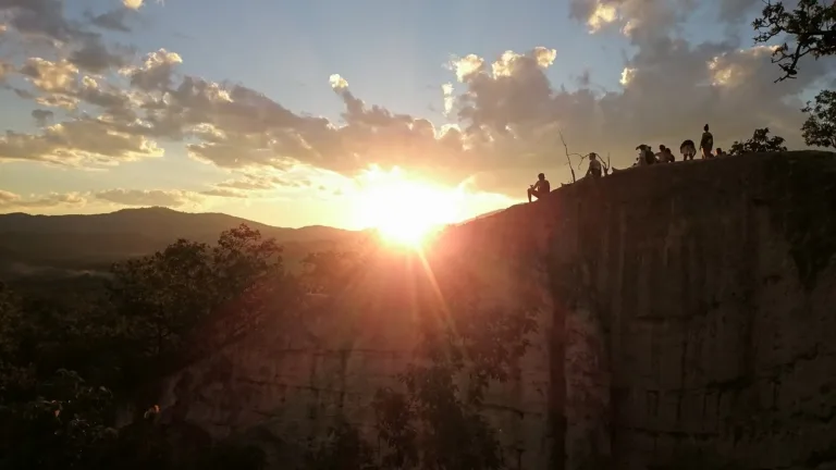
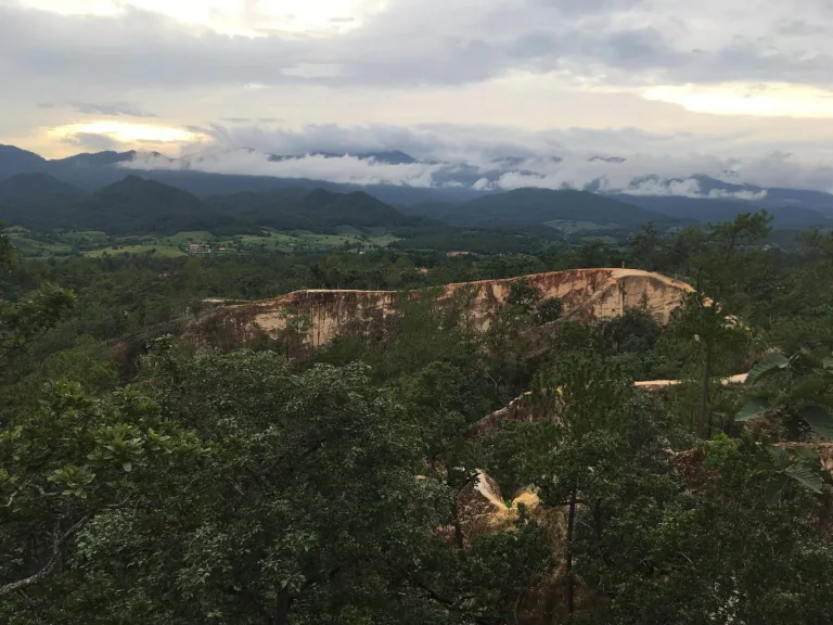
SunsetOrange light over the Pai valley
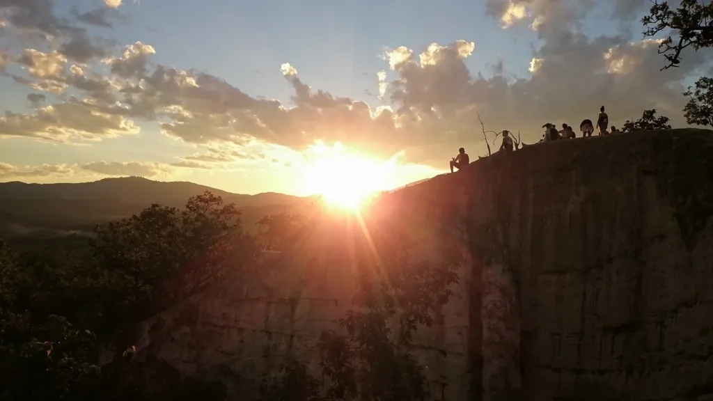
Eroded ridges · Pai
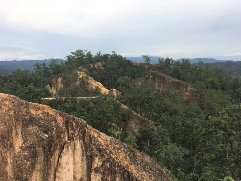
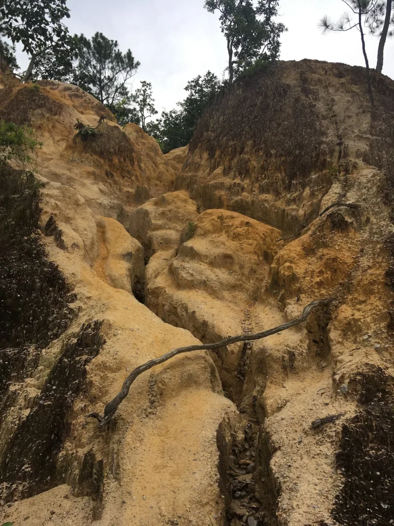
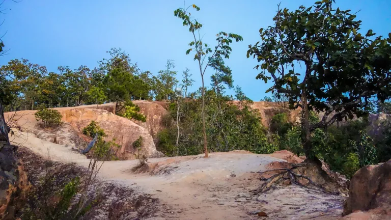
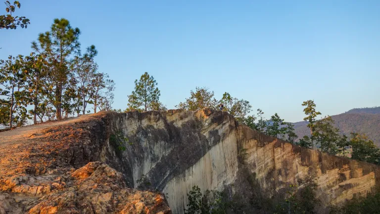
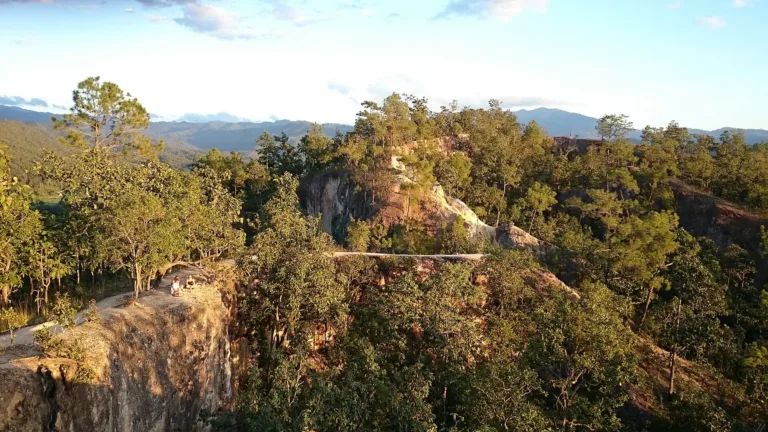
Eroded earth ridges and cliffs beside Highway 1095, 7–8 km from Pai town. The name means "the monitor lizard's path"; travellers call it Pai Canyon. A favourite free sunset spot.
Holiday / event — crowded · Just outside the best season · Chance of a sea of mist 5/10
sea-of-mist places: morning matters most
Jun – Sep
Falls — People fell in 2017, 2024 and 2026; the outer ridges have no railings
30–60 minutes
Patchy on the ridges
01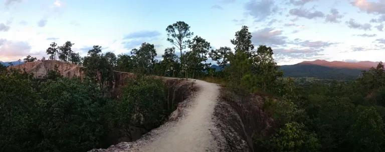 02
 03
 04
Tap a day card to see that day’s weather, rain, haze and hourly forecast
Best time to go Fine all day little rain through the day
Holiday — traffic on the way up and parking fills fast; leave early
Green band = hours used for the score
Best time to go Fine all day little rain through the day
Holiday — traffic on the way up and parking fills fast; leave early
Green band = hours used for the score
Best time to go Fine all day little rain through the day · light drizzle possible at times
Holiday — traffic on the way up and parking fills fast; leave early
Green band = hours used for the score
Best time to go Best window 06:00–15:00 Little rain · light drizzle possible at times
No warnings today — normal road and weather conditions
Green band = hours used for the score
Best time to go Best window 06:00–14:00 Little rain · light drizzle possible at times
No warnings today — normal road and weather conditions
Green band = hours used for the score
Best time to go Fine all day little rain through the day
Thick morning fog with visibility under 1 km — use headlights and drive slowly
Green band = hours used for the score
Best time to go Fine all day little rain through the day
No warnings today — normal road and weather conditions
Green band = hours used for the score
Scored from cloud cover at every level and tonight’s moonlight — the darker the sky, the clearer the Milky Way · tap another night below for the next 7 nights
Kong Lan (Pai Canyon), Thung Yao, Pai, Mae Hong Son.
Arrive 16:30 for sunset, or 06:00 for the mist
Morning sea of mist Nov–Feb
Photos from Wikimedia Commons and contributors · full credits inClassic page
People fell in 2017, 2024 and 2026; the outer ridges have no railings
Loose sand and gravel, slippery wet or dry
Leave the ridges in rain or thunder
Bring a torch if staying for sunset
Adults 0 THB · Time needed 30–60 minutes
Every sunset, especially Nov–Feb
| Toilet optional | 5 ฿/person |
| Songthaew / taxi from Pai town optional | 100 ฿/vehicle |
Cash · Prices may change by season — check with the venue
Tap a month on the wheel to see weather, rain, haze and crowds from 10 years of records
Best time · Nov–Feb is cool and clear with fine sunsets and morning mist
Watch out · Mar–Apr is hazy and hot · May–Oct rain makes the ridges dangerously slippery
Oct by the records 21–29°C · avg rain 143 mm (21 rainy days) · clear 4 days · avg PM2.5 6
Kong Lan lies beside Highway 1095 (Pai–Mae Malai) at about km 90, some 7–8 km south of Pai town, with the entrance sign on the left coming from Chiang Mai. Most sources place it in Thung Yao subdistrict (some say Mae Hi), Pai district. Foreign travellers call it Pai Canyon and Thais now say "Pai Canyon" too, but both names refer to the same place.
At least five Thai sources agree that in the local dialect "kong" means a road or path and "lan" is the monitor lizard, so Kong Lan is "the monitor lizard's path" — a track only wide enough for a lizard, like the ridge-top walkways that take one person at a time. A fan website tells a tale about a hunter and his grandson Lan, but there is no reliable source for it.
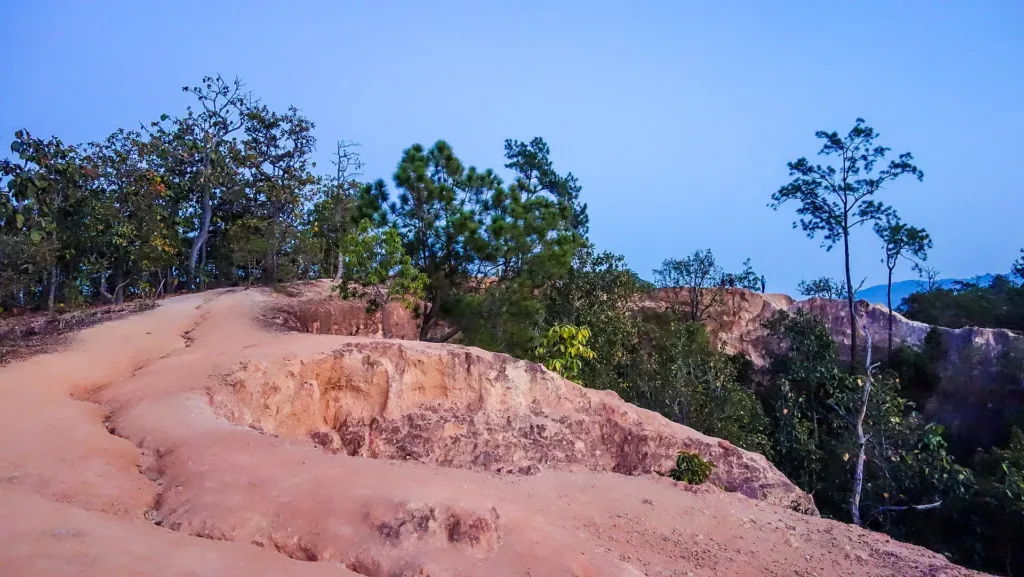
Kong Lan is not a river-cut canyon like the Grand Canyon but a landscape of narrow ridges and deep gullies: some ground has subsided into deep clefts while other parts remain as thin ridges. Wind and rain have long eroded the orange-red soil and soft rock into cliffs, channels and earth steps. The main viewing area covers about 5 rai, topped by dry dipterocarp forest mixed with pine. Some Thais compare it with Phae Mueang Phi in Phrae.
No Department of Mineral Resources data dates the rocks of Kong Lan specifically. Some sources describe red sandstone or laterite on top of sedimentary beds, and studies of northern intermontane basins suggest such basins usually hold Late Tertiary to Quaternary sediments, so the deposits are probably geologically young — but this still needs site-specific confirmation. A 2009 paper by Punya Charusiri and colleagues lists Pai among about ten small north–south, fault-bounded Tertiary basins in the Mae Hong Son area, which supports this reading, though it does not study Kong Lan itself.
The landscape is still changing: every rainy season the gullies cut deeper, and the surface of loose sand and gravel is slippery wet or dry. In August 2017 officials said erosion had caused part of the cliff edge to collapse.
Pai's own history runs deep. Wikipedia says people have lived in the area for more than 5,000 years and the Lawa were dominant about 2,000 years ago. Around 1251 Tai Yai settlers founded Ban Wiang Nuea about 3 km north of today's town, later joined by people from Chiang Mai; Daily News says the earliest known inhabitants were the Phai or Prai people.
In 1481 Lanna defeated the Tai Yai but let them stay, so the town was split in two. Daily News (2024) says that Phra Chao Mahotaraprathet, ruler of Chiang Mai, sent Chao Kaew Mueang to survey the border, who advised Khun Sang Pai, the first headman, to move the town to the west bank of the Pai River as Wiang Tai, today's Pai town. Wikipedia dates the final battle that destroyed Wiang Nuea to 1869, so the dates of the move do not match; it is safest to place it around the mid-19th century. A legend says that around 1477 a white bull elephant of King Tilokaraj escaped and swam in the river, which was then named "Pai" from phlai, a bull elephant — only a legend.
During the Second World War, in 1943, the Japanese army began improving the Chiang Mai–Pai road and the tracks to Mae Hong Son to support the attacks on Imphal and Kohima. Work stopped in early 1944 and the road became a retreat route. Today's Highway 1095 grew from it, and the Chiang Mai–Pai stretch is famous for its 762 curves. Thailand began building it as a proper road in 1967 and finished paving it in the early-to-mid 1990s, while Pai's airstrip was built in 1947 and paved in 2007.
About 2 km from Kong Lan is the Tha Pai Memorial Bridge, which many websites say the Japanese built in the war. But an information panel added in 2007 admits it was not built by the Japanese army: the present steel bridge was put up by a Thai agency around 1976, reportedly using spans from the old Nawarat Bridge in Chiang Mai, though some point out that parts carry a 1930 US steel company mark and others are a Bailey bridge.
Waves of newcomers gave Pai its mix of cultures: Karen in the 18th century, Lisu and Lahu in the early 20th, Muslim traders around 1950, Nationalist Chinese soldiers in the early 1960s and Tai Yai from Myanmar more recently. After Visit Thailand Year in 1987 Western backpackers discovered Pai, followed by minivan tours on the Chiang Mai–Mae Hong Son loop.
There is no record of when Kong Lan opened to tourists, but as Pai grew popular the orange ridges by the highway became a backpackers' sunset spot. Kong Lan was also a location for Tanit Jitnukul's film "Pai in Love", released on 10 December 2009, and a sign from the film became a favourite photo spot.
No agency charges entry. There is only roadside parking, toilets at 5 baht and drink stalls. From the car park it is about 200 m up steps and gravel to the fenced main viewpoint, but the outer ridges have no railings; in places they are only a foot wide, and one is nicknamed the "death bridge".
On 14 August 2017 a 46-year-old Dutch woman fell about 6–10 m into a gully in the evening and injured her back, and the district chief ordered warning signs and fences at dangerous points. On 28 July 2024 a 25-year-old British man fell about 5 m and was wedged between rocks until rescued by the Wiang Tai rescue team, tourist police and soldiers, and on 30 January 2026 a foreign woman fell into a deep ravine and was hauled out with ropes by the Thung Yao and high-angle rescue teams. Earlier, in November 2022, TAT's Mae Hong Son office had warned about fall and slip points and poor light after sunset. After the January 2026 fall, local officials acknowledged that falls happen almost every year and said they would review signs and barriers, but no follow-up has been reported.
Pai today is a major tourist town: immigration counted about 220,000 foreign visitors in 2024, and in February 2025 the governor and police announced five measures after tensions between locals and some groups of tourists. Kong Lan remains one of the top sunset spots, with people arriving from late afternoon to claim a place.
Arrived? Check in, collect a stamp and tell others what it is like right now
Check your location first, so you do not fill in the form for nothing
Location must be on and within 3 km · One check-in per place per day · come back on other days to check in again
Post photos from anywhere — no need to be here · Up to 20 photos at a time · JPG / PNG / WebP · GPS location data is removed automatically
The Chiang Mai–Pai stretch of Highway 1095 has 762 curves
From Pai town on Highway 1095 · Fuel
Hire from Pai town · 100–200 baht
To Pai, then local transport · About 150–250 baht
From Pai town take Highway 1095 toward Chiang Mai for 7–8 km; the entrance is at about km 90
Roadside car park at the entrance; fills up in the evening
Patchy on the ridges
Always open; best 06:00–19:00
around 8 km fromPai town
Pai Canyon (Kong Lan)
0 THB
Approx. nightly price for 2 adults (next week) · final price depends on your dates
Answers travellers want before they go — a one-minute read
Yes; Kong Lan is the local name and Pai Canyon the travellers' name
Kong is a path and lan a monitor lizard — a path only a lizard could use
No; toilets cost 5 baht
About 7–8 km, 15–20 minutes
The main viewpoint is safe, but the outer ridges have no railings and people have fallen
No; the current bridge dates from around 1976
Best day this week: Thursday 29 Oct · Check in when you arrive to collect a stamp