 01
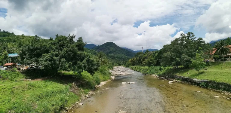
Khlong Tha Di and Khao LuangThe bridge view with southern Thailand's highest mountains behind
NAKHON SI THAMMARAT · MOUNTAIN VILLAGE
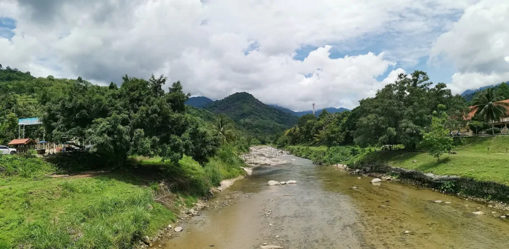
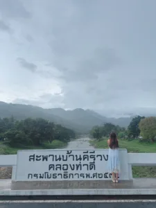
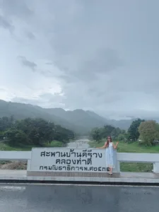
A concrete bridge over Khlong Tha Di in the middle of Khiri Wong village, backed by the Khao Luang range. Built after the great 1988 flood, it is where the village's "best air in Thailand" sign stands. Morning mist, free entry.
Holiday / event — crowded · Thunderstorm risk 15:00–18:00 · Hot (Late morning) feels like 38°C · Chance of a sea of mist 5/10
sea-of-mist places: morning matters most
Late mornings at weekends and on long holidays
30 min–1 hour at the bridge (half a day to a day for the village)
Open 24 hours (public bridge)
Free
01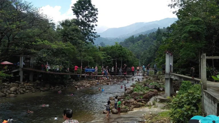 02
 03
 04
 05
Tap a day card to see that day’s weather, rain, haze and hourly forecast
Best time to go Best window 06:00–13:00 Little rain · light drizzle possible at times
Rain at times — slippery roads, allow extra travel time
Holiday — traffic on the way up and parking fills fast; leave early
Green band = hours used for the score
Best time to go Best window 06:00–11:00 Little rain
Rain at times — slippery roads, allow extra travel time
Holiday — traffic on the way up and parking fills fast; leave early
Green band = hours used for the score
Best time to go Best window 06:00–12:00 Little rain · light drizzle possible at times
Heavy rain, about 61 mm — watch for flooding and slippery roads
Heavy rain at times — slippery roads, allow extra travel time
Holiday — traffic on the way up and parking fills fast; leave early
Green band = hours used for the score
Best time to go Best window 06:00–11:00 Little rain
Rain at times — slippery roads, allow extra travel time
Green band = hours used for the score
Best time to go Fine all day little rain through the day · light drizzle possible at times
No warnings today — normal road and weather conditions
Green band = hours used for the score
Best time to go Best window 06:00–11:00 Little rain · light drizzle possible at times
No warnings today — normal road and weather conditions
Green band = hours used for the score
Scored from cloud cover at every level and tonight’s moonlight — the darker the sky, the clearer the Milky Way · tap another night below for the next 7 nights
Khiri Wong Bridge is a concrete bridge across Khlong Tha Di in the middle of Khiri Wong village, Kamlon subdistrict, Lan Saka district, Nakhon Si Thammarat — about 25–30 km from town, with the Khao Luang range, southern Thailand's highest, as its backdrop.
It was built after the great flood of late 1988, when flash floods carried mud and logs down from Khao Luang into the village. Today it is Khiri Wong's symbol and home to its "best air in Thailand" sign, a must-stop photo spot.
The bridge is open at all times and free. Light mist often hangs over the mountains at dawn. Nearby are a suspension bridge, the Nan Hin Tha Ha swimming spot, the village market and natural-dye craft groups.
Light mist often drifts over the Khao Luang range at dawn, around 6:00–8:00, most clearly at the end of the rains and start of the cool season (Oct – Jan), after a rainy night and on still mornings.
Photos from Wikimedia Commons and contributors · full credits inClassic page
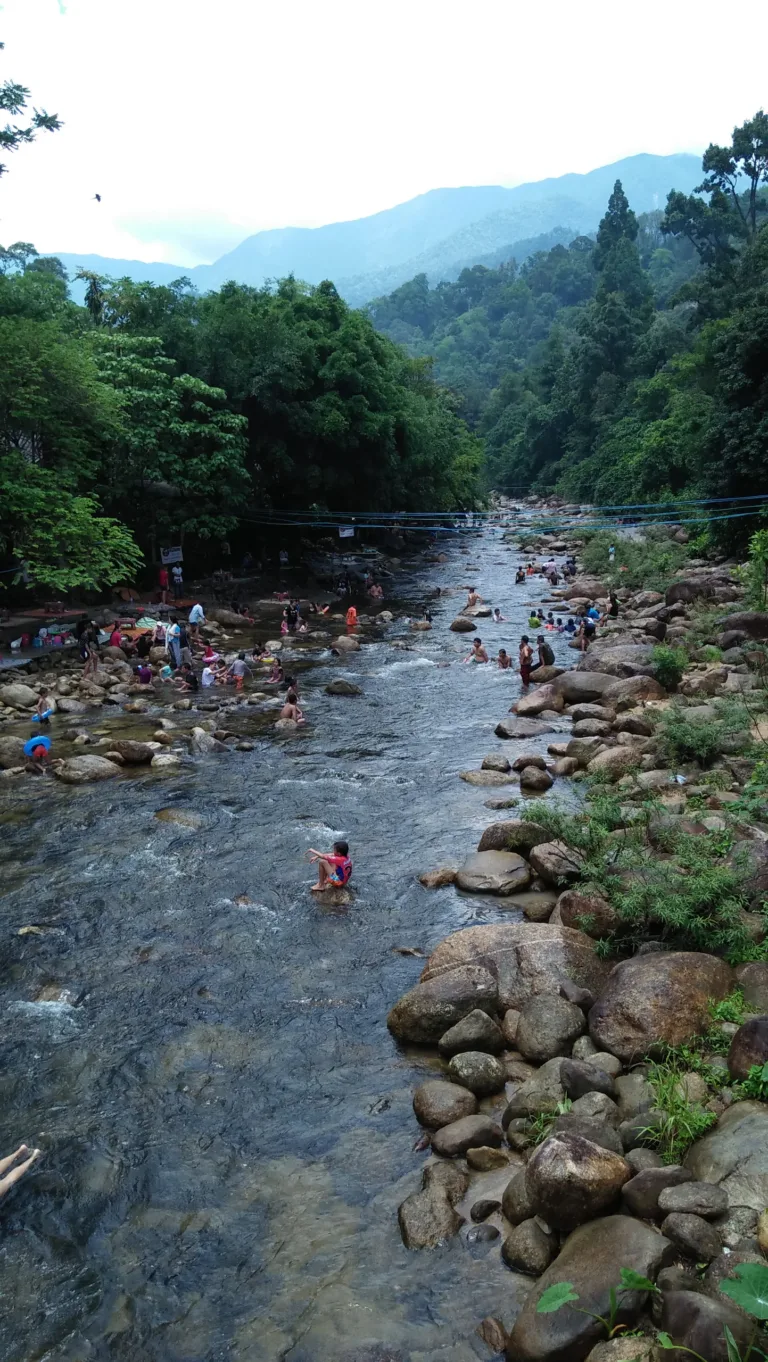
Khlong Tha Di drains the Khao Luang range; rain in the mountains can raise the water fast even when it is dry in the village. If the water turns muddy, speeds up or roars, get out at once
Stream rocks are mossy and very slippery — wear strapped shoes and walk slowly
Villagers drive across the bridge — keep to the edge for photos
The community asks visitors to take rubbish home and never throw it in the canal
Adults 0 THB · Time needed 30 min–1 hour at the bridge (half a day to a day for the village)
Late mornings at weekends and on long holidays
| Wooden songthaew, Nakhon–Khiri Wong, from Talat Yao optional | 50 ฿/person |
| Bicycle hire in the village optional | 50 ฿/day |
| Natural-dye workshop optional | 150 ฿/person |
Mostly cash; larger shops take transfers · Prices may change by season — check with the venue
Tap a month on the wheel to see weather, rain, haze and crowds from 10 years of records
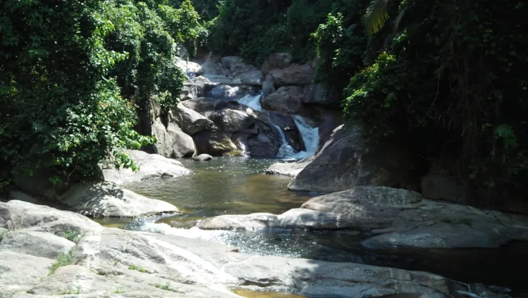
Best time · February–April has little rain, and Khlong Tha Di runs clear and gentle — good for swimming. January often brings morning mist; come at dawn for the bridge in the mist.
Watch out · October–December is the northeast monsoon: heavy, persistent rain, fast-rising water and flash-flood risk. Never swim when the water is muddy or fast.
Oct by the records 24–30°C · avg rain 307 mm (28 rainy days) · clear 0 days · avg PM2.5 6
Khiri Wong Bridge is a concrete bridge across Khlong Tha Di, linking the two halves of Khiri Wong village in Kamlon subdistrict, Lan Saka district, Nakhon Si Thammarat, about 25–30 km from town. Behind it rises the Khao Luang range, whose peak of about 1,835 m is the highest in southern Thailand. Today the bridge is the village's symbol and the site of its "best air in Thailand" sign — but its story is bound up with more than two centuries of valley history, from the first settlers to a disaster that changed the course of the stream and of village life.
Villagers say the settlement was once "Ban Khun Nam" — "headwaters village" — because it lies near the streams running off Khao Luang. Of the many that once flowed here, three main ones remain: Khlong Pong, Khlong Tha Ha and Khlong Tha Chai. They meet in front of the village as a single large stream once called Khlong Khun Nam, which runs to the sea at Pak Nakhon and Pak Phanang. After the 1988 flood the Royal Irrigation Department renamed it Khlong Tha Di, though older villagers still call it Khlong Khun Nam. "Khiri Wong" combines khiri (mountain) and wong (circle) — a village ringed by mountains — and is also the name of Wat Khiri Wong, the heart of the community.
The most widely told story is that the first settlers were commoners fleeing conscription for wars in Kedah (Saiburi) under Kings Rama I and II. They followed Khlong Khun Nam upstream to a small plain walled in by mountains — hard to track, with water all year — cleared it, built homes and planted fruit trees up three slopes: Khao Hoi Sang, Khao Yot Phen and Khao Luang. Local scholar Theeraphan Chulakanchana (1996) recorded seven founding families — Talueng-jit, Talueng-phet, Suksai, Praphat, Jaranil, Thawatkan and Suchonjit — who intermarried until the whole village was kin.
Elders tell other versions too: that the founders fled being tattooed as serfs of Nakhon Si Thammarat's nobles; that people from Ban Yan Yao came looking for rope for fish weirs, found an old chedi and settled to build a temple; that a group hid the Phra Buddha Sihing image here when Bangkok asked Nakhon's ruler for it; that veterans of the Kedah war were rewarded with more than 400 rai of land; or that they fled Burmese captors who tattooed prisoners' faces. Theeraphan also notes finds of stone tools and deity images. Whatever the truth, all point to long settlement in the valley.
Since the ancestors, Khiri Wong people have farmed "suan samrom" — mixed orchards of mangosteen, durian, rambutan, longkong, langsat, champedak, jackfruit, sator, niang and betel palm grown among forest trees, so that at a glance orchard and forest are hard to tell apart. They also gathered forest produce and herbs, fished and hunted. Mangosteen rind was used to heal cuts, and monks dyed robes with leaves and bark — know-how that later grew into the village's natural-dye groups.
Deep as the valley was, villagers always traded with the coast. They hollowed whole logs into "ruea nuea" (northern boats) and floated durian, mangosteen, sator, niang, betel nut and betel leaf down to Pak Nakhon, Pak Phanang, Chian Yai and Hua Sai, exchanging them for rice, salt, shrimp paste, dried fish and kerosene — usually several boats together, because of the rapids. Khiri Wong people called themselves "phuak nuea" (northerners) and the coast people "phuak nok" (outsiders), and generations of barter gave rise to the phrase "kloe khao, kloe le" — the kin-like friendship of mountain people and sea people. The spot in front of Wat Khiri Wong was once the village landing.
In 1962 the Laem Talumphuk storm wrecked homes and orchards and washed so much soil into the streams that river travel, used for generations, came to an end. Phor Than Thuean Suchato, then abbot of Wat Khiri Wong, led villagers in cutting a road towards Wat Khok and building a wooden bridge out of the village so they could carry fruit out again. In 1975 flash floods brought earth and rock down from the mountains once more; many villagers fell into debt and had to sell land, so in 1980 they founded a savings-for-production group to escape moneylenders — it later grew to tens of millions of baht.
The community grew strong. In 1985–1986 Khiri Wong was ranked the best Village Self-Development and Defence village in the province and region, received a national commendation, and won the "Land of Dhamma, Land of Gold" award after Phra Khru Nithet Thammarak urged villagers to give up vices. Electricity arrived around the same time.
Then came the worst disaster of all. Between 19 and 24 November 1988 more than 1,050 mm of rain fell on the Khao Luang range in six days. Saturated slopes — some cleared of forest for rubber — gave way, and on 21–22 November floodwaters carrying mud, sand and logs swept into the village. Around 100 houses were washed away, the school, fresh market and pavilion were badly damaged, orchards became sand flats and many people died. Villagers say only the temple remained to hold them together. They call it the "great flood and landslide of '31", and the ordination hall and a damaged house are kept as a memorial to this day.
The disaster hit all of Nakhon Si Thammarat. FAO figures put the province's death toll at 373 and damage at over 7,357 million baht; Kathun village in Phipun district, on the other side of Khao Luang, was hit hardest by mud and logs. On 17 January 1989 the Cabinet revoked all logging concessions in natural forests nationwide — a turning point in Thai forest policy.
After the waters fell, officials advised moving the village, but Khiri Wong refused to leave its ancestors' land. King Bhumibol granted more than 100 million baht for long-term flood protection and asked the Royal Irrigation Department to dredge the stream and line its banks with stone so heavy rain could drain away; World Vision built about 300 temporary homes. The flood had also straightened the stream so that it now cut through the middle of the village, splitting it in two. Community records say the Public Works Department built a bridge of about 100 m across it in 1991 — the bridge over Khlong Tha Di was born of this recovery and became the landmark of a village reborn. Around the same time the Interior Ministry divided the crowded community into four villages: Khiri Wong (Moo 5), Khiri Thong (Moo 8), Khun Khiri (Moo 9) and Khiri Tham (Moo 10).
The lesson turned villagers back to the forest. They founded the "Add Green to Khao Luang" fund, later renamed the Khiri Wong Ecotourism Club, replanted from the valley floor to the summit of Khao Luang, and lined Khlong Pong, Tha Ha, Tha Chai and Tha Di with pterocarpus trees to hold the banks. Women banded together to make durian paste, and other craft groups followed to reduce reliance on the forest. Every year the village holds a "November Remembrance" to make merit for the dead.
After the 1997 economic crisis the government promoted domestic tourism, and self-reliant Khiri Wong drew attention. In 1998 it won a Thailand Tourism Award (towns and communities) and TAT's eco-tourism village contest. Villagers guided treks up Khao Luang and opened homestays; TAT later built about 10 km of road and interpretive signs, the Industry Ministry chose it as one of 20 tourism-industry villages nationwide, and the Tourism Ministry named it one of four model OTOP tourism villages.
The "best air in Thailand" label comes from a 2009 survey by the Pollution Control Department's air-quality bureau, which recorded an Air Quality Index of 17–49 — "very good". The community put the sign at the bridge, and photos there became proof of having "made it to Khiri Wong"; shops even sell "canned air" and bridge keyrings as souvenirs. Visitors poured in — by 2017 some 400–500 a day, double at weekends — bringing rubbish and traffic, so the Kamlon Subdistrict Administrative Organisation banned parking in front of Wat Khiri Wong on holidays, built a car park for about 100 cars and asked visitors to take their rubbish home.
In 2022 Ban Khiri Wong had 338 households and 902 people. Villagers keep traditions such as the Fifth-Month merit-making, Buddhist Lent, the Tenth-Month Festival — when orchard fruit is offered to the temple — and the Chak Phra procession pulled with wooden naga-shaped poles. In 2025 Khiri Wong was named a top model community in the "Community Tourism, Local Ways" awards. Visitors can help this village, which rose again from a sand flat, by parking where the community asks, keeping rubbish out of the stream and respecting the valley's way of life.
Arrived? Check in, collect a stamp and tell others what it is like right now
Check your location first, so you do not fill in the form for nothing
Location must be on and within 1.5 km · One check-in per place per day · come back on other days to check in again


Post photos from anywhere — no need to be here · Up to 20 photos at a time · JPG / PNG / WebP · GPS location data is removed automatically
From Nakhon Si Thammarat town, take Highway 4015 towards Lan…
Highway 4015 Nakhon–Lan Saka, then follow signs to Khiri Wong · Minimal fuel
Talat Yao stand in town, departures 7:00–16:00 · About 50 THB
Nakhon Si Thammarat airport · Car hire
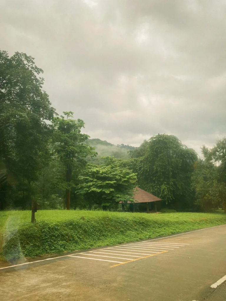
Paved all the way; winding near the valley
Community car parks (no parking in front of Wat Khiri Wong on holidays)
Petrol stations on Highway 4015 before the village
Mobile signal OK in the village, weaker in the forest
Open 24 hours (public bridge)
around 28 km fromNakhon Si Thammarat town
Khiri Wong Bridge, Khlong Tha Di, Lan Saka, Nakhon Si Thammarat
0 THB
Approx. nightly price for 2 adults (next week) · final price depends on your dates
Best day this week: Tuesday 27 Oct · Check in when you arrive to collect a stamp