Khao Takiab
A seaside hill at the southern end of Hua Hin beach, with Wat Khao Takiab, a golden 16 m standing Buddha facing the sea, 128 steps up to views over Hua Hin bay, a Guanyin shrine and troops of macaques.
Before you goWhich of the next 7 days is best Best dayFriday 16- Severe weatherNone · light showers
- EarthquakesNone in 48 h
- Major disastersNone
- Site noticesNone
About
Overview · highlights · who it suits
Khao Takiab — "Chopstick Hill" — is a rocky hill jutting into the Gulf of Thailand at the southern end of Hua Hin beach, about 5–7 km from town in Nong Kae subdistrict. On it stand Wat Khao Takiab, a golden standing Buddha about 16 m tall facing the sea, and a great many macaques.
Its name comes from its shape, pointing into the sea like the tip of a chopstick, and it is also linked to the Ta Mong Lai folk tale told around the Gulf. 128 steps lead up to a chedi and a viewpoint over Hua Hin beach, Khao Takiab beach and the fishing village below.
At the foot of the hill are a seaside Guanyin shrine, the fishing community's seafood restaurants and the quieter Khao Takiab beach. It is open daily and free to visit.
Don't-miss highlights
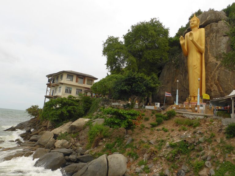
The sea-calming Buddha
A golden Buddha about 16 m tall, facing the sea
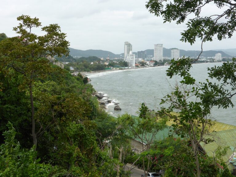
Views over Hua Hin bay
Hua Hin beach, Khao Takiab beach and the town skyline
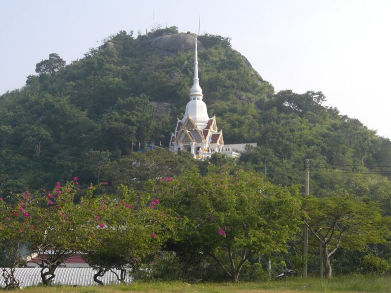
Hilltop chedi
128 steps up to the chedi and shrine on the summit
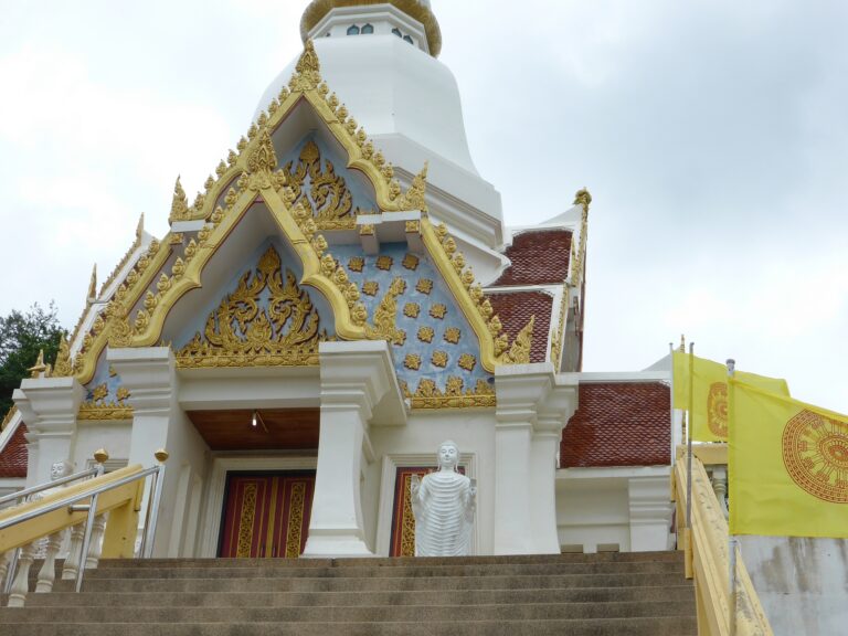
Guanyin shrine
A thousand-armed Guanyin by the sea and a Chinese pavilion
Fishing village
Fresh seafood restaurants at the foot of the hill
Before you go
Gallery
Get a feel for the place · tap a photo to enlarge
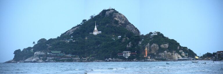 Khao Takiab from the seaKhao Takiab from the beach in the evening · Photo: Athikhun.suw (CC BY-SA 4.0)
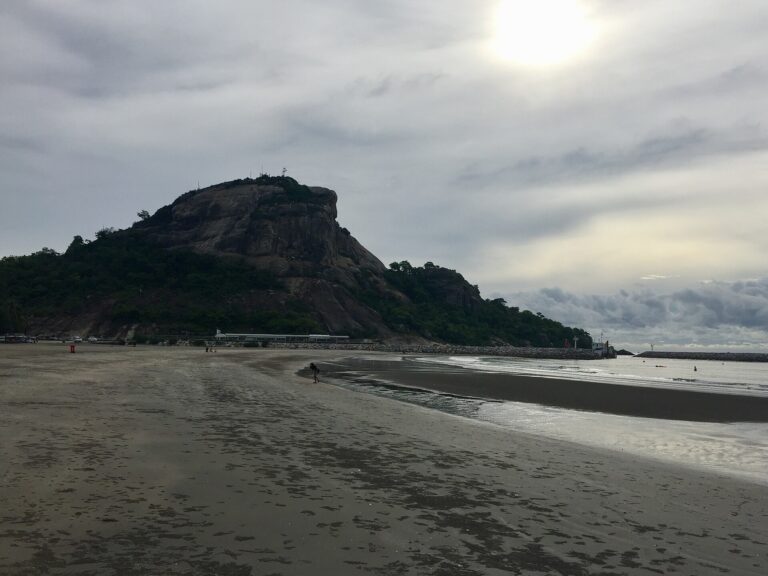 Khao Takiab from the beachThe chedi on top of Khao Takiab · Photo: HAH (CC BY 2.5)Hilltop chediThe golden standing Buddha facing the sea at Khao Takiab · Photo: Joachim Lutz (CC BY-SA 4.0)Standing Buddha facing the seaSteps up to Wat Khao Takiab · Photo: Joachim Lutz (CC BY-SA 4.0)
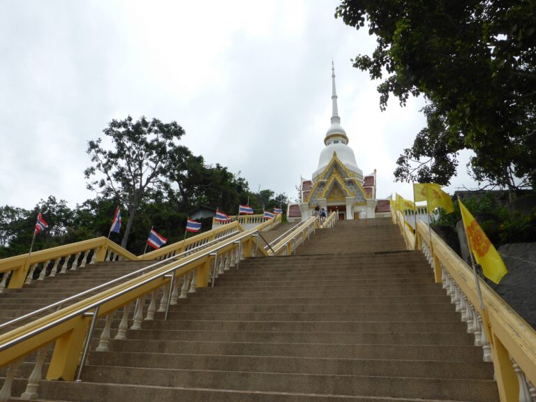 Steps up to the templeGate and chedi at Wat Khao Takiab · Photo: Joachim Lutz (CC BY-SA 4.0)Gate and chediBells and the view over Hua Hin bay from Khao Takiab · Photo: rudy.rijen (CC BY-SA 3.0)
 Bells and Hua Hin bayThe coast and Hua Hin skyline from Khao Takiab · Photo: Joachim Lutz (CC BY-SA 4.0)The Hua Hin coastlineA troop of macaques on the temple terrace · Photo: Joachim Lutz (CC BY-SA 4.0)
 Macaque troopA macaque at Khao Takiab · Photo: rudy.rijen (CC BY-SA 3.0)
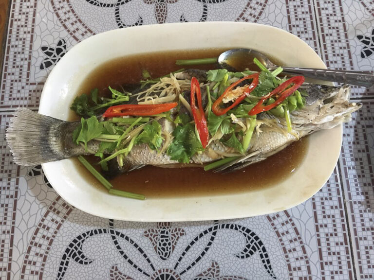
 MacaqueSteamed fish from a Khao Takiab seafood restaurant · Photo: mmmmngai (CC BY-SA 2.0)Steamed fish at a seafood restaurant
Photo credits11 photos from Wikimedia Commons
 Khao Takiab jutting into the Gulf of Thailand, seen from the seaPhoto: darrylkeith CC BY-SA 3.0
 Khao Takiab from the beach in the eveningPhoto: Athikhun.suw CC BY-SA 4.0
 The chedi on top of Khao TakiabPhoto: HAH CC BY 2.5
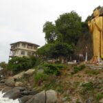 The golden standing Buddha facing the sea at Khao TakiabPhoto: Joachim Lutz CC BY-SA 4.0
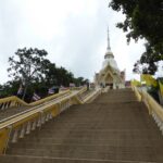 Steps up to Wat Khao TakiabPhoto: Joachim Lutz CC BY-SA 4.0
 Gate and chedi at Wat Khao TakiabPhoto: Joachim Lutz CC BY-SA 4.0
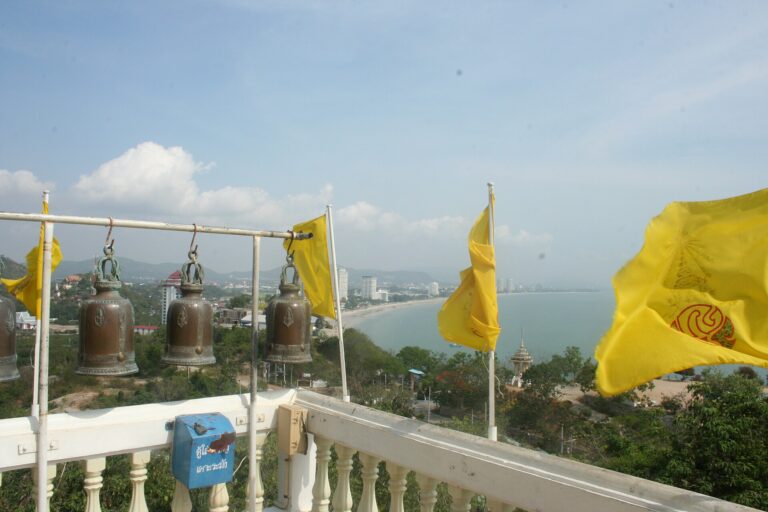
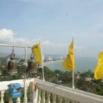 Bells and the view over Hua Hin bay from Khao TakiabPhoto: rudy.rijen CC BY-SA 3.0
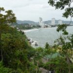 The coast and Hua Hin skyline from Khao TakiabPhoto: Joachim Lutz CC BY-SA 4.0
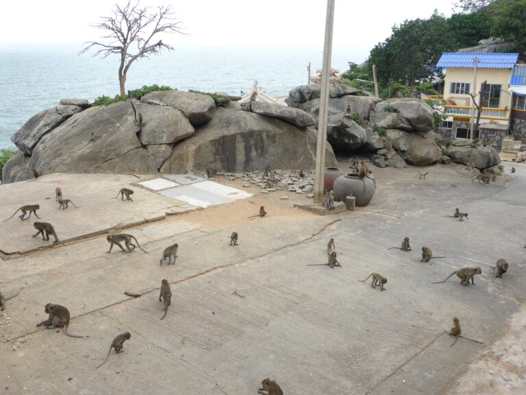
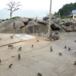 A troop of macaques on the temple terracePhoto: Joachim Lutz CC BY-SA 4.0
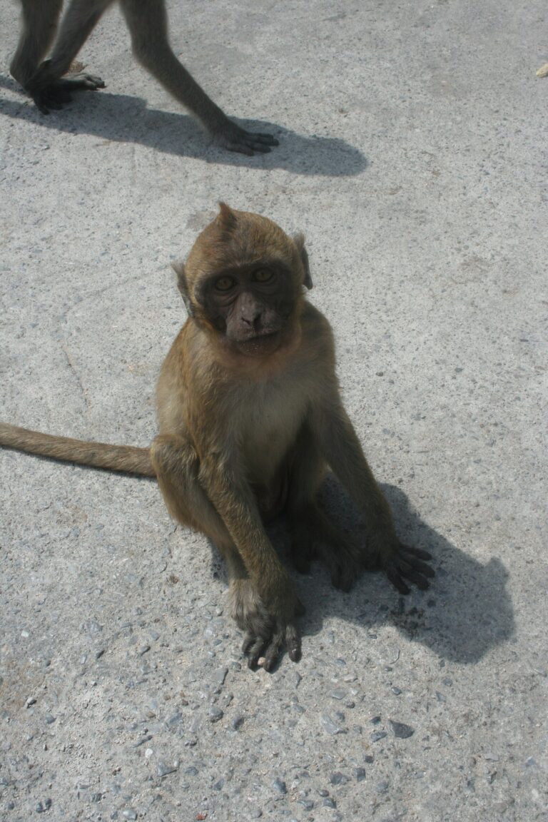
 A macaque at Khao TakiabPhoto: rudy.rijen CC BY-SA 3.0
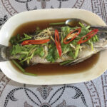 Steamed fish from a Khao Takiab seafood restaurantPhoto: mmmmngai CC BY-SA 2.0
Before you go
Weather, haze and crowds before you set off
Best time of day — hourly
Today in detail
Open-MeteoWhat to bring
Local cautions
- Monkeys Many macaques live on the hill and grab food bags, bottles and sunglasses. Keep belongings closed, don't feed them and avoid eye contact
- Steep stairs The viewpoint stairs are steep and very hot at midday — go in the morning or late afternoon
- Jellyfish Venomous jellyfish appear in the Gulf at times. Stay out if there are warning signs or red flags. If stung, pour vinegar for at least 30 seconds, never rinse with fresh water, and get to hospital (1669)
- Dress Hilltop temple — cover shoulders and knees
Moreค่าใช้จ่าย · คนเยอะไหม · Travel warnings · อากาศละเอียด
What to bring —
Estimated costs
Crowds — estimate
Travel warnings
Best months
Tap a month to see weather, rain, haze and crowds
December–April has little rain and clear skies, so the whole sweep of Hua Hin beach is visible. Go up in the morning or late afternoon for good light and less heat.
September–November is wet, with slippery steps and murky sea. Midday sun on the hilltop terraces is fierce, and parking fills fast on long holidays.
- Weather
- Rain
- Haze
- Crowds
See 10 years of real weather dataMonthly temperature, rainy days, clear days and haze
Past weather records
Check-ins & visitor photos
Location must be on and within 2 km · you can check in on every visit
History & stories
Legend · history · architecture
Khao Takiab is a low hill jutting into the Gulf of Thailand at the far southern end of the Hua Hin shoreline, in Nong Kae subdistrict, about 5–7 km from town. Locals say the name — "Chopstick Hill" — comes from the way it points into the sea like a chopstick tip. To the north is Hua Hin beach, to the south the roughly 1.5 km Khao Takiab beach, with a fishing village at the foot of the hill.
Communities around Khao Takiab predate the resort. When the southern railway arrived around 1911–1912, Hua Hin subdistrict had about 1,200 people, mostly migrants from Prachuap Khiri Khan and Phetchaburi, and "Ban Takiab" was one of its three most densely settled villages, alongside Ban Hua Hin and Ban Nong Kae. A 1912 Royal Thai Survey Department map already shows settlements around Bo Fai station, Nong Kae and Khao Tao. The landscape has a string of small seaside hills — Khao Takiab, Khao Lanthom and Khao Tao — with mangroves along the shore and grassland following the railway down to Ban Takiab.
Early Ban Takiab villagers fished, farmed and wove cloth. Fishermen from villages in Phetchaburi and Prachuap Khiri Khan came to set "pho" — fixed stake traps along the shore — and settled, forming a fishing community, while some farmers turned to fishing full-time. The fishing village at the foot of Khao Takiab today descends from that community.
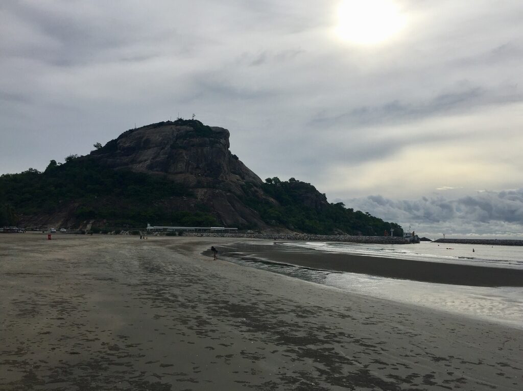 Khao Takiab from the beach — locals link its name to the Ta Mong Lai legend · Photo: Athikhun.suw
Read more history 13 more paragraphs
The name is also tied to the folk tale of Ta Mong Lai, told all along the Gulf coast. Ta Mong Lai was a drunkard with a wife, Nang Ramphueng, and a beautiful daughter, Nang Yom Doi. Chao Lai, son of a lord in the Phetchaburi area, disguised himself as a fisherman to court Nang Yom Doi and won her mother's approval, while Ta Mong Lai favoured Chao Krung Chin, a Chinese junk trader. Both sides sent suitors on the same day, and husband and wife fought so bitterly that they hurled their belongings at each other.
In the legend, the objects that fell into the Gulf became islands and hills: the hat became Khao Lom Muak at Prachuap Bay, the farmer's hat Laem Ngop and the basket Ko Krabung in Trat. Nang Ramphueng died of grief and became Khao Mae Ramphueng at Bang Saphan; Ta Mong Lai blamed his daughter and tore her in two, becoming the Ko Nom Sao islands at Sam Roi Yot and Chanthaburi; Chao Lai became Khao Chao Lai at Cha-am; and Ta Mong Lai himself became Khao Ta Mong Lai at Prachuap. Hua Hin locals add that Khao Takiab came from chopsticks thrown in the same fight. Scholars see these names scattered around the Gulf as a trace of people linked by sea trade and migration, with the Chinese trader reflecting the old junk trade with China.
A 2022 study by Apilak Kasemphonkul on how the Ta Mong Lai legend travelled found it had split into 16 different stories across coastal and island communities in western, eastern and southern Thailand, in four ways: keeping the plot but changing details, turning episodes into new tales, adding sub-plots, and merging with other stories. Adapting the legend to each area's hills and islands reflects the sea-trade networks between port towns — which explains why Hua Hin has its own version linking Khao Takiab to the tale.
There is no clear record of when Wat Khao Takiab was founded; tourism sources estimate it dates from around the 1850s and call it an old seaside community temple. Locals say the hilltop temple was once surrounded by sea, until villagers built up a causeway and a road to reach it.
Just west of Khao Takiab is Wat Khao Krailat, built in 1931 by the people of Ban Khao Takiab. A Dhammayut temple under the patronage of Wat Ratchabophit in Bangkok, it enshrines "Luang Pho Krailat" and has a reclining Buddha, a large standing Buddha and a viewpoint over Hua Hin — evidence that the Khao Takiab community had grown enough to build its own temple by the early reign of King Prajadhipok.
As Hua Hin became a resort after the southern railway arrived in 1911, and King Prajadhipok built Klai Kangwon Palace in the late 1920s, Khao Takiab became a place royals visited: Queen Rambai Barni came to the temple often, and a visit is recorded in 1934.
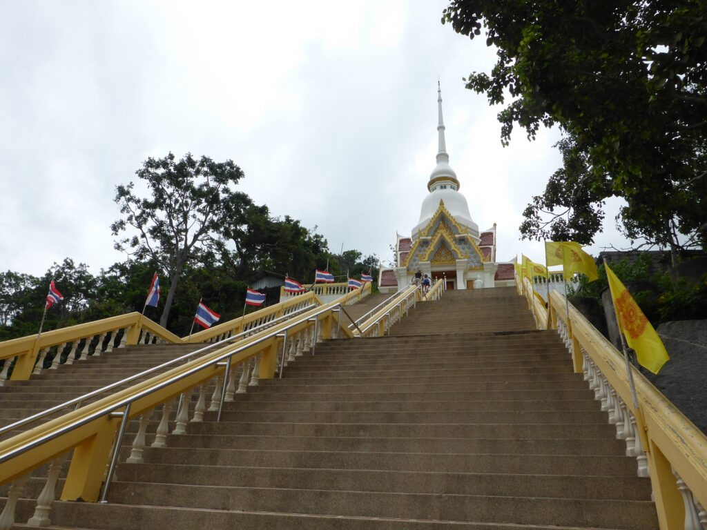 Steps up to Wat Khao Takiab, restored after the temple was once abandoned · Photo: Joachim Lutz
Wat Khao Takiab later fell into disuse for lack of resident monks — abandoned around 1966, according to one source — until villagers and the monastic community restored it and re-established it as an active temple in 1985. New buildings and Buddha images followed, creating the temple seen today.
Administratively, Hua Hin's sanitary district and later municipality extended over Nong Kae subdistrict from 1937. From 1987 the municipality organised 31 neighbourhood communities, among them the Takiab community, classed as still rural in character. In 1995 the Ban Takiab municipal school had 12 teachers and 294 pupils, and the municipality covered 86.36 km², before Hua Hin was later upgraded to a city municipality.
Its best-known feature is the golden standing Buddha at the seaward foot of the hill, about 16 m tall (some sources say about 20 m), facing out to sea. Locals call it the "sea-calming" Buddha and believe it protects the community from natural disasters and storms.
From the car park, 128 steps climb to the chedi and shrine on the summit, which the temple says houses a Buddha footprint and relics. Bells on the terrace are rung for luck, and a monk sometimes sprinkles visitors with holy water. The viewpoint takes in the long curve of Hua Hin beach to the town, Khao Takiab beach and the fishing village below.
Khao Takiab also reflects Hua Hin's Chinese culture: a thousand-armed Guanyin by the sea is a favourite for prayers and photos, there is a Chinese-style pavilion, and a statue of the Laughing Buddha into whose belly people toss coins for luck.
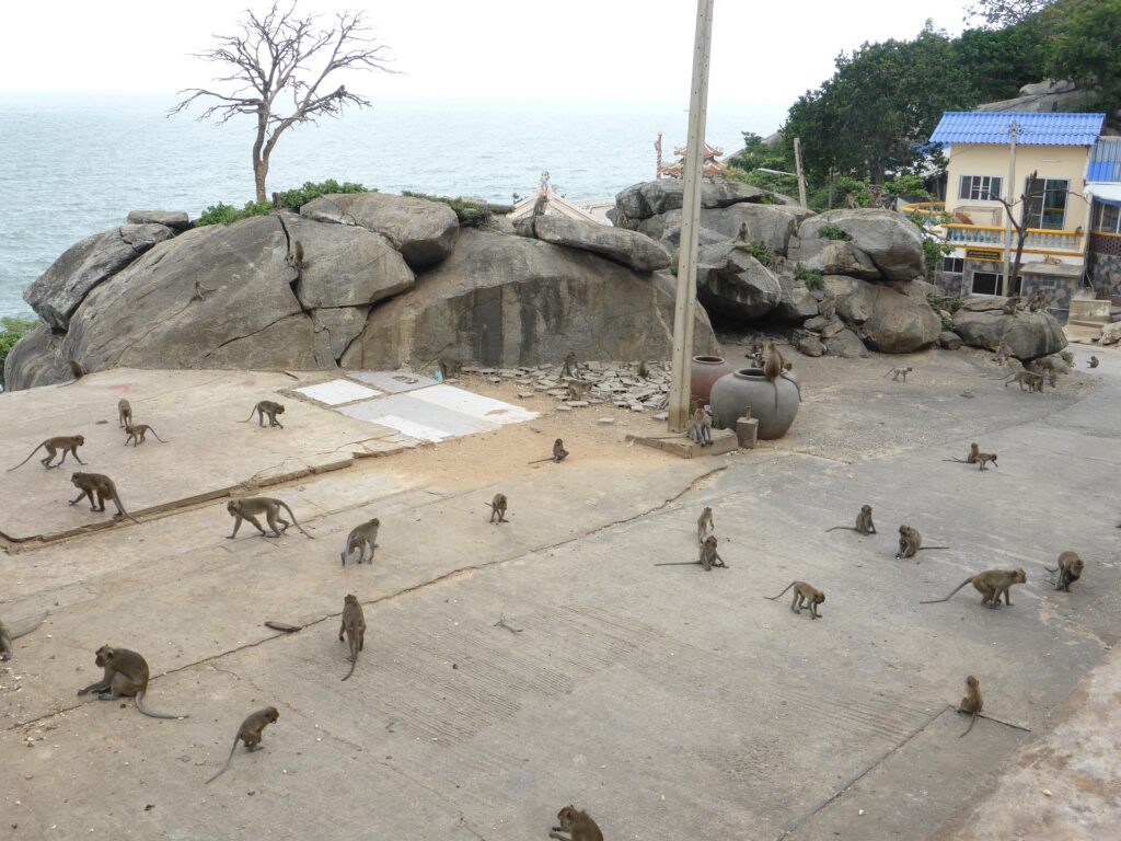 Macaques on Khao Takiab · Photo: Joachim Lutz
The other reason for its nickname "Monkey Mountain" is the macaques living on the hill and in the surrounding community. Together with Khao Hin Lek Fai there were more than 3,000 in 2021 and the population was growing fast, causing problems for residents and visitors. The municipality has sterilized thousands since 2017, and in July 2021 planned 600 more with the Department of National Parks to curb numbers and the risk of disease passing from animals to people.
Today Khao Takiab is the last stop of the green songthaews from Hua Hin town and a place for seafood from the fishing community, with fish, prawns, shellfish and crab straight off the boats. The temple is open daily with free entry; visitors can help by dressing modestly, not feeding the monkeys and taking their rubbish with them.
Location & getting there
Map · how to get there · costs
Directions use live traffic to estimate travel time
- Travel timeAbout 15 min from Hua Hin town
- RoadPaved road to the foot of the hill and up to the car park
- ParkingParking at the foot of the hill and on the hill (limited)
- FuelPetrol stations in Hua Hin town
Suggested route
From Hua Hin town, head south on Phetkasem Road for about 4 km, then turn left onto Khao Takiab Road following the signs. The road leads to the foot of the hill and the fishing village, with a road up to a car park on the hill.
Without a car, take the green Khao Takiab songthaew from Hua Hin town — it terminates right at Khao Takiab — or use a ride-hailing app.
You can also walk along the beach from Hua Hin at low tide, but it is several kilometres in strong sun.
3 ways to get there
South on Phetkasem Road, then Khao Takiab Road
Khao Takiab line from Hua Hin town, ride to the end
From Hua Hin town
Prices and times are estimates and vary with season and traffic
Nearby next stops
Stops on the same route