 01
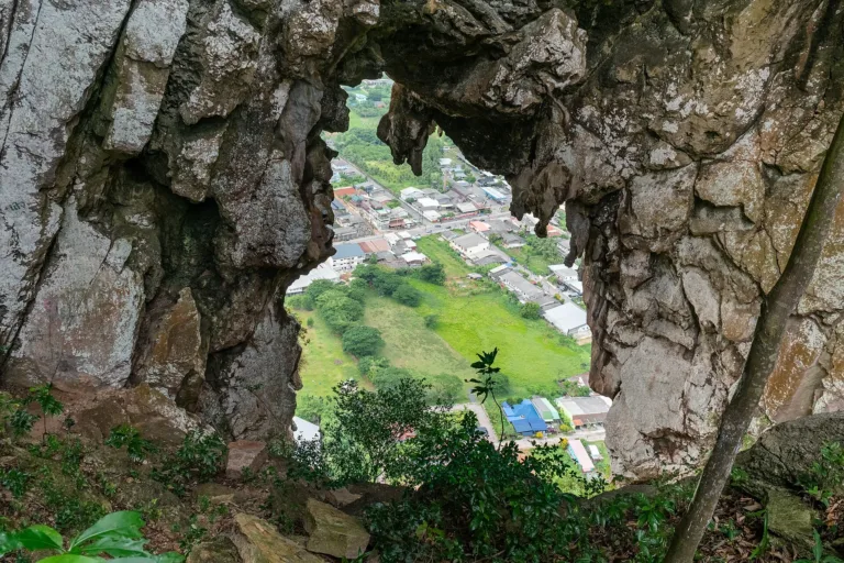
The Ok Thalu holeLook through it down to Phatthalung town
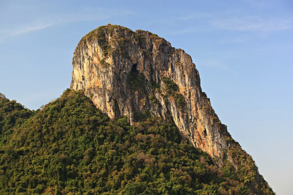
Phatthalung · the provincial emblem mountain
A limestone mountain in central Phatthalung with a hole through its peak, the province's emblem; 1,000+ steps lead up for city views.
Holiday / event — crowded · Thunderstorm risk 14:00–16:00 · Outside this place's best season
Oct – Dec
Very steep stairs; carry water and avoid rain, when steps are slippery. The section above the hole is a rope climb up a rock face, not for the inexperienced.
1.5–3 hours
Good all the way
01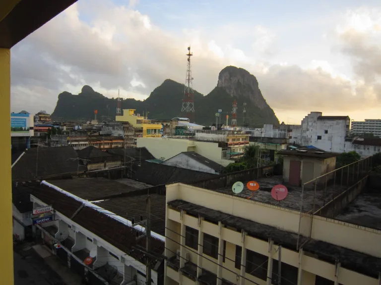 02
 03
 04
Tap a day card to see that day’s weather, rain, haze and hourly forecast
Best time to go Best window 06:00–14:00 Little rain · light drizzle possible at times
Holiday — traffic on the way up and parking fills fast; leave early
Green band = hours used for the score
Best time to go Best window 06:00–14:00 Little rain · light drizzle possible at times
Holiday — traffic on the way up and parking fills fast; leave early
Green band = hours used for the score
Best time to go Best window 06:00–14:00 Little rain · light drizzle possible at times
Thunderstorms — heavy bursts, lightning and gusts possible
Rain at times — slippery roads, allow extra travel time
Holiday — traffic on the way up and parking fills fast; leave early
Green band = hours used for the score
Best time to go Best window 06:00–13:00 Little rain · light drizzle possible at times
Rain at times — slippery roads, allow extra travel time
Green band = hours used for the score
Best time to go Best window 06:00–14:00 Little rain · light drizzle possible at times
No warnings today — normal road and weather conditions
Green band = hours used for the score
Best time to go Best window 06:00–14:00 Little rain · light drizzle possible at times
No warnings today — normal road and weather conditions
Green band = hours used for the score
Best time to go Rain most of the day lightest around 14:00–17:00
Rain at times — slippery roads, allow extra travel time
Green band = hours used for the score
Scored from cloud cover at every level and tonight’s moonlight — the darker the sky, the clearer the Milky Way · tap another night below for the next 7 nights
Khao Ok Thalu, a limestone mountain in the middle of Phatthalung town, is pierced near its top by a hole about 10 m across, and appears on the provincial seal. Srivijaya-era clay votive tablets have been found in its caves, and local legend tells of a quarrelling family turned to stone alongside nearby Khao Hua Taek.
More than 1,000 concrete steps lead to the hole in about 30 minutes, with views over the town; the true summit needs a short rope climb. Entry is free; climb early in the morning or late afternoon.
Arrive Start before 08:00 or after 16:00 to avoid the sun
On some rainy-season mornings mist covers the summit
Photos from Wikimedia Commons and contributors · full credits inClassic page
Adults 0 THB · Time needed 1.5–3 hours
Weekend mornings and evenings, when locals exercise on the stairs
| Climb | Free |
| Climb, foreign | Free |
Cash for water and snacks at the foot · Prices may change by season — check with the venue
Phatthalung Hospital · Emergency 1669 · Tourist Police 1155
Tap a month on the wheel to see weather, rain, haze and crowds from 10 years of records
Best time · January–March brings clear skies and milder heat, and June–August has less rain than the Andaman side; climb at dawn or late afternoon.
Watch out · October–December is the Gulf-side wet season, with slippery steps and rock; April–May is very hot for a midday climb.
Oct by the records 22–29°C · avg rain 273 mm (27 rainy days) · clear 0 days · avg PM2.5 5
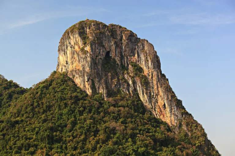
Khao Ok Thalu is a limestone mountain in the middle of Phatthalung town, spanning three subdistricts, Khuha Sawan, Prang Mu and Phaya Khan. It runs north–south for about 2 km and is up to about 1 km wide. Near the top a hole about 10 m across pierces right through, giving the name "Ok Thalu" (pierced chest). Its height varies by source: TAT gives about 250 m, Khaosod about 245 m above sea level, and English Wikipedia 177 m.
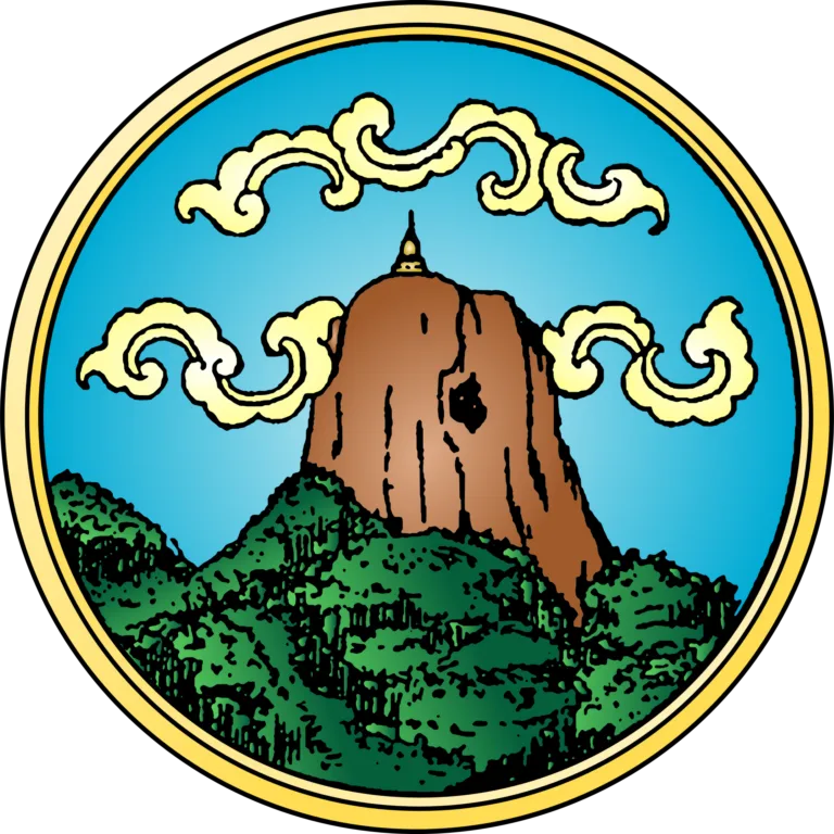
Phatthalung people regard Khao Ok Thalu as sacred, a kind of city pillar and the home of the goddess Chao Mae Dudee. The provincial seal shows the mountain with a chedi on top, and the provincial slogan names it alongside shadow puppets and Nora dance, rice fields, waterfalls, waterbirds, the lake and hot springs.
The oldest evidence linked to the mountain is unfired clay votive tablets of bodhisattvas and deities in Srivijaya style, found in caves at Khao Ok Thalu and Khuha Sawan. TAT dates them to the 13th–14th Buddhist centuries, showing the area took up Mahayana Buddhism from India some 1,200 years ago.
The mountain holds several caves; a Wongnai write-up names Tham Phim, Tham Khura and Tham Talap. Near the summit a wide cave mouth and shaft pierce through to the other side, so from inside the sky looks as if seen down a barrel.
Phatthalung has a long history. Under Ayutthaya it was a southern town based at Sathing Phra, now in Songkhla, often raided and burned by Malay pirates. In the Thonburi and Rattanakosin eras the town moved several times and played a part in the Nine Armies War and the suppression of the Kedah revolt, until in 1933 the monthon system was abolished and it became Phatthalung province. Throughout, Khao Ok Thalu remained a landmark visible from afar.
Khao Ok Thalu became a mountain in the middle of town in 1924, when Phatthalung moved to Khuha Sawan subdistrict. Wat Khuha Sawan, about 2 km from the foot, is tied to the town's story. The provincial temple register dates it to 1381, without firm evidence; it was extensively restored in 1889 for King Chulalongkorn's tour of the Malay Peninsula, recorded by a "Cho Po Ro 108" inscription on the cliff before the cave. Phraya Khanasai Sunthon (Sa Suwannasan) restored it again in 1924, King Prajadhipok visited and left an inscription in 1928, the Fine Arts Department registered it as an ancient monument in 1935, and King Bhumibol and Queen Sirikit visited and left inscriptions in 1959. The cave is about 18 m wide and 28 m long, with 37 Buddha images.
The legend has several versions. One recorded by Pramot Thatsanasuwan in "Thiao Thua Thai" tells of a handsome man happily married until he took a second wife. The first wife confronted her, and as they hurled objects at each other the husband stepped in and was struck through the chest by a rice pestle, becoming Khao Ok Thalu, while the second wife, struck on the head, became Khao Hua Taek (Broken Head Mountain).
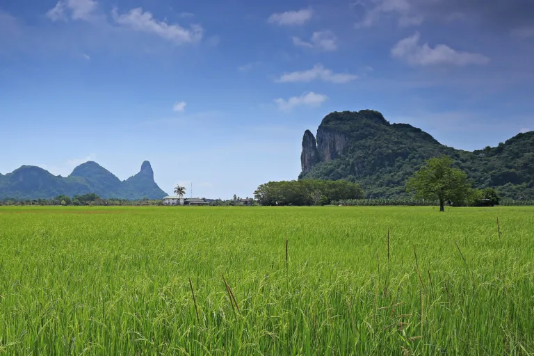
Another version names the man Mueang, his first wife Sila and his second wife Buppha, with Sila's daughter Yisun and Buppha's son Chang Khang. The women quarrel; Sila strikes Buppha with a spindle and Buppha hits back with a pestle. Both die and become mountains, Sila as Khao Ok Thalu and Buppha as Khao Hua Taek, the reverse of the first version. Khao Hua Taek can be seen on the way up, and the original form of the tale is unknown.
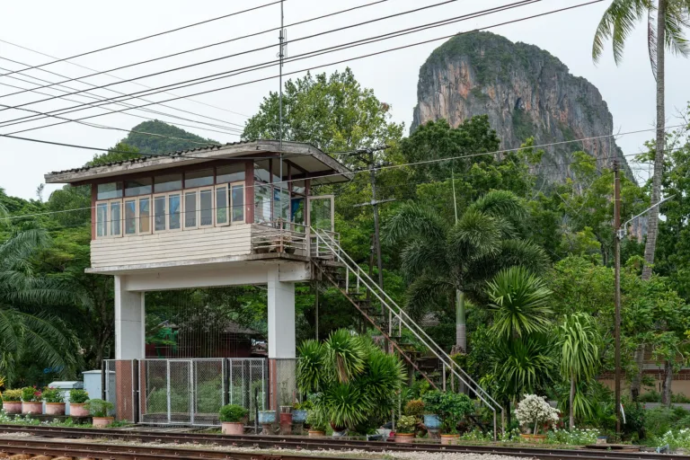
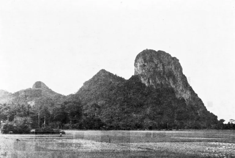
A 1943 photo in the Prime Minister's Office book "Phap Mueang Thai" shows rice paddies around Khao Ok Thalu, a reminder of Phatthalung's farming roots. Today the mountain rises east of Phatthalung railway station, and the hole is visible from the platform, so southern line passengers know they have reached Phatthalung.
The southern railway made Khao Ok Thalu the first sight for many visitors. A paper in Rusamilae Journal says the Trang–Thung Song section opened on 1 April 1913, the line to Phatthalung followed, and the line from Songkhla met it at Phatthalung station. The branch to Nakhon Si Thammarat at Ban Khao Chum Thong has been called Khao Chum Thong Junction since 1917, and an original plan to run straight from Trang to Phatthalung was changed because of the mountains around Khao Phap Pha.
There are two concrete stairways. On the right (facing the mountain) the older stairs go straight up to the hole; TAT says there are more than 1,000 steps taking about 30 minutes, while other sources say 1,066 or about 1,100. The left route, guarded by a pair of three-headed nagas, passes Wang Suk Khati Tham forest monastery and a nuns' meditation retreat, with a purple Ganesha, a four-faced Brahma beside a green Vishnu, and many Buddha images.
Originally there were no stairs, only a steep, difficult natural path; later 1,066 steps were built to make the gap reachable. At the top are a Buddha image and a hermit statue, with fences in places for safety. Climbers advise going in the morning because of the heat, and warn the path is slippery and dangerous in the rains.
At the hole are images of Luang Pu Thuat, Luang Pho Panyananda and the Phra Phuttha Chayanti Buddha. Rest points along the way look out to Khao Hua Taek. Reaching the true summit means climbing another 50 m or so of rock face; a 2024 review says a rope is needed. The top gives a 360-degree view over Phatthalung.
Though it is the provincial symbol, a 2018 article by Wimonmat Prichakul of Prince of Songkla University noted that Khao Ok Thalu was "not organised for sightseeing", while Phatthalung's best-known stops were Thale Noi, Phrai Wan waterfall and Lam Pam lake. Climbing is free today, and the stairs are a morning and evening workout route for locals.
Arrived? Check in, collect a stamp and tell others what it is like right now
Check your location first, so you do not fill in the form for nothing
Location must be on and within 3 km · One check-in per place per day · come back on other days to check in again
Post photos from anywhere — no need to be here · Up to 20 photos at a time · JPG / PNG / WebP · GPS location data is removed automatically
From Phatthalung town or the station, head toward Wat Khuha …
Bangkok → Phetkasem Road → Phatthalung · Fuel
Bangkok → Phatthalung station · By class
Bangkok → Trang or Hat Yai Airport → Phatthalung · Varies
Phetkasem Road (Hwy 4/41) → Phatthalung → Hwy 4047 past Wat Khuha Sawan to the foot
Parking at the foot of the mountain, Khuha Sawan subdistrict
Petrol stations in Phatthalung town
Good all the way
Climb any day (daylight recommended)
around 840 km fromBangkok
Khao Ok Thalu
0 THB
Approx. nightly price for 2 adults (next week) · final price depends on your dates
Answers travellers want before they go — a one-minute read
About 245–250 m (some sources say 177 m)
More than 1,000; sources say 1,066 or about 1,100
About 30 minutes to the hole; the summit needs another 50 m or so of rock climbing
No, it is free
Best day this week: Wednesday 28 Oct · Check in when you arrive to collect a stamp