 01
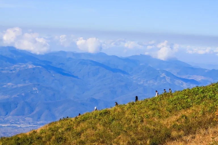
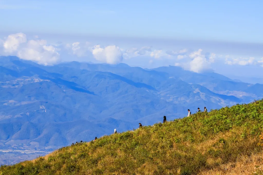
Ridge-top grasslandRare semi-alpine grassland
Nature trail · Doi Inthanon
A 3.2 km loop at about 2,157 m on Doi Inthanon through cloud forest, ridge-top grassland and rhododendron cliffs. A local guide is required, and the trail is open only 1 Nov–31 May.
Holiday / event — crowded · Chance of a sea of mist 5/10
sea-of-mist places: morning matters most
Sea of mist Nov–Jan, clearest before 07:30
05:30–06:00 to register for the first slot and catch the mist
Highway 1009 is steep and winding, with fog and dew in the morning; use low gear
4G at the car park; patchy on the trail
01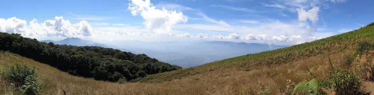 02
 03
 04
Tap a day card to see that day’s weather, rain, haze and hourly forecast
Best time to go Best window 06:00–12:00 Little rain
Holiday — traffic on the way up and parking fills fast; leave early
Green band = hours used for the score
Best time to go Best window 06:00–13:00 Little rain · light drizzle possible at times
Holiday — traffic on the way up and parking fills fast; leave early
Green band = hours used for the score
Best time to go Fine all day little rain through the day · light drizzle possible at times
Holiday — traffic on the way up and parking fills fast; leave early
Green band = hours used for the score
Best time to go Best window 06:00–13:00 Little rain
No warnings today — normal road and weather conditions
Green band = hours used for the score
Best time to go Best window 06:00–11:00 Little rain · light drizzle possible at times
Thick morning fog with visibility under 1 km — use headlights and drive slowly
Green band = hours used for the score
Best time to go Fine all day little rain through the day · light drizzle possible at times
No warnings today — normal road and weather conditions
Green band = hours used for the score
Best time to go Fine all day little rain through the day
No warnings today — normal road and weather conditions
Green band = hours used for the score
Scored from cloud cover at every level and tonight’s moonlight — the darker the sky, the clearer the Milky Way · tap another night below for the next 7 nights
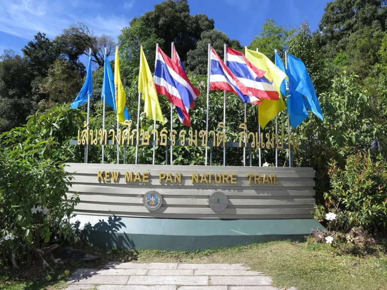
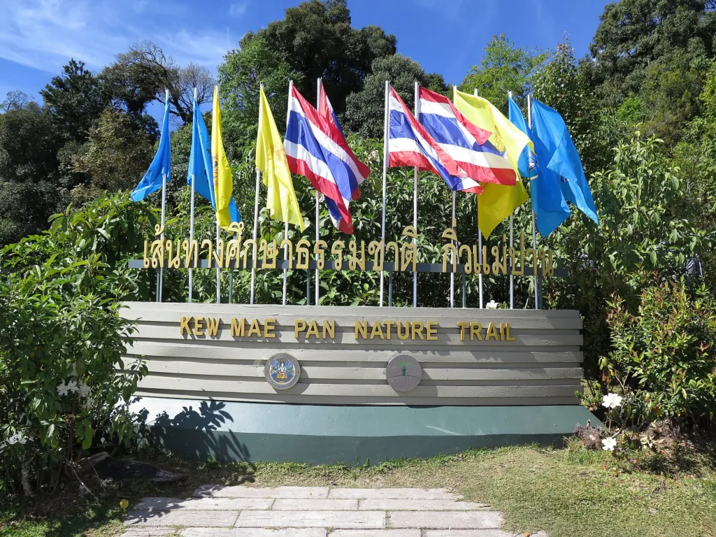
Kew Mae Pan Nature Trail, Doi Inthanon National Park, Chom Thong, Chiang Mai — a 3.2 km loop on a ridge at about 2,157 m.
Arrive 05:30–06:00 to register for the first slot and catch the mist
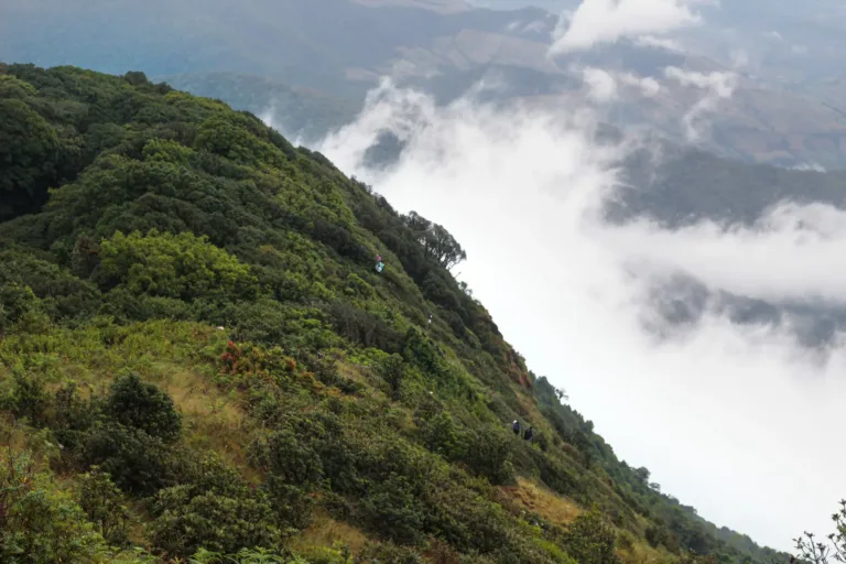
Sea of mist Nov–Jan, clearest before 07:30
Photos from Wikimedia Commons and contributors · full credits inClassic page
No solo hiking; 200 baht per group of up to 10
Winter mornings 0–9 °C, windy on the ridge
Avoid if you have heart disease, high blood pressure or asthma
Never sit or stand on the viewpoint railings
Adults 60 THB · Car 30 THB · Time needed 2–3 hours
Dec–Jan, especially New Year, when over 10,000 people a day visit the mountain
| Park entry, Thai adult optional | 60 ฿/person |
| Park entry, foreign adult optional | 300 ฿/person |
| Park entry, Thai child optional | 30 ฿/person |
| Park entry, foreign child optional | 150 ฿/person |
| Local guide (up to 10 per group) optional | 200 ฿/group |
| Car optional | 30 ฿/vehicle |
| Motorbike optional | 20 ฿/vehicle |
Park entry via the QueQ app or cash at the gate; guide fee in cash · Prices may change by season — check with the venue
Tap a month on the wheel to see weather, rain, haze and crowds from 10 years of records
Best time · Nov–Dec morning sea of mist · Dec–Jan hard frosts · Jan–Mar rhododendrons in bloom
Watch out · Closed 1 Jun–31 Oct · Mar–Apr haze spoils the views
Oct by the records 12–18°C · avg rain 186 mm (25 rainy days) · clear 4 days · avg PM2.5 8
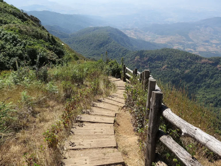
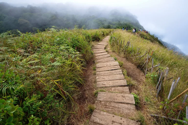
The Kew Mae Pan nature trail starts at about km 42 of Highway 1009 (Chom Thong–Doi Inthanon summit), near the twin royal chedis and about 5 km below the summit. The trailhead sits at about 2,157 m. It is a 3.2 km loop taking 2–3 hours, with 21 interpretation points, passing through moss-draped montane forest, ridge-top grassland and a cliff edge where rhododendrons grow. Every group must walk with a local guide.
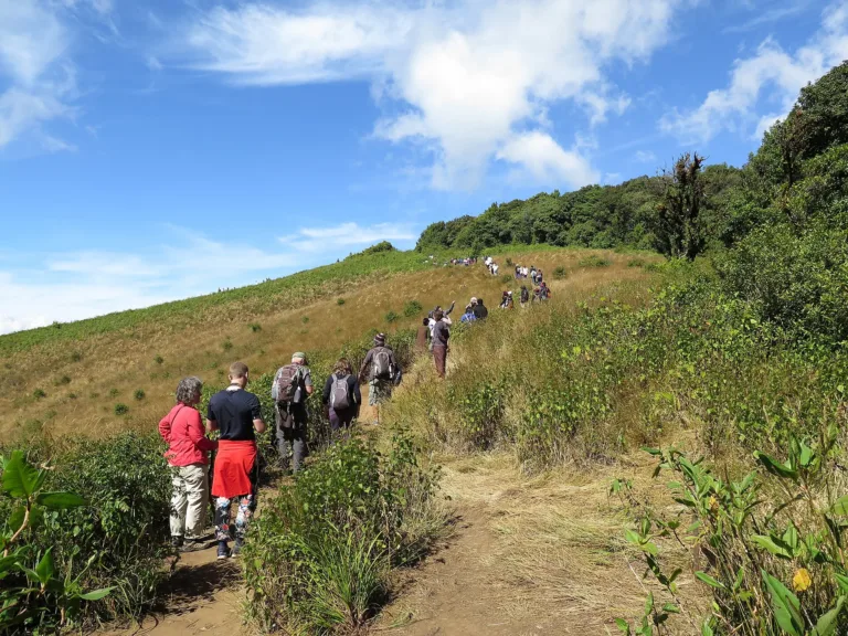
In northern Thai, "kiw" means a narrow ridge between two valleys, and "Mae Pan" is the Mae Pan stream that runs off this side of the mountain. Kew Mae Pan is therefore the narrow ridge above the Mae Pan headwaters. At its narrowest the trail follows a ridge with deep drops on both sides, where you walk single file behind the guide.
The mountain was once called Doi Luang or Doi Ang Ka, after a bog near the summit where crows came to bathe. That bog is now the Ang Ka trail, Thailand's highest sphagnum bog and the source of the Mae Klang stream, which flows into the Ping River. Chiang Mai people regard Ang Ka water as sacred and have used it in important rites. The mountain itself is granite, part of the Thanon Thong Chai range, and its summit at 2,565 m is the highest point in Thailand.
King Inthawichayanon, seventh ruler of Chiang Mai and father of Princess Consort Dara Rasmi, cared about the northern mountain forests and wished his remains to be kept on Doi Luang. English Wikipedia dates his reign from 1870, while Thai sources usually give 1873. He died on 23 November 1897, after which the mountain became known as Doi Inthanon.
The popular story is that Dara Rasmi carried part of his ashes to a reliquary on the summit. Silpa Wattanatham, summarising historian Somrit Luechai, notes that the story appears only in later books, while three people close to Dara Rasmi — Princess Poon Pismai Diskul, Chao Saeng Dao na Chiang Mai and Chao Kaeo Nawarat — mention only that she left a marker on the summit, with no burial. The summit reliquary of King Inthawichayanon still stands and is still venerated. Princess Poon Pismai also recorded that Dara Rasmi inscribed her name on a rock at the summit. A plaque at the reliquary says she built it in March 1915, the Air Force added a small chedi beside it in 1975, and after it decayed in the late 1980s it was rebuilt with donations from Lanna royal descendants, monks, airmen and the public (this comes from a transcription of the plaque and still needs checking).
The slopes of Doi Inthanon have long been home to Pgaz K'nyau (Karen) villages such as Ban Mae Klang Luang, Ban Pha Mon and Ban Nong Lom, and to Hmong at Ban Khun Klang near the park headquarters. Before the 1970s villagers practised rotational farming, hunting and opium growing, and the loss of watershed forest became a national concern. Today about 35 villages depend on the park's forest, and Karen and Hmong communities lead its eco-tourism.
The Hmong village of Ban Khun Klang sits at about 1,400 m in the Mae Klang watershed. A 1999 Chulalongkorn thesis put its age at about 100 years, or three generations. Opium was once the main cash crop before temperate crops replaced it. A monastic residence opened in 1976, a school in 1977 and electricity arrived on 29 August 1984; the population grew from 737 in 1986 to 1,129 in 163 households in 1998, when villagers were still asserting their right not to be relocated.
The history of the Karen of Ban Mae Klang Luang has several versions. A Chulalongkorn social-research article says Sgaw Karen reached the Ban Luang area in 1787 and the village was founded in 1934 by the family of Peh-lo-ke, while Thai Post says settlement began around 1870 under Nai Ta-ro from Mae Hong Son. In the 1980s and early 1990s lowland Chom Thong farmers clashed with the mountain communities over water; in 1995 Mae Klang Luang's leader helped found an upland watershed network; and in 1999 Somsak Khiri Phumthong started community tourism, whose income since 2009 has paid for roads, firebreaks and scholarships.
On 2 October 1972 the government of Field Marshal Thanom Kittikachorn declared Doi Inthanon Thailand's sixth national park, about 270 km². On 16 January 1974 King Bhumibol and Queen Sirikit made their first visit to Doi Khun Klang and asked for the park to be expanded to protect the watershed. The same year the King walked about 6 km through the forest to see a handful of Arabica trees at Ban Nong Lom–Pha Mon, after which the Royal Project gave seed to more than ten Karen villages, which became the mother stock for coffee across the area.
In February 1979 the Royal Project Foundation set up the Royal Inthanon Research Station near Ban Khun Klang to test temperate crops as alternatives to opium; it later became the Royal Agricultural Station Inthanon. Karen and Hmong families now grow coffee, chrysanthemums and vegetables for the Royal Project. Sources give different founding dates for the station (February 1979 or 30 January 1980) and sizes (150 or 600 rai). It stands on former opium fields, and in 2017 the Hmong of Ban Khun Klang and Ban Khun Wang sent about 10 tonnes of fruit, vegetables and flowers for King Rama IX's royal cremation.
In 1987 the Royal Thai Air Force and the public built the Naphamethinidon chedi for King Bhumibol's 60th birthday, and in 1992 the Naphaphonphumisiri chedi for Queen Sirikit's 60th birthday. The last part of the Kew Mae Pan trail has a viewpoint over the twin chedis. The summit also hosts an Air Force radar station, and the 48 km road within the park is said to have been cut by the Army in the 1970s to reach it. A third chedi beside the twin chedis had its foundation stone laid on 27 December 2024 by ACM Phanphakdi Phatthanakun, with a construction ceremony on 3 April 2026 led by ACM Seksan Khantha and completion due in August 2028. Queen Sirikit, to whom the second chedi is dedicated, died in October 2025.
Official park documents do not say when the Kew Mae Pan trail opened. Secondary sources differ: some say it was planned in 1997 and opened as a self-guided trail in 2001, others around 1999. It began as a patrol path against poaching and encroachment before birdwatchers discovered it. It is safest to say it opened to the public around 1999–2001. The closest thing to an official record is a 2020 EGCO press release calling Kew Mae Pan the first nature-classroom trail it developed with the Royal Forest Department and saying it had served visitors for 20 years — pointing to an opening around 1999–2000.
Around 2004 the park and local communities trained villagers who had farmed and hunted to work as trail guides, giving them income in place of opium and hunting. In 2007 the Thai Rak Pa Foundation, supported by EGCO, helped develop the trail. By 2012–13 hikers were recording a 200-baht guide fee at the trailhead, the same rate charged today.
Most English-language sources say the guides are Hmong from Ban Khun Klang, while the government PR website lists the Karen Mae Klang Luang tourism association as the contact, and Thai news simply says "local guides". Guide numbers keep growing: 215 in the 2024–25 season (137 adults, 78 youth) and 328 in 2025–26 (217 adults, 111 youth).
The trail closes every year from 1 June to 31 October to let nature recover and to repair the boardwalks, and reopens on 1 November with a ceremony at the km 42 viewpoint around 06:30. In 2022 it was 10 °C at the reopening; in 2023 there were three slots a day of about 200 people each; and on 1 November 2025 it reopened in rain and fog at 14 °C.
Popularity has brought problems. In December 2016, over a long holiday, traffic queued for more than 2 km at Kew Mae Pan, and photos of tourists sitting and standing on the viewpoint railings went viral. The park chief threatened legal action and penalties for guides who allowed it. A Kasetsart University study published in 2018 found rubbish problems from visitor numbers beyond capacity and recommended a cap.
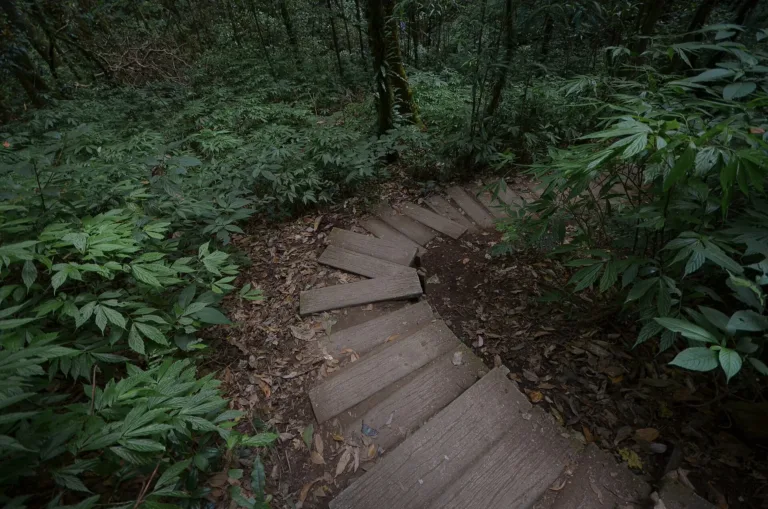
In 2019 the Thai Conservation of Forest Foundation, EGCO, the park and the local guide group carried out a major upgrade. Conservation architect Julaporn Nantapanich of Pa Nua Studio surveyed the impacts, and the team built a hardwood boardwalk on steel piles set only at selected points, so the soil is not compacted and small animals can pass beneath, plus humidity-proof signs and a registration app to cut queues. It was handed to the park on 12 February 2020 (some blogs date it to 2018, but that was the summit trail). During COVID-19 the trail closed from 9 January 2021 because the guide committee feared the virus would reach their villages, and reopened on 3 February 2021 at 6 °C with the rhododendrons in full bloom. On 10 November 2021 the park reopened with booking and a cap of 2,000 people a day.
On 14 August 2016 a Royal Thai Army UH-72A helicopter, number 9656, lost contact while flying back to Phitsanulok after flood-relief flights in Mae Hong Son. The wreck was found the next day on a hill in the Kew Mae Pan area, around km 45–46 and about 2 km from the radar station. All five aboard died, including Maj. Gen. Nopporn Ruenjan, commander of the 4th Infantry Division.
Since 2023 Doi Inthanon has been one of the first six parks to sell e-tickets through the QueQ app, up to 15 days ahead. From November 2023 to May 2024, 117,383 people walked Kew Mae Pan (78,543 Thai, 38,840 foreign), and the following season 123,776 (80,950 Thai, 42,826 foreign).
Kew Mae Pan is one of the coldest places in the country. Winter mornings are often 0–9 °C, and when the grass tips drop below zero, frost ("moei khap") forms. On 8 December 2019 Kew Mae Pan recorded 2 °C while the summit hit −1 °C. On 1 January 2026 the season's 24th frost brought −3.5 °C on the grass and 4 °C at Kew Mae Pan, after 11,999 people had visited the mountain the day before. Other notable readings: on 17 December 2013 Kew Mae Pan was 0 °C and the summit −2 °C, with frost along more than 5 km; at 06:30 on 21 December 2017 a ground thermometer in front of the national observatory at km 44.4 read −5 °C, which NARIT called unprecedented (a ground reading, not an official air temperature); and the 2025–26 winter brought 12 consecutive frost days, 22 December 2025–2 January 2026, beating the previous 10-day run of January 2024.
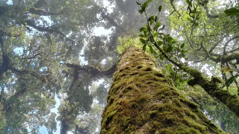
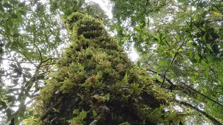
The ecosystems on the trail are rare in Thailand. The first stretch is cloud forest with moss, ferns and epiphytic orchids, then the path opens onto semi-alpine grassland found elsewhere in Thailand only on Doi Pha Hom Pok and Doi Chiang Dao. The cliffs hold red rhododendrons (Rhododendron arboreum) that bloom once a year, roughly December to March, and the small Lan Sadet waterfall sits near the start. Pha Ngaem Noi is a pair of rocks with a heart-shaped stone beside them.
More than 30 Burmese gorals live on the cliffs and can sometimes be seen on rocky ledges in the morning. Doi Inthanon has over 380 bird species; summit specialities include the Inthanon race of the Green-tailed Sunbird and the Chestnut-tailed Minla. The iridescent blue-purple Inthanon beetle is another local celebrity.
On 15 September 2026 the Cabinet approved nominating Doi Inthanon as Thailand's 11th ASEAN Heritage Park, citing 89.49% forest cover, 1,271 plant species (43 endemic) and 378 bird species. ASEAN Centre for Biodiversity experts visited on 23–25 September 2026, and recognition is expected by 2027. The trail's new season normally opens on 1 November 2026.
Arrived? Check in, collect a stamp and tell others what it is like right now
Check your location first, so you do not fill in the form for nothing
Location must be on and within 3 km · One check-in per place per day · come back on other days to check in again
Post photos from anywhere — no need to be here · Up to 20 photos at a time · JPG / PNG / WebP · GPS location data is removed automatically
Highway 1009 is steep and winding, with fog and dew in the m…
Highway 108 then 1009 to km 42 · Fuel
Rent in town; 150cc or more · 250–450 baht/day
From Chom Thong market · 200–300 baht/person
Summit and waterfalls · 1,200–1,800 baht/person
Highway 108 (Chiang Mai–Hot) to km 58, right onto Highway 1009 up Doi Inthanon to km 42, near the twin royal chedis
Car park at the trailhead visitor centre, km 42; fills fast on holidays
Fill up in Chom Thong before the climb
4G at the car park; patchy on the trail
06:00–16:00 (registration from 05:30, last group about 15:50)
around 100 km fromChiang Mai city
Kew Mae Pan Nature Trail
300 THB
Approx. nightly price for 2 adults (next week) · final price depends on your dates
Answers travellers want before they go — a one-minute read
1 November–31 May; closed 1 June–31 October for recovery
Yes, 200 baht per group of up to 10
A 3.2 km loop, about 2–3 hours, with climbs and steps
Around December–March, best in January–February
Winter mornings 0–9 °C; on some days frost forms on the grass
No; the Ang Ka boardwalk near the summit is the accessible alternative
Best day this week: Thursday 29 Oct · Check in when you arrive to collect a stamp