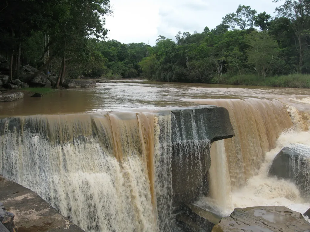
High-water season, safety and time needed
Jun – Sep (wettest)
Rainy season — Strong currents; no swimming
About 08:00–16:30
1–2 hours
7 days ahead
When to go
this week
Tap a day card to see that day’s weather, rain, haze and hourly forecast
Best time to go Best window 06:00–16:00 Little rain · light drizzle possible at times
Holiday — traffic on the way up and parking fills fast; leave early
Hour by hour
Green band = hours used for the score
Best time to go Fine all day little rain through the day · light drizzle possible at times
Holiday — traffic on the way up and parking fills fast; leave early
Hour by hour
Green band = hours used for the score
Best time to go Fine all day little rain through the day · light drizzle possible at times
Holiday — traffic on the way up and parking fills fast; leave early
Hour by hour
Green band = hours used for the score
Best time to go Best window 06:00–11:00 Little rain
No warnings today — normal road and weather conditions
Hour by hour
Green band = hours used for the score
Best time to go Best window 06:00–13:00 Little rain · light drizzle possible at times
No warnings today — normal road and weather conditions
Hour by hour
Green band = hours used for the score
Best time to go Fine all day little rain through the day
No warnings today — normal road and weather conditions
Hour by hour
Green band = hours used for the score
Best time to go Fine all day little rain through the day
No warnings today — normal road and weather conditions
Hour by hour
Green band = hours used for the score
Kaeng Sopha Waterfall
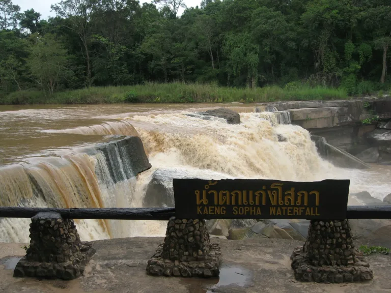
Kaeng Sopha Waterfall, Thung Salaeng Luang National Park, Phitsanulok.
- Few people, soft light
- Swimming (dry season)
- Afternoon light
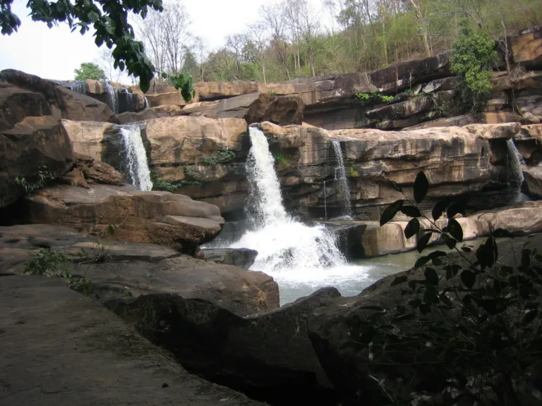
- Rock shelf below the fallsThe three stepsMorning
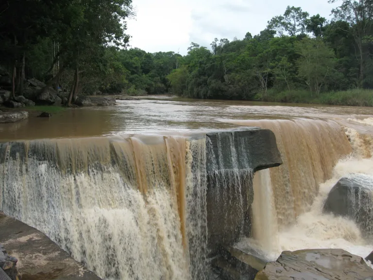
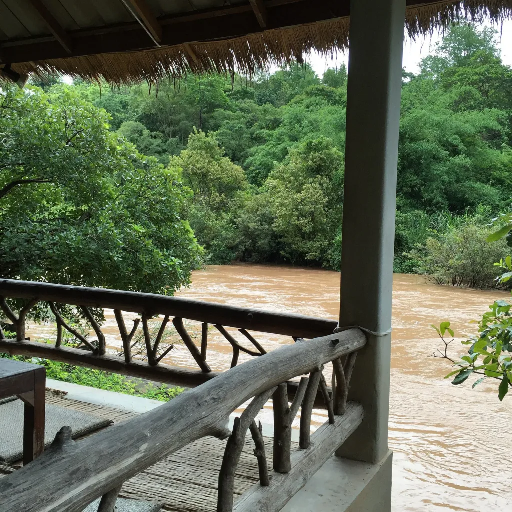
- Viewing railRainy-season torrentAfternoon
Gallery
Photos from Wikimedia Commons and contributors · full credits inClassic page
Good to know here
Strong currents; no swimming
Very slippery with moss
- Viewing only in the rains
- Add Kaeng Song and Poi falls
- Wear non-slip shoes
Adults 40 THB · Car 30 THB · Time needed 1–2 hours
Long holidays
- Kids Yes; supervise closely
- Seniors Yes; about a 200 m walk, uneven rocks
- Wheelchair No ramp data; car park only
- Pets Pets are not allowed in the park
- Kaeng SongRiverside cafés
- Resorts on Highway 12Simple dishes
- Swim only in marked spots
- Take rubbish home
- Do not climb the falls cliff
- No soap in the river
- Strong currents in the rains
- Slippery rocks
- Flash floods after upstream rain
Best months
Tap a month on the wheel to see weather, rain, haze and crowds from 10 years of records
Best time · Jul–Oct for powerful flow (viewing only) · Nov–Apr for clear water and swimming
Watch out · Heavy rain can bring swimming bans or closures
17°Jan
19°Feb
22°Mar
23°Apr
24°May
24°Jun
23°Jul
23°Aug
23°Sep
22°Oct
20°Nov
18°Dec
Oct by the records 22–30°C · avg rain 165 mm (19 rainy days) · clear 6 days · avg PM2.5 8
The story of this place
Kaeng Sopha Waterfall lies in Thung Salaeng Luang National Park, run by ranger unit SL.2 (Kaeng Sopha), beside Highway 12 (Phitsanulok–Lom Sak) at km 71–72. Sources place it in Wang Thong or Nakhon Thai district, since the Khek River here marks the boundary. It is said to be Phitsanulok's largest waterfall.
Read more 6 more paragraphs
The name joins kaeng, a rocky rapid, with sopha, beautiful. Some sources say it was once called Kaeng Chan Dai, as the stepped ledges look like a staircase, though this is unconfirmed.
The falls drop from the Khek River, headwater of the Wang Thong River, over three great rock steps. Reported heights differ — about 40 m or about 70 m — and no official figure was found. Below the main drop the river runs over more rapids, and above is a broad rock shelf you can cross in the dry season; the rocks are mossy in the humid evergreen forest.
Thung Salaeng Luang was declared Thailand's third national park in 1963; about 20 km² was withdrawn for the army in 1972, and new boundaries of about 789,000 rai were declared on 27 May 1975; and now covers about 1,262 km² across Phitsanulok and Phetchabun. In the 1960s–80s this forest was a base of the Communist Party of Thailand, near the battlegrounds of Khao Kho and Phu Hin Rong Kla.
In May 2017, after heavy rain, the park banned swimming and posted staff along the river; the park head warned that rainy-season currents could drown people. In 2021 the park closed for recovery from 1 June to 31 July and reopened on 1 September after COVID, 100 people per slot. The falls are reported to have appeared on a 2007 waterfall stamp, though this is unconfirmed.
Flow peaks July–October, reddish with sediment and for viewing only; from November to April the water is clearer and calmer, and the park head recommends March–April for swimming. On Highway 12 you also pass Kaeng Song falls at about km 45 and Poi falls in Khao Krayang forest park at about km 59–60.
From Phitsanulok take Highway 12 — widened to four lanes in 2013–16 and reopened on 12 March 2016 — through Wang Thong, turn at km 71–72 and drive about 2 km to the car park, then walk about 200 m in the shade — roughly 72–80 km, about an hour. No public transport reaches the falls. Entry is 40 baht for Thai adults and 20 for children, 200 and 100 for foreigners, plus 30 per car; it opens about 08:00–16:30. The mossy rocks are very slippery and flash floods can follow upstream rain, so swim only where the park allows.
- 1960s–80sThe forest is a Communist Party base
- 1963Thung Salaeng Luang National Park declared
- 1972About 20 km² withdrawn for the army
- 27 May 1975New park boundaries declared, about 789,000 rai
- 2007Reportedly on a waterfall stamp
- 12 Mar 2016Four-lane Highway 12 opens
- May 2017Swimming banned after heavy rain
See 1 events
- 1 Sep 2021Reopens after COVID, 100 per slot
Check-ins & visitor photos
Arrived? Check in, collect a stamp and tell others what it is like right now
Check your location first, so you do not fill in the form for nothing
Location must be on and within 3 km · One check-in per place per day · come back on other days to check in again
Post photos from anywhere — no need to be here · Up to 20 photos at a time · JPG / PNG / WebP · GPS location data is removed automatically
How to get there
Highway 12 in good condition
Highway 12 · Fuel
Phitsanulok–Lom Sak, off at km 71–72, then walk about 2 km · Local fare
Highway 12 km 71–72, then about 2 km
Car park by the falls
Wang Thong district
Fair
About 08:00–16:30
around 75 km fromPhitsanulok town
Kaeng Sopha Waterfall
200 THB
Stays near Kaeng Sopha Waterfall
Approx. nightly price for 2 adults (next week) · final price depends on your dates
FAQ
Before you goKaeng Sopha Waterfall
Answers travellers want before they go — a one-minute read
Which park is it in?
Thung Salaeng Luang National Park
How many tiers?
Three great rock steps
Can I swim?
In the dry season in marked spots; not in the rains
What is the fee?
40 baht Thai, 200 baht foreign, 30 per car
How far is it?
Highway 12 km 71–72 plus 2 km, about 1 hour
Is the suspension bridge here?
No; it is about 10 km away
Ready to go to Kaeng Sopha Waterfall?
Best day this week: Thursday 29 Oct · Check in when you arrive to collect a stamp