 01
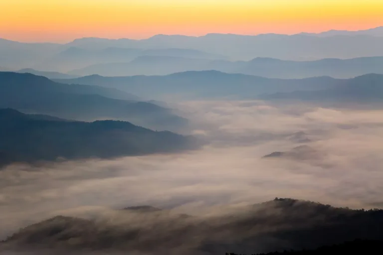
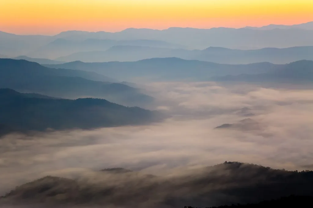
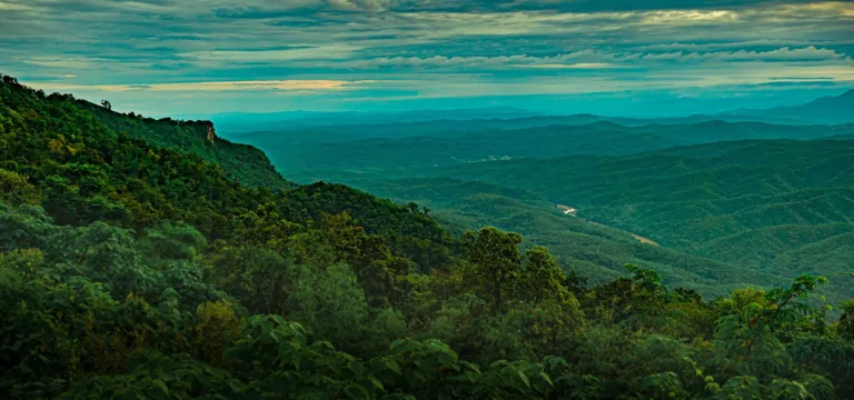
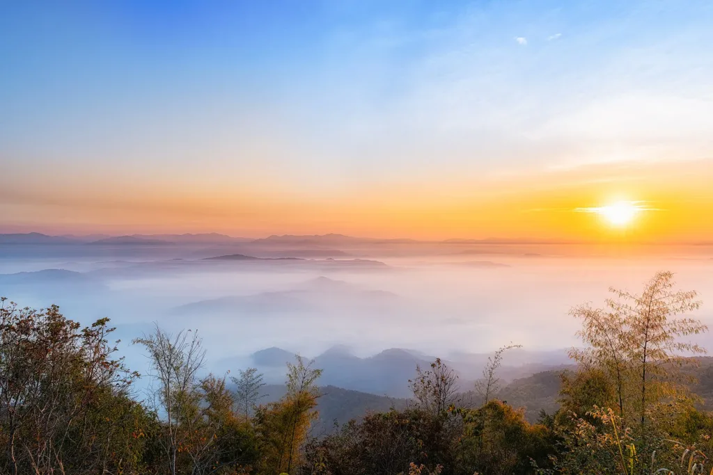
Morning sea of mistMist over the Nan River valley on almost every cool-season morning
NAN · SI NAN NATIONAL PARK
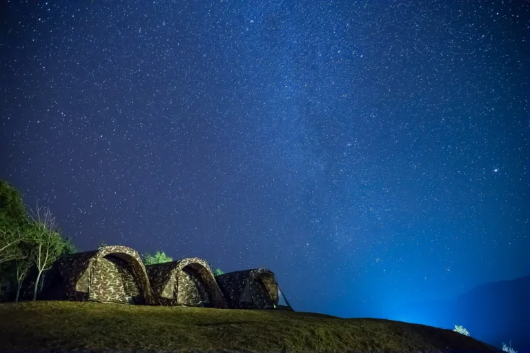
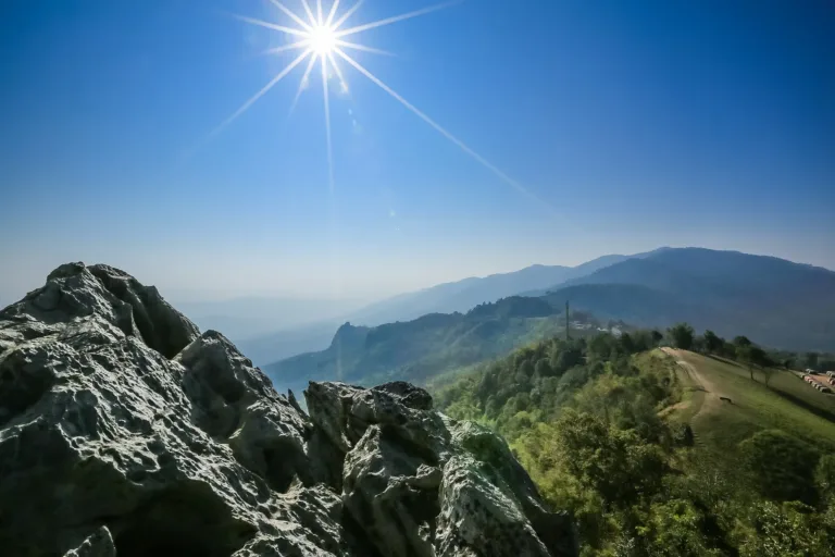
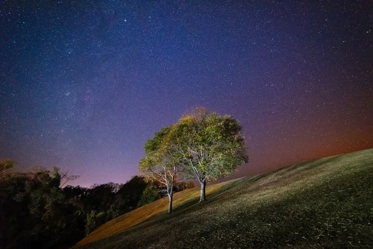
A broad grassy ridge at about 888 m in Si Nan National Park, Nan — stargazing campsites, a sea of mist over the Nan River valley, and the Lion Head crag.
Holiday / event — crowded · Chance of a sea of mist 5/10
sea-of-mist places: morning matters most
A sea of mist forms almost every morning from October to January, filling the Nan River valley below — clearest around 5:30–7:30. Watch from the stargazing lawn on the eastern hill or the Doi Samer Dao sign, which has a 360° view.
Before 11:00 on long weekends for a good tent spot; up by 5:00 for the sea of mist
From Nan town take Highway 101 south to Wiang Sa, turn right onto Highway 1026 to Na Noi (about 35 km from Wiang Sa), then left onto Highway 1083 (Na Noi–Pang Hai) for about 15–16 km to Doi Samer Dao — about 80 km in all, on a paved and not very steep road. Another, more winding route comes from Rong Kwang district in Phrae. By public transport, take a bus to Wiang Sa bus station, the green local bus (Wiang Sa–Na Muen) to Na Noi, then hire a pickup up the mountain.
Mobile signal works in parts of the ridge and may drop in places
01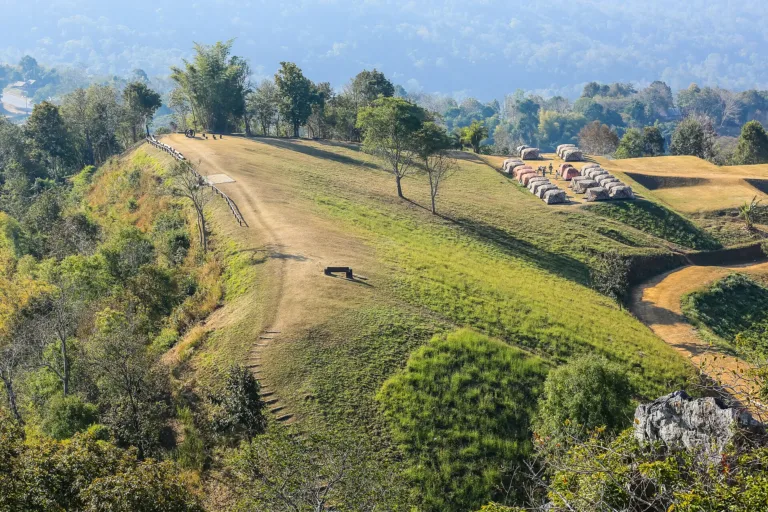 02
 03
 04
 05
Tap a day card to see that day’s weather, rain, haze and hourly forecast
Best time to go Fine all day little rain through the day
Holiday — traffic on the way up and parking fills fast; leave early
Green band = hours used for the score
Best time to go Fine all day little rain through the day
Holiday — traffic on the way up and parking fills fast; leave early
Green band = hours used for the score
Best time to go Fine all day little rain through the day
Holiday — traffic on the way up and parking fills fast; leave early
Green band = hours used for the score
Best time to go Best window 06:00–15:00 Little rain · light drizzle possible at times
No warnings today — normal road and weather conditions
Green band = hours used for the score
Best time to go Fine all day little rain through the day · light drizzle possible at times
No warnings today — normal road and weather conditions
Green band = hours used for the score
Best time to go Fine all day little rain through the day
No warnings today — normal road and weather conditions
Green band = hours used for the score
Best time to go Fine all day little rain through the day
No warnings today — normal road and weather conditions
Green band = hours used for the score
Scored from cloud cover at every level and tonight’s moonlight — the darker the sky, the clearer the Milky Way · tap another night below for the next 7 nights
Doi Samer Dao is a wide grassy ridge in Si Sa Ket subdistrict, Na Noi district, Nan, inside Si Nan National Park, at about 888 m. Its name means roughly "level with the stars".
Its draws are stargazing from the ridge-top campsite, a sea of mist filling the Nan River valley on cool-season mornings, sunsets over cornfields, and Pha Hua Sing, a limestone crag shaped like a crouching lion.
The park is open all year, but camping is allowed only from about 1 October to the end of February. Entry is 20 baht for Thai adults and 30 baht per car.
A sea of mist forms almost every morning from October to January, filling the Nan River valley below — clearest around 5:30–7:30. Watch from the stargazing lawn on the eastern hill or the Doi Samer Dao sign, which has a 360° view.
Photos from Wikimedia Commons and contributors · full credits inClassic page
Electricity runs only at set hours and charging at ordinary sockets is not allowed — bring a power bank and torch
There is no park shop; locals sell food in season. Buy water and supplies in Na Noi, and no grilling in front of tents
Pha Hua Sing and Pha Chu need a ranger escort and have been closed over rockfall risk — don't climb on your own
No hot water in the showers and very cold mornings — bring warm clothes and a sleeping bag
Adults 20 THB · Car 30 THB · Time needed 1 night
Long weekends and weekends in Dec – Jan; the campsite fills fast
| Park entry, adult (Thai) | 20 ฿/person |
| Park entry, child (Thai) | 10 ฿/person |
| Car | 30 ฿/vehicle |
| Tent hire for 2, with bedding optional | 345 ฿/tent/night |
| Tent hire for 3, with bedding optional | 405 ฿/tent/night |
| Own tent (pitch fee) optional | 70 ฿/tent/night |
Mostly cash · Prices may change by season — check with the venue
Camping season 1 Oct – end Feb (check with the park each year)
Tap a month on the wheel to see weather, rain, haze and crowds from 10 years of records
Best time · November–January is cool to cold with open skies; a sea of mist forms almost every morning and the night sky is full of stars, sometimes the Milky Way. Camping runs from 1 October to the end of February.
Watch out · March–April brings very heavy forest-fire smoke to Nan, hiding the views, and camping is closed from 1 March to 30 September. July–September is very wet, with slippery roads.
Oct by the records 18–26°C · avg rain 118 mm (17 rainy days) · clear 7 days · avg PM2.5 8
Doi Samer Dao is a broad grassy ridge in Si Sa Ket subdistrict, Na Noi district, Nan, at about km 16 of Highway 1083 (Na Noi–Pang Hai), inside Si Nan National Park. At about 888 m it is not especially high, but most of it is open ground with two hilltops that look out in every direction — over the Nan River valley, layer upon layer of ranges, and the Pha Hua Sing crag.
The name, roughly "level with the stars", comes from how it feels to lie on the open ridge at night when the sky is completely dark and full of stars. Travellers took up the name and it became the park's viewpoint name.
The ridge's story is tied to the birth of Si Nan National Park. In 1989 the Royal Forest Department ordered Sombat Wiangkham, a forest officer from Nam Nao National Park then posted to Wiang Kosai National Park, to survey several national reserve forests in Wiang Sa district — about 435 km² (271,875 rai) — with a further survey ordered on 19 October 1989. At first the area was called "Mae Sakhon National Park", after the well-known headwater forest.
In 1991 the survey was extended to the forests on the right bank of the southern Nan River, Huai Nguang and Nam Wa, covering Wiang Sa, Na Noi and Na Muen districts. On 19 April 1993 Nan province backed the plan, and on 12 January 1994 Forest Department director-general Phong Leng-ee approved a park of about 934 km² (583,750 rai), excluding large villages, and renamed it "Si Nan National Park" because the expansion and a move of the headquarters had made the old name confusing.
On 25 May 2007 a royal decree, published in the Royal Gazette (vol. 124, part 25 Kor), formally declared it Thailand's 104th national park, covering about 640,237 rai (1,024 km²) in Khueng, San and Nam Muap subdistricts of Wiang Sa, Si Sa Ket, Chiang Khong and Sathan of Na Noi, and Bo Kaeo and Na Thanung of Na Muen — following both banks of the Nan River down to the Sirikit Dam reservoir.
The park protects key headwaters of the Nan River, which flows about 60 km through it. Its ranges run north–south, topped by Khao Khun Huai Huek at about 1,234 m. The forest is mostly mixed deciduous and dry dipterocarp, with Irvingia, ironwood, Xylia, padauk and rosewood, and is home to tiger, leopard, wild cats, dhole, mouse deer and palm civets. In 2019 the park had about 115,358 visitors.
On Doi Samer Dao itself, the eastern hill is the "stargazing lawn", good for both sunrise and sunset, with a high cliff looking down over the ranges and the Nan River; the western slope watches the sun set over cornfields. Nearby is Pha Hua Sing, a limestone crag shaped like a crouching lion facing east, with a 360° view from the top — but only with a ranger guide. Visitor reviews say Pha Hua Sing and Pha Chu were once closed for about two years over rockfall risk after an earthquake.
About 4 km away is Pha Chu, another sunrise and sea-of-mist viewpoint, looking down on the Nan River winding through the forest. It is a walk of about 2 km up — roughly an hour there and back — with a ranger guide required. The name comes from a legendary love triangle: Chao Ueang Phueng loved Chao Chan Pha but was forced to marry Chao Chuang, so she leapt from the cliff; Chan Pha followed her, and Chuang, seeing them, jumped too but fell further away. Ueang Phueng became an orchid clinging beneath a chan pha tree, and Chuang a pine — "chuang" means pine in northern Thai and "ueang phueng" is a kind of orchid. The cliff is also said to have Thailand's longest flagpole: the flag only reaches the top after the national anthem has been sung about 12 times.
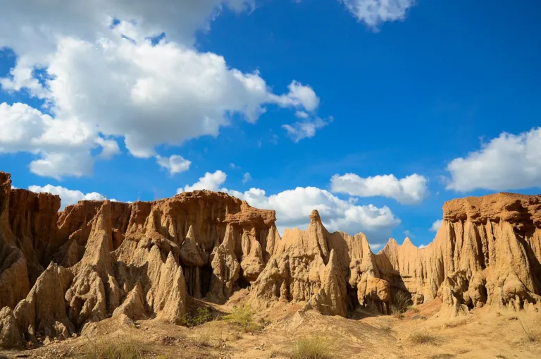
Near Na Noi town, about 24 km from the park headquarters, are the Sao Din Na Noi earth pillars, also called "Hom Chom", in Chiang Khong subdistrict — strange pillars spread over more than 20 rai, like Phrae's Phae Mueang Phi, formed as uplifted sediments were carved by water, wind and rain. Estimates of their age vary wildly, from about 10,000–30,000 years to several million. On 7 November 1989 the cabinet listed the site as a natural area worth conserving. It is also a prehistoric site where chipped stone tools, stone axes and stone bracelets have been found, now kept at the Nan National Museum, and was the subject of a Silpakorn University study in 2012. On 10 November 1995 Princess Sirindhorn brought Chulachomklao Royal Military Academy cadets here on a study trip. Villagers hold the pillars sacred, and about 800 m away is Khok Suea ("tiger pen"), a deep pit where villagers are said to have driven and killed tigers that preyed on their cattle.
At the park's southern end the Nan River flows into the Sirikit Dam reservoir, where Ban Pak Nai lies in Na Thanung subdistrict, Na Muen. It was once a riverside village, but when Sirikit Dam was built the old village went under the reservoir; settlers from many places moved in and took up freshwater fishing. Today there are floating fish restaurants and pontoon ferries across to Ban Tha Faek in Nam Pat, Uttaradit — which stop when the reservoir runs low, as in July 2021.
Today Doi Samer Dao is southern Nan's favourite campsite. The park is open all year, but camping is allowed only from about 1 October to the end of February. The terraced campsite has two toilet blocks without hot water, power at set hours and no park shop; in season, villagers come up to sell food. The Tourism Authority of Thailand sees Doi Samer Dao and Si Nan as the magnets of "South Nan", and in 2022 developed the "Suk Samer Dao" community route at Ban Nong Pa Kha in Si Sa Ket, where visitors can try award-winning Na Noi robusta coffee, visit the Phra That Si Sa Ket stupa and see Wat Na Tao's scripture library, said to be over 600 years old.
Visitors can help by taking all rubbish back down, not lighting fires or grilling in front of tents, keeping noise and lights down after 22:00 for stargazers, and staying off cliffs and closed areas.
Arrived? Check in, collect a stamp and tell others what it is like right now
Check your location first, so you do not fill in the form for nothing
Location must be on and within 3 km · One check-in per place per day · come back on other days to check in again
Post photos from anywhere — no need to be here · Up to 20 photos at a time · JPG / PNG / WebP · GPS location data is removed automatically
From Nan town take Highway 101 south to Wiang Sa, turn right…
Highways 101, 1026 and 1083, about 80 km · Fuel
Bangkok–Wiang Sa, green bus to Na Noi, then a pickup up the mountain · Bus about 40 baht, pickup about 400 baht
Highway 101 to Wiang Sa, Highway 1026 to Na Noi, then Highway 1083 (Na Noi–Pang Hai) to about km 16; paved, not too steep, fine for sedans
The park's central car park near the campsite
Petrol stations in Na Noi — fill up before going up
Mobile signal works in parts of the ridge and may drop in places
Open daily; camping only 1 Oct – end Feb
around 80 km fromNan town
Doi Samer Dao, Si Nan National Park, Na Noi
Approx. nightly price for 2 adults (next week) · final price depends on your dates
Best day this week: Wednesday 28 Oct · Check in when you arrive to collect a stamp