Opening hours, entry fee and time needed
About 08:00–17:00
Free
Half a day to one night
Cool-season long weekends
7 days ahead
When to go
this week
Tap a day card to see that day’s weather, rain, haze and hourly forecast
Best time to go Fine all day little rain through the day
Holiday — traffic on the way up and parking fills fast; leave early
Hour by hour
Green band = hours used for the score
Best time to go Fine all day little rain through the day
Holiday — traffic on the way up and parking fills fast; leave early
Hour by hour
Green band = hours used for the score
Best time to go Fine all day little rain through the day
Holiday — traffic on the way up and parking fills fast; leave early
Hour by hour
Green band = hours used for the score
Best time to go Best window 06:00–13:00 Little rain · light drizzle possible at times
Thick morning fog with visibility under 1 km — use headlights and drive slowly
Hour by hour
Green band = hours used for the score
Best time to go Best window 06:00–14:00 Little rain · light drizzle possible at times
No warnings today — normal road and weather conditions
Hour by hour
Green band = hours used for the score
Best time to go Best window 08:00–19:00 Little rain · light drizzle possible at times
No warnings today — normal road and weather conditions
Hour by hour
Green band = hours used for the score
Best time to go Fine all day little rain through the day
Thick morning fog with visibility under 1 km — use headlights and drive slowly
Hour by hour
Green band = hours used for the score
Bhumibol Dam
Bhumibol Dam, Khao Kaeo, Sam Ngao, Tak.
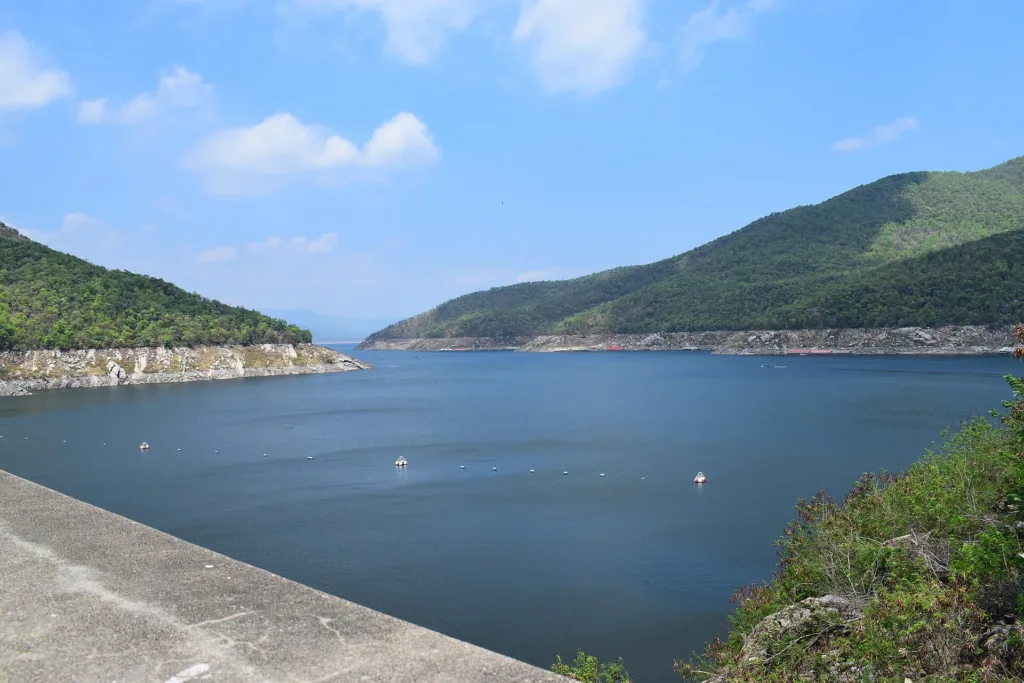
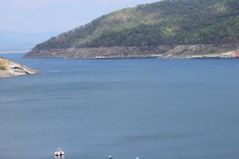
- Calm water, clear views
- Strong sun
- Sunset over the reservoir
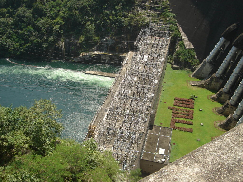
- Dam crestWide view of reservoir and valleyMorning
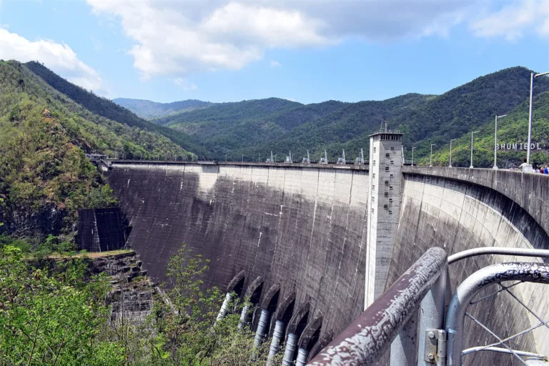
- BHUMIBOL DAM letteringCliff by the damLate morning
- ReservoirSunsetEvening
Gallery
Photos from Wikimedia Commons and contributors · full credits inClassic page
Good to know here
Depend on water level; agree return fares first
Key infrastructure; stay in permitted zones
Wear a life jacket
- Book dam lodging on 055-881-237
- Agree raft or boat fares before setting off
- Go early for calm water and clear views
- Ask which boat routes run at the current level
Adults 0 THB · Time needed Half a day to one night
Cool-season long weekends
| Golf green fee, weekday optional | 300 ฿/person |
Cash · Prices may change by season — check with the venue
- Kids Excellent
- Seniors Yes; crest and gardens reachable by car
- Wheelchair Crest and gardens fairly flat
- Pets Ask first
- Heun Phu KaewNorthern food on a hilltop
- Sam Ngao districtMade-to-order food
- Stay in permitted areas
- Wear a life jacket on the water
- No drones in restricted zones without permission
- Don't litter in the reservoir
- Some areas restricted
- Boat services depend on water level
Best months
Tap a month on the wheel to see weather, rain, haze and crowds from 10 years of records
Best time · Nov–Feb is cool and the reservoir is usually full
Watch out · April is very hot
19°Jan
20°Feb
23°Mar
25°Apr
25°May
25°Jun
24°Jul
24°Aug
24°Sep
23°Oct
22°Nov
20°Dec
Oct by the records 23–29°C · avg rain 190 mm (23 rainy days) · clear 6 days · avg PM2.5 7
The story of this place
Bhumibol Dam blocks the Ping River at Khao Kaeo, Sam Ngao district, Tak, about 50–60 km from Tak town and some 480 km from Bangkok. Run by EGAT, it was Thailand's first multipurpose dam, serving power, irrigation, flood relief, fisheries and tourism.
Read more 12 more paragraphs
Conceived and approved in 1951 as the Yanhee project, with preparatory work from 1952, it was renamed "Bhumibol Dam" by King Bhumibol on 25 July 1957.
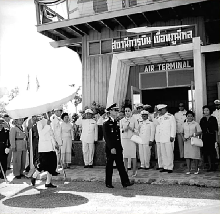
Most sources date the start of construction to 1958 (some say 1957, likely the naming or preparatory year). The King laid the foundation stone on 24 June 1961, and the dam was formally inaugurated on 17 May 1964 with its first two generators, at a cost of about 3.5 billion baht. The King and Queen visited the dam in 1964.
A 1963 World Bank report says the first loan, 175-TH for US$66 million, was signed in November 1957, on condition that the Yanhee Electricity Authority be created, which it was in September 1957. Construction began late in 1958 and the first power was sold in March 1961; the first phase cost about US$100 million, and later loans paid for units 3–4. Two sources say King Bhumibol opened the dam in person on 17 May 1964.
Filling the reservoir displaced about 2,400 households from 21 villages in the Doi Tao and Hot area to plots along the Mae Tuen–Doi Tao–Hot road, with compensation of 400 baht per rai (less in practice), and a self-help settlement gave 5 rai each to 1,711 families, according to a single Thai Post report (2018).
It is a concrete arch-gravity dam 154 m high with a 486 m crest — Thailand's tallest dam and its only concrete arch dam. The reservoir holds 13,462 million m³ (about 9,762 million usable), covers some 300 km² and stretches over 200 km to Hot district in Chiang Mai. It first filled in 1970.
The power station has eight units: units 1–6 installed 1964–69 and uprated to 76.3 MW each, unit 7 of 115 MW in 1982 and unit 8, a 171 MW pump-turbine, in 1996 — about 743.8 MW in total per IEA's technical report (Wikipedia gives 779.2 MW). In 1965 it supplied about 73.66% of the nation's electricity, falling to about 2% by 2003.
In 1991 the Lower Mae Ping dam was built 5.5 km downstream as the lower pond for pumped storage. With Sirikit Dam it irrigates about 10 million rai and holds back an average of some 2,050 million m³ of floodwater a year, and its spillway was used in the great flood of 2011. As for floating solar, Thansettakij reported in July 2026 that 158 MW (expandable to 205.4 MW) had been contracted for about 4,092 million baht, but it still awaited Cabinet approval and the commercial start date had slipped.
Water levels swing widely: about 43.4% on 24 August 2024 and about 8,247 million m³ (61%) on 30 September 2024; about 89.8% on 7 October 2025, rising to about 97% on 4–6 November 2025 — the highest since 2011, under Typhoon Kalmaegi — before peaking at 13,406 million m³ (99.59%) on 13 November with no spillway needed; and about 8,512 million m³ (63%) on 28 September 2026. Raft and boat routes depend on the level.
Visitors can walk the dam crest and viewpoints, stay in EGAT guesthouses with a pool and bicycle hire, eat northern food at Heun Phu Kaew on a hilltop, play the public 18-hole golf course, and camp.
On the reservoir, towed raft houses and boats visit Phra Phutthabat Khao Nam, Valentine Island with a sandy swimming beach, Doi Chao Pho Luang and the Kaeng Soi archaeological site. Doi Khao Nam is an island hill with a Buddha footprint on top, found in 1947, about 5 km or 30 minutes by boat. Boats to Doi Tao run only on some routes depending on water levels, so charter and agree the fare first.
Other stops include the Luang Pho Chet Kasat statue on a hill, the Lower Mae Ping dam, the Ping Phiphat Bridge, the Namjai garden, a teak tree planted by King Bhumibol in 1970 and the 50-Year Bridge. EGAT also hosts an international mountain-bike race.
From Tak take Highway 1 to the junction at km 566+600, turn left onto Highway 1357 and continue to about km 15 for the dam entrance. There is no direct public transport. The grounds open about 08:00–17:00 and are free. November to February is best — cool, with the reservoir usually full after the rains — while April is very hot, with a record of 43.7 °C.
- 1951Yanhee dam project approved
- Sep 1957Yanhee Electricity Authority created
- Nov 1957World Bank loan of US$66 million
- 25 Jul 1957Renamed Bhumibol Dam by the King
- 1958Construction begins (some say 1957)
- Mar 1961First power sold
- 24 Jun 1961King lays the foundation stone
See 13 events
- 17 May 1964Formal inauguration
- 1965Supplies about 73.66% of national power
- 1970Reservoir first full; King plants a teak tree
- 1982Unit 7 installed
- 1991Lower Mae Ping dam built
- 1996Pump-turbine unit 8 installed
- 2011Spillway used in the great flood
- 24 Aug 2024Reservoir about 43.4%
- 30 Sep 2024Reservoir about 61%
- 4–6 Nov 2025About 97%, highest since 2011
- 13 Nov 2025Yearly peak at 99.59%
- 28 Sep 2026Reservoir about 63%
- Jul 2026Floating solar contracted at 158 MW, awaiting Cabinet
Check-ins & visitor photos
Arrived? Check in, collect a stamp and tell others what it is like right now
Check your location first, so you do not fill in the form for nothing
Location must be on and within 1 km · One check-in per place per day · come back on other days to check in again
Post photos from anywhere — no need to be here · Up to 20 photos at a time · JPG / PNG / WebP · GPS location data is removed automatically
How to get there
Paved highways throughout
Highways 1 and 1357 · Fuel
Highway 1 to km 566+600, then left on Highway 1357 to about km 15
Car parks around the dam
Sam Ngao district
Good
About 08:00–17:00
around 55 km fromTak town
Bhumibol Dam
0 THB
Stays near Bhumibol Dam
Approx. nightly price for 2 adults (next week) · final price depends on your dates
FAQ
Before you goBhumibol Dam
Answers travellers want before they go — a one-minute read
Why was it called Yanhee?
The original project name, before the King renamed it in 1957
Is it Thailand's biggest dam?
The tallest (154 m) and largest by storage (13,462 million m³)
Can I stay overnight?
Yes; EGAT guesthouses or camping
Is there a fee?
No
Can I take a boat to Doi Tao?
Some charter routes, depending on water level
When did it open?
17 May 1964
Ready to go to Bhumibol Dam?
Best day this week: Thursday 29 Oct · Check in when you arrive to collect a stamp