Su Tong Pae Bridge
A bamboo bridge about 500 m long across the rice fields of Ban Kung Mai Sak, linking Wat Phu Sama Naram with a Tai Yai (Shan) village. Its name means "a prayer fulfilled"; monks walk it on their alms round at dawn, over fields that turn green in the rains and gold at harvest.
Before you goWhich of the next 7 days is best Best dayMonday 19- The bridge was damaged by flash floods in August 2026 and major repairs began on 21 September 2026 — check the "Su Tong Pae – Suan Tham Phu Sama" page before you go.
- River levelNormal · 1.1×
- Severe weatherNone
- EarthquakesNone in 48 h
- Major disastersNone
- Site noticesNotice posted
About
Overview · highlights · who it suits
Su Tong Pae is a bamboo bridge about 500 m long that crosses rice fields and the Mae Sa-nga stream, linking Wat Phu Sama Naram (Suan Tham Phu Sama) on the hillside with Ban Kung Mai Sak, a Tai Yai (Shan) village in Pang Mu subdistrict, about 8–10 km from Mae Hong Son town.
It was built by monks and villagers so the monks could walk their alms round into the village without wading through the paddies. "Su Tong Pae" is Tai Yai for "a prayer fulfilled". Every morning around 6:00 the monks and novices still walk the bridge to receive alms — the most beautiful moment of the day.
The fields around the bridge change with the seasons: bright green in the rains, golden as the rice ripens around October–November, and stubble after the harvest. In the cool season, morning mist often drifts over the fields.
Don't-miss highlights
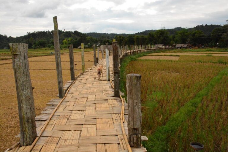
A bamboo bridge across the fields
A woven-bamboo walkway about 500 m long over paddies and the Mae Sa-nga stream
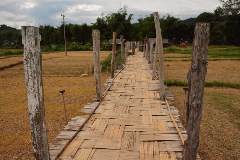
Alms round on the bridge
Monks and novices receive alms from villagers around 6:00 every morning
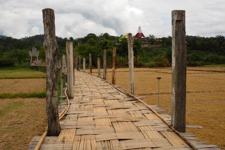
Wat Phu Sama Naram
The hillside meditation temple at the end of the bridge, overlooking the valley
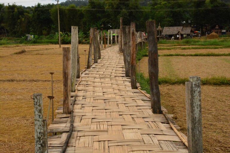
Fields that change colour
Lush green in the rains, gold as the rice ripens
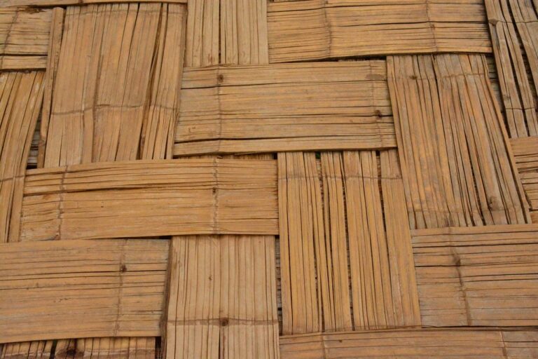
Hand-woven bamboo
The deck is woven by villagers from local bamboo
Before you go
Gallery
Get a feel for the place · tap a photo to enlarge
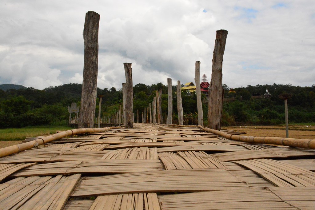
Bridge across the fieldsSu Tong Pae bridge leading toward Wat Phu Sama Naram on the hill · Photo: paularps (CC BY 2.0)Toward the hillside templeTimber posts and a woven-bamboo deck stretching across the fields · Photo: paularps (CC BY 2.0)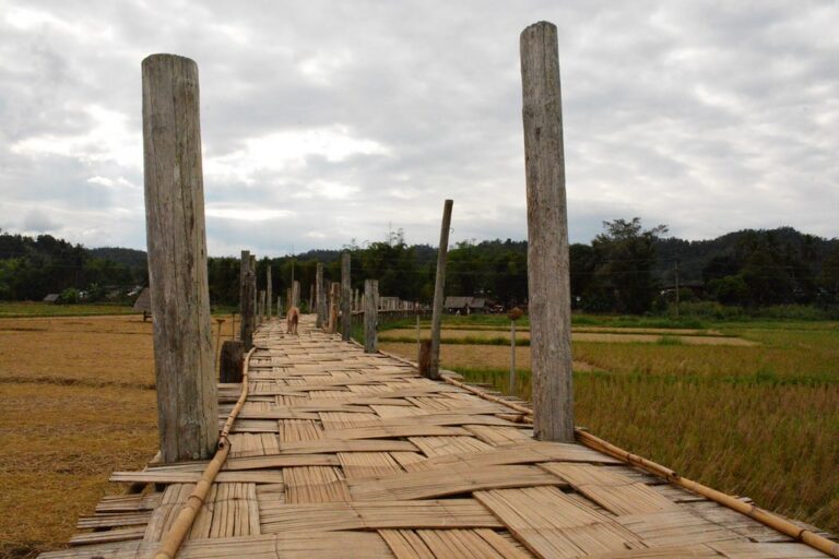 Timber posts in the fieldsHarvested paddies around the bridge · Photo: paularps (CC BY 2.0)Fields after the harvestA bamboo walkway more than 500 m long · Photo: paularps (CC BY 2.0)The long bamboo walkwayWoven bamboo deck with the hills of the Mae Hong Son valley · Photo: paularps (CC BY 2.0)
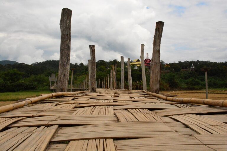 Bamboo deck and hillsWoven bamboo pattern on the bridge deck · Photo: paularps (CC BY 2.0)Woven bamboo pattern
Photo credits7 photos from Flickr
 Su Tong Pae bamboo bridge across the rice fields of Ban Kung Mai SakPhoto: paularps CC BY 2.0
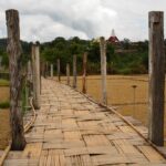 Su Tong Pae bridge leading toward Wat Phu Sama Naram on the hillPhoto: paularps CC BY 2.0
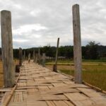 Timber posts and a woven-bamboo deck stretching across the fieldsPhoto: paularps CC BY 2.0
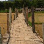 Harvested paddies around the bridgePhoto: paularps CC BY 2.0
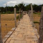 A bamboo walkway more than 500 m longPhoto: paularps CC BY 2.0
 Woven bamboo deck with the hills of the Mae Hong Son valleyPhoto: paularps CC BY 2.0
 Woven bamboo pattern on the bridge deckPhoto: paularps CC BY 2.0
Before you go
Weather, haze and crowds before you set off
Best time of day — hourly
MoreWhat to bring · costs · crowds · travel warnings · detailed weather
What to bring —
Estimated costs
Crowds — estimate
Travel warnings
Best months
Tap a month to see weather, rain, haze and crowds
October to early November the rice ripens gold around the bridge; December–January is cool with morning mist over the fields. Arrive in time for the monks' alms walk around 6:00.
February–April brings heavy wildfire smoke (Mae Hong Son's PM2.5 usually peaks in March) and bare, dry fields. August–September has the heaviest rain and flash floods have damaged the bridge — check its status before you go.
- Weather
- Rain
- Haze
- Crowds
See 10 years of real weather dataMonthly temperature, rainy days, clear days and haze
Past weather records
Check-ins & visitor photos
Location must be on and within 2 km · you can check in on every visit
History & stories
Legend · history · architecture
Before Mae Hong Son existed, the valley along the Pai River is believed to have been home to the Lua (Lawa). Around 1831 Chao Kaew Mueang Ma, sent by the ruler of Chiang Mai to lead men west over the mountains to capture wild elephants, found a good site and set up an elephant camp. Its old name, "Mae Rong Son", is said to refer to a channel used for training elephants, later shifting to Mae Hong Son. Around 1856 unrest west of the Salween River drove many Tai Yai (Shan) people from the Shan State into the area, and in 1874 the settlement was raised to a town, with the Tai Yai leader Chan Kale as its first ruler under the title Phaya Singhanat Racha. It became a province in 1910.
Ban Kung Mai Sak dates from the same era. Around 1831 Tai Yai settlers from the Myanmar side, led by Nai Sue and Nai Cha Kan, first joined relatives on the plain by the Pai River (today's Ban Pang Mu) before clearing well-watered land at the foot of the hills to the northwest, starting with about 20 houses. In Tai Yai, "kung" means a gentle hill, and "mai sak" refers to the teak that once grew thickly here; in those early days teak was Mae Hong Son's key export, traded with British companies.
Today about 700 people live in Ban Kung Mai Sak, most of them Tai Yai who speak Tai Yai and Northern Thai. They grow one rice crop a year, plant garlic after the rice harvest, and take day work. Life still follows the temple and the Tai Yai festival year, from Poy Sang Long (novice ordinations) in the hot season to Poy Lern Sip Et at the end of Buddhist Lent.
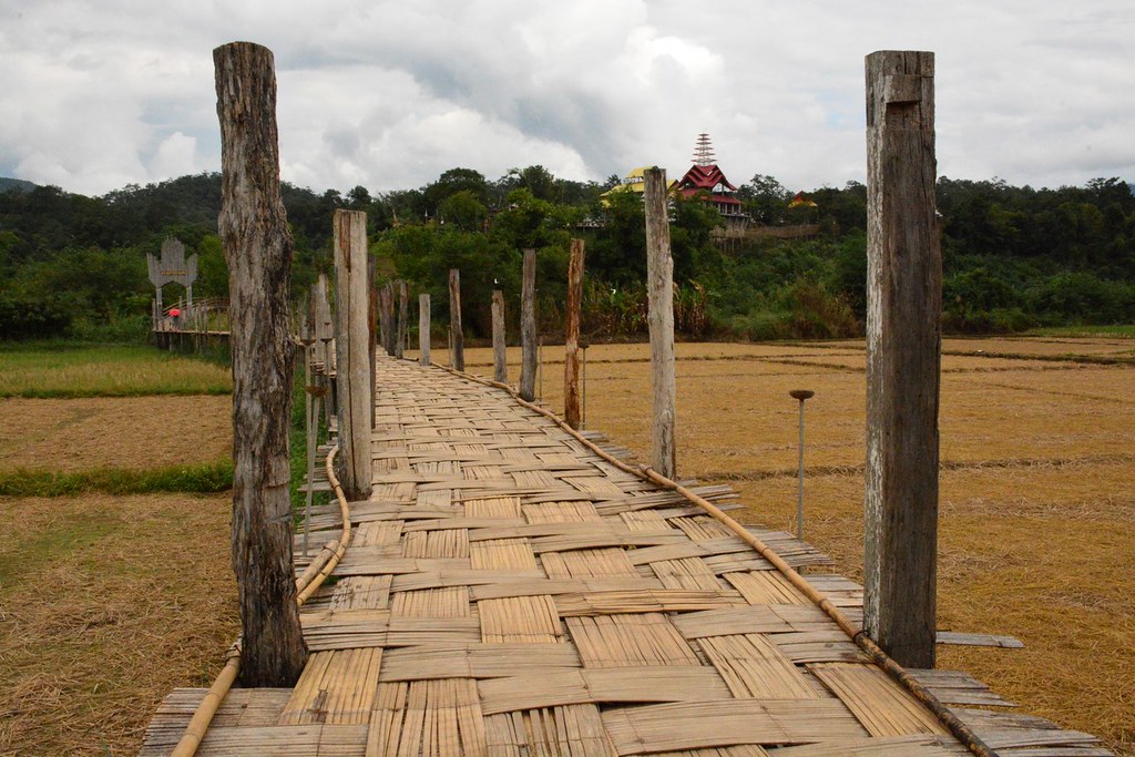 The bridge leading to Wat Phu Sama Naram (Suan Tham Phu Sama) on the hill · Photo: paularps
Read more history 11 more paragraphs
On a low hill among the paddies above the village, Phra Palat Chittaphat Akkapanyo founded Suan Tham Phu Sama on 20 March 2008, on about 6 rai, as a place for meditation, Dhamma training for villagers and students, and lodging for monks and novices. It has since grown to about 26 rai and become Wat Phu Sama Naram. Most buildings use local materials in a mixed Tai Yai–Burmese style, such as the "Ruean Pho Tham", a pavilion thatched with tong tueng leaves designed to the abbot's ideas. On the hill sits a crowned Burmese-style Buddha in the Mara-vijaya posture that villagers call "Phra Chao Phara Su Tong Pae" (Luang Pho Su Tong Pae), later given the formal name "Phra Phuttha Samakkhi Athitthan Maha Chakkraphat".
Between the temple and the village lie the Mae Sa-nga stream and the paddies, so every morning the monks on their alms round had to wade along muddy dikes, sometimes treading on villagers' seedlings. The abbot set out to build a bridge across the fields for the monks and for villagers coming to the temple.
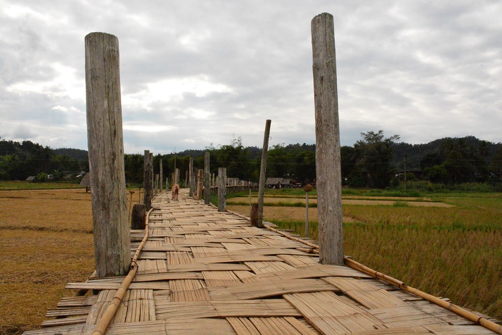 Timber posts and a woven-bamboo deck built by monks and villagers · Photo: paularps
It was built entirely on faith. A landowner gave the land to the temple; villagers donated timber posts — many of them old house posts — along with bamboo, labour and money, with no government budget. The temple's own notices say work began on 20 April 2012 and, after about two and a half months, the bridge opened on 5 August 2012 (some sources give 2011). It cost about 800,000 baht; about 2 m wide and some 500 m long (not counting the path up to the temple), it uses timber posts and beams with a woven-bamboo deck, and is said to be the longest bamboo bridge in Thailand.
"Su Tong Pae" is Tai Yai for "a prayer fulfilled". As the story goes, the abbot vowed to build the Buddha image on the hill and to complete the bridge; when both were done, the name was given to the image and the bridge alike. People believe that a wish or merit made on the bridge will come true, and some call it "the bridge of merit and success".
The bridge became widely known after the 2015 Upper North tourism film "Su Tong Pae: Friendship, Prayer, Time" by Bundit Thongdee, which set off a trend of bamboo bridges across rice fields elsewhere; some compare it with the 1,200 m U Bein teak bridge at Amarapura in Myanmar. Fame brought problems too: visitors jumping and running wore out the bamboo deck faster, and photographers chased monks during the alms round, blocking their way or asking them to walk slowly for pictures. The temple, meanwhile, has kept its character as a Dhamma garden, with no donation boxes or loudspeakers urging people to give.
A bamboo bridge needs repairs almost every year. In 2015 part of it collapsed under too much weight, and it was rebuilt in 2016 with funds from the Mae Hong Son Provincial Administrative Organization and temple donations.
In the early hours of 9 September 2023, around 2:40 a.m., heavy rain sent the Mae Sa-nga into flood; the bridge broke in places and the whole structure was affected. On 15 September government agencies, businesses, the temple committee and villagers met at the temple and agreed to keep the original design — timber with woven bamboo — but make it stronger. Work began on 18 September, a fund-raising pha pa ceremony followed on the 24th, and villagers and soldiers finished in October, in time for the end of Lent: a chanting ceremony with 1,000 lamps on 13 October, alms-giving the next morning, then the Jong Phara procession, Ok Phansa, the Tak Bat Thewo alms-giving and the kathin ceremony on 28–31 October 2023.
More frequent floods are tied to changes in the waterway. Around 2023 a collapsed bank shifted the Mae Sa-nga's course, and a weir was built some four or five years before 2026. A farmer whose paddy lies under the bridge says the weir sits higher than the fields and silt builds up in front of it, so floodwater cannot drain and stands in the paddies for over a week, where it once drained within two days. Villagers of Pang Mu and Kung Mai Sak met and asked for the weir to be lowered.
 The bridge with the hills of the Mae Hong Son valley · Photo: paularps
In 2026 the bridge was hit by two flash floods. Heavy rain in the Mae Sa-nga and Mae Sa-ngi headwaters raised the water on the night of 2 August; on the morning of 3 August logs and debris lodged at the bridge tilted the section over the Mae Sa-nga, so monks dismantled part of it and closed the crossing, helped by Pang Mu subdistrict staff and a police aviation unit clearing debris. A second flood on 13 August tore away more than 20 m. In the meantime the section over the fields stayed open for the view, but no one could cross to the temple.
In mid-September monks and novices, Kung Mai Sak villagers, soldiers and Volunteer Defence Corps members stripped out rotten bamboo, wove new panels and re-laid the sections that could be fixed first, while the temple asked for drinking water, food, cement and sand. Major repairs began on 21 September 2026, adding steel beams for strength and re-laying the bamboo deck in the original style, aiming to be ready for the end of Lent and the tourist season; new posts had to wait for the water to fall.
Su Tong Pae is still a place of merit for the community. Every morning around 6:00 the monks and novices of Wat Phu Sama Naram walk the bridge into the village, and on holy days there are big alms-givings on it — 29 monks and novices in thick mist on 1 January 2021, 35 on Khao Phansa, 14 July 2022, and 70 on Khao Phansa, 30 July 2026. At the end of Lent the Tai Yai also build "jong phara", bamboo-and-paper pavilions to welcome the Buddha back from the Tavatimsa heaven. Visitors can help look after the bridge by walking slowly, not jumping, and giving the monks room.
Location & getting there
Map · how to get there · costs
Directions use live traffic to estimate travel time
- Travel timeAbout 15–20 min from Mae Hong Son town
- RoadPaved all the way; the last stretch is a village road
- ParkingParking near the bridge on the village side
- FuelPetrol stations in Mae Hong Son town
Suggested route
From Mae Hong Son town, head north on Highway 1095 (Mae Hong Son–Pai) through Pang Mu subdistrict, then turn left following signs for Ban Kung Mai Sak / Su Tong Pae Bridge. It is about 8–10 km and 15–20 minutes on flat, paved roads.
Parking is near the bridge on the village side; Wat Phu Sama Naram sits on the hill at the other end.
Without a car, rent a motorbike in town or hire a songthaew/tuk-tuk for the round trip; many Mae Hong Son city tours also stop here.
4 ways to get there
North on Highway 1095 from town, then follow signs to Ban Kung Mai Sak; paved all the way
Rent in Mae Hong Son town; flat and easy riding
Hire from town; agree the price and waiting time first
Usually combined with other sights around town in one day
Prices and times are estimates and vary with season and traffic
Food nearby
Popular places within 5–10 km