 01
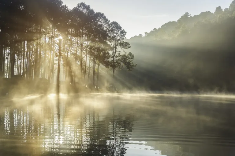
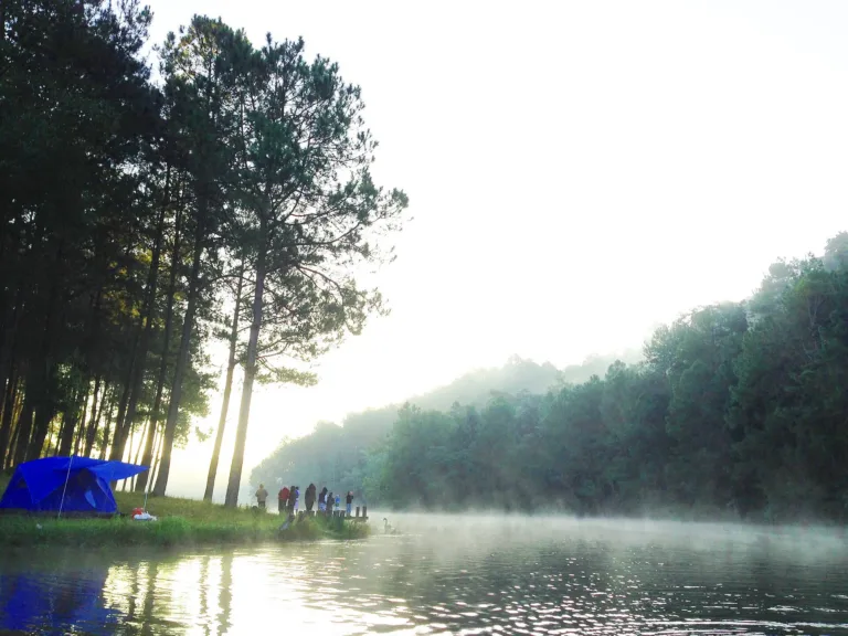
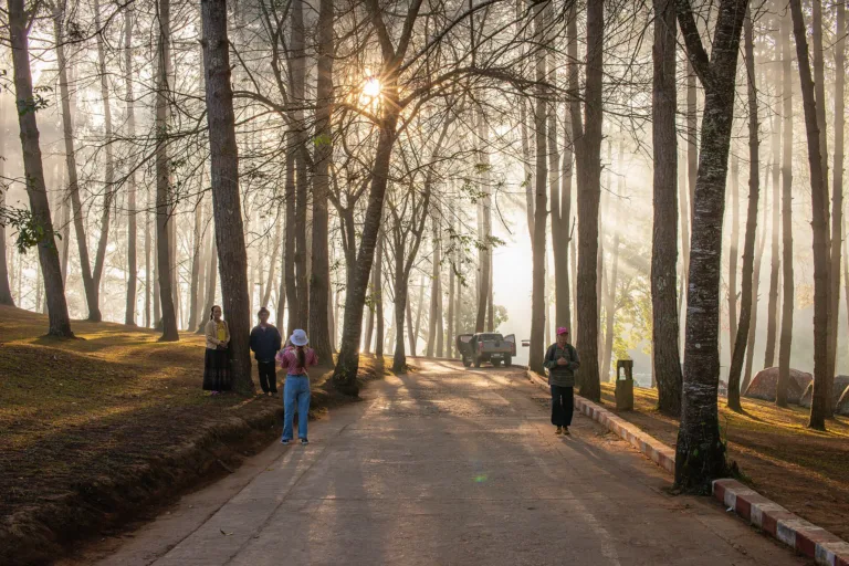
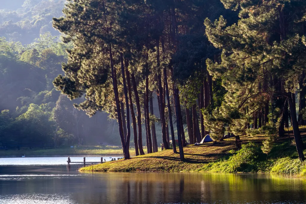
Morning mist on the lakeMist drifting through the pines
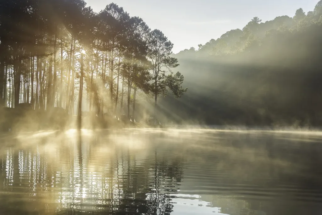
Pine-forest lake · Mae Hong Son
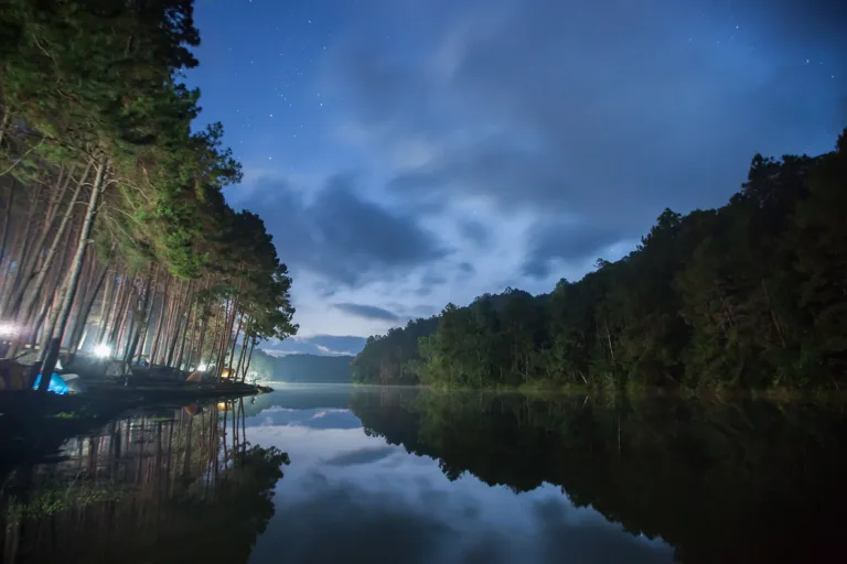
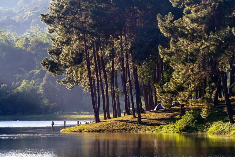
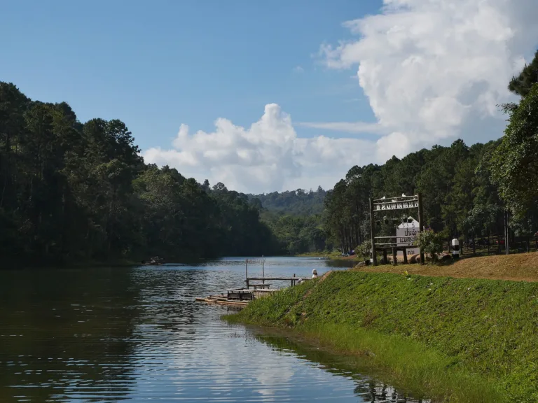
A pine-ringed reservoir in the mountains on the Thai–Myanmar border, Mok Cham Pae, Mae Hong Son. Officially the Pang Tong 2 Royal Initiative Project, on former opium land and bare hills; nicknamed "the Switzerland of Thailand" for its morning mist and lakeside camping.
Holiday / event — crowded · Just outside the best season · Chance of a sea of mist 5/10
sea-of-mist places: morning matters most
May – Sep
Narrow steep road — Hairpins and fog; drive in daylight
Half a day or one night
Weak; no Wi-Fi
01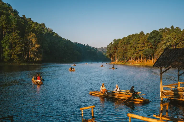 02
 03
 04
Tap a day card to see that day’s weather, rain, haze and hourly forecast
Best time to go Fine all day little rain through the day · light drizzle possible at times
Holiday — traffic on the way up and parking fills fast; leave early
Green band = hours used for the score
Best time to go Fine all day little rain through the day
Holiday — traffic on the way up and parking fills fast; leave early
Green band = hours used for the score
Best time to go Fine all day little rain through the day
Holiday — traffic on the way up and parking fills fast; leave early
Green band = hours used for the score
Best time to go Best window 06:00–15:00 Little rain
No warnings today — normal road and weather conditions
Green band = hours used for the score
Best time to go Best window 06:00–15:00 Little rain · light drizzle possible at times
No warnings today — normal road and weather conditions
Green band = hours used for the score
Best time to go Fine all day little rain through the day · light drizzle possible at times
No warnings today — normal road and weather conditions
Green band = hours used for the score
Best time to go Fine all day little rain through the day
No warnings today — normal road and weather conditions
Green band = hours used for the score
Scored from cloud cover at every level and tonight’s moonlight — the darker the sky, the clearer the Milky Way · tap another night below for the next 7 nights
Pang Ung (Pang Tong 2 Royal Initiative Project), Ban Ruam Thai, Mok Cham Pae, Mueang Mae Hong Son.
Arrive 05:30 for the mist, or before 16:00 to camp
Mist over the water 05:00–07:00, Nov–Feb
Photos from Wikimedia Commons and contributors · full credits inClassic page
Hairpins and fog; drive in daylight
Nights can drop below 10 °C
Shared toilets, cold showers
Adults 20 THB · Time needed Half a day or one night
Long weekends: 5 Dec and New Year
| Thai adult entry optional | 20 ฿/person |
| Foreign adult entry optional | 100 ฿/person |
| Own tent optional | 100 ฿/group |
| Tent hire with bedding optional | 300 ฿/group |
| Bamboo raft optional | 150 ฿/group |
| Charcoal BBQ set optional | 100 ฿/group |
Cash · Prices may change by season — check with the venue
Tap a month on the wheel to see weather, rain, haze and crowds from 10 years of records
Best time · Nov–Feb is cold, with mist rising off the water around 05:00–07:00
Watch out · Mar–Apr is hazy · in the rains the narrow steep road is slippery · Dec–Jan long weekends are packed
Oct by the records 19–25°C · avg rain 155 mm (23 rainy days) · clear 6 days · avg PM2.5 6
Pang Ung is at Ban Ruam Thai, Mok Cham Pae subdistrict, Mueang Mae Hong Son, about 44 km north of Mae Hong Son town and about 10 km from Ban Rak Thai. The lake surface is about 1,100 m above sea level. Its official name is the Pang Tong 2 Royal Initiative Project (Pang Tong 2 Royal Forest Park). It is not the Pang Ung Royal Project Development Centre in Chiang Mai, nor Ban Pang Ung in Mae Chaem.
The name comes from northern Thai: "pang" is a temporary camp for forest workers such as loggers or elephant handlers, and "ung" is a low muddy hollow that holds water. Together it means "the camp by the waterlogged hollow" — before it became today's reservoir.
Before the project, the Pang Tong area was dangerous border country next to Myanmar, used by armed groups, smugglers, opium growers and illegal loggers. Several sources say the land around the Pang Ung lake was once the opium fields of hill communities, later abandoned to bare hills and degraded forest.
King Bhumibol the Great and Queen Sirikit, the Queen Mother, started the Pang Tong development programme for border security: gathering hill peoples and landless families into villages, allocating land, replacing opium, restoring watershed forest and building reservoirs. The Land Development Department records the Pang Tong Highland Service and Development Centre as founded in 1979, and the King and Queen first stayed overnight at Pang Tong on 19–20 February 1981.
Royal-initiative reforestation began at Pang Tong 1 (Huai Makhuea Som) in 1983 and spread to Pang Tong 2, 3 and 4. On 7 February 1984 King Bhumibol asked for the forest around the Pang Tong reservoir and the Pang Ung weir to be restored to its original state, and Pang Tong 2 — Pang Ung — was set up that year. The lake's main inflow is the Huai Makhuea Som stream. An army website quoted on a gotoknow blog says that during the royal visit of 7–9 February 1984 the King also inspected the planned reservoir site at Ban Pang Ung. MGR Online says King Bhumibol gathered several minority groups to live together at Ban Ruam Thai, and the house of former headman Lung Pala became the village's first homestay.
Two principles guided the work: "plant three kinds of forest for four benefits" and "where there are people, there is water". The two-needle and three-needle pines ringing the lake were planted to restore the watershed after decades of shifting cultivation, so the misty pine reflections seen today are a forest people planted.
Target villages included Ban Pang Tong (Shan, Karen), Ban Na Pa Paek (Hmong, Shan, Karen), Ban Huai Makhuea Som and Ban Ruam Thai, whose people sources do not clearly identify — some say Shan and other groups. The Yunnanese descendants of the KMT 93rd Division live at Ban Rak Thai, about 10 km further on, which is why most visitors combine the two.
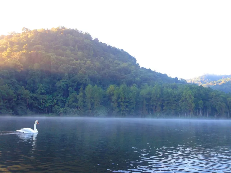
The garden around the project office stands on former opium land and now grows avocado, persimmon, pear, plum, roses, hydrangeas and herbs. The project breeds the rare khiat laeo mountain frog and propagates the ueang sae orchid, and on the lake are black and white swans: a 2010 blog says Queen Sirikit gave one pair of each, and Daily News in 2025 linked their breeding to the Pang Tong wildlife breeding station. The date of the gift is not recorded.
Agencies at Pang Tong include the army, fisheries, agricultural extension, land development, irrigation, the agriculture department, the national parks department, livestock and the 21st Infantry Regiment, King's Guard. The website 90route records a royal visit to the Pang Tong 2 reservoir on 15 February 1997 without naming the royal — probably Queen Sirikit, and Queen Sirikit came regularly to work at Pang Tong, for example in 2001 and 2006.
As the morning mist and bamboo rafts among the pines became known, Pang Ung was nicknamed "the Switzerland of Thailand"; the comparison with Korea's Nami Island comes from social-media posts around 2021. A 2007 blog describes easy camping and cabins for under 500 baht.
By around 2008 Pang Ung was so crowded that the governor capped visits at 300 people per round, no more than 10 rounds a day, and 300 overnight, with bookings through the Mae Hong Son Arts and Crafts Centre. Over New Year 2009 every bed was taken. That year the province's town plan also required new buildings at Ban Rak Thai (Moo 6), Pang Ung's companion village, to follow Yunnanese style.
During COVID in 2020–21 Mae Hong Son tourism almost stopped, then demand surged: in December 2021 lodgings were full and tents spread everywhere, and over Father's Day weekend in 2022 some visitors slept in their cars, with mornings around 12–17 °C.
Today Tham Pla–Namtok Pha Suea National Park runs the campsite and tourism inside the project. On 29 September 2022 the park received a Thailand Tourism Standard award, and on 1 October 2022 it opened the season with fewer tents, online booking and assigned pitches. The 2024 season opened on 2 October, and that December the province let private cars drive all the way up instead of transferring to local songthaews.
The 2025 camping season opened on 1 October 2025 with booking through the national parks system. Queen Sirikit died on 24 October 2025, and Mae Hong Son held a candle-lighting tribute that December. The swans and pines of Pang Ung remain a reminder of the work the King and Queen began on this border.
Its companion village Ban Rak Thai has its own recent history: on 8 July 2021 the local council stopped an unpermitted viewpoint café building, and on 10–11 June 2025 a flash flood swept through the village, fortunately without deaths. No serious accidents have been reported at Pang Ung itself.
Arrived? Check in, collect a stamp and tell others what it is like right now
Check your location first, so you do not fill in the form for nothing
Location must be on and within 1.7 km · One check-in per place per day · come back on other days to check in again
Post photos from anywhere — no need to be here · Up to 20 photos at a time · JPG / PNG / WebP · GPS location data is removed automatically
The stretch from Ban Na Pa Paek junction is narrow, steep an…
From town on Highway 1095, then the Mok Cham Pae turn · Fuel
From Sai Yut market at 09:00 and 14:00 · Ask for fares
From Mae Hong Son town · From about 600 baht
From town take Highway 1095 toward Pai; at about km 10 turn left to Ban Mok Cham Pae and follow signs to Ban Ruam Thai. The last stretch from the Ban Na Pa Paek junction is narrow and steep
Park car park; full on holidays
Mae Hong Son town
Weak; no Wi-Fi
About 06:00–18:00 (campers stay overnight)
around 44 km fromMae Hong Son town
Pang Ung
100 THB
Approx. nightly price for 2 adults (next week) · final price depends on your dates
Answers travellers want before they go — a one-minute read
No; Mae Hong Son's Pang Ung is the Pang Tong 2 royal initiative project
Pang is a temporary camp and ung a waterlogged hollow
After a royal directive on 7 Feb 1984; Pang Tong 2 was set up that year
Usually around 1–2 October each year
Since the 2024 season, yes; check before you go
December mornings around 12–14 °C, colder at night
No
Best day this week: Thursday 29 Oct · Check in when you arrive to collect a stamp