Ao Nang Beach
Krabi's Andaman beach framed by limestone cliffs — the launch point for longtail boats to Railay and the islands, a beachfront lined with restaurants and hotels, and a sunset over the sea every evening in the dry season.
Before you goWhich of the next 7 days is best Best dayToday- Severe weatherNone
- EarthquakesNone in 48 h
- Major disastersNone
- Site noticesNone
About
Overview · highlights · who it suits
Ao Nang Beach lies about 18 km west of Krabi town, a sandy beach facing the Andaman Sea with towering limestone cliffs on both sides. It is the hub of Krabi tourism, and the beachfront road is lined with restaurants, cafés, hotels and tour operators.
It is the closest departure point for longtail boats to Railay Beach, Koh Poda, Chicken Island and the 4-islands tour. The sea is best from Dec – Mar; May – Oct is the monsoon, with big waves and frequent red flags banning swimming. In the dry season the sun sets into the sea behind the islands every evening.
Don't-miss highlights
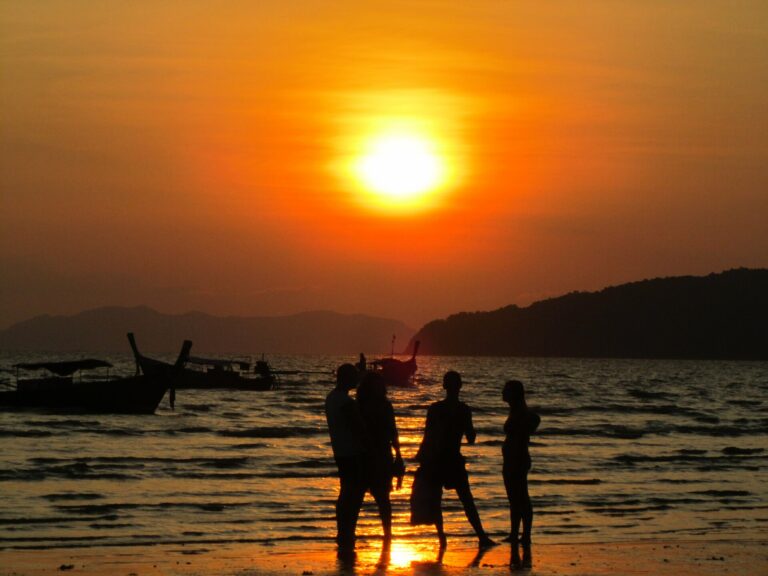
Sunset over the sea
The beach faces west, so the sun sets behind the islands and karsts every evening
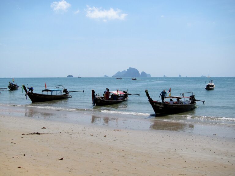
Longtails to Railay and the islands
The departure point for Railay Beach, Koh Poda, Chicken Island and the 4-islands tour
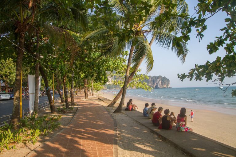
Beachfront promenade
A shady walkway along the beach lined with restaurants and cafés
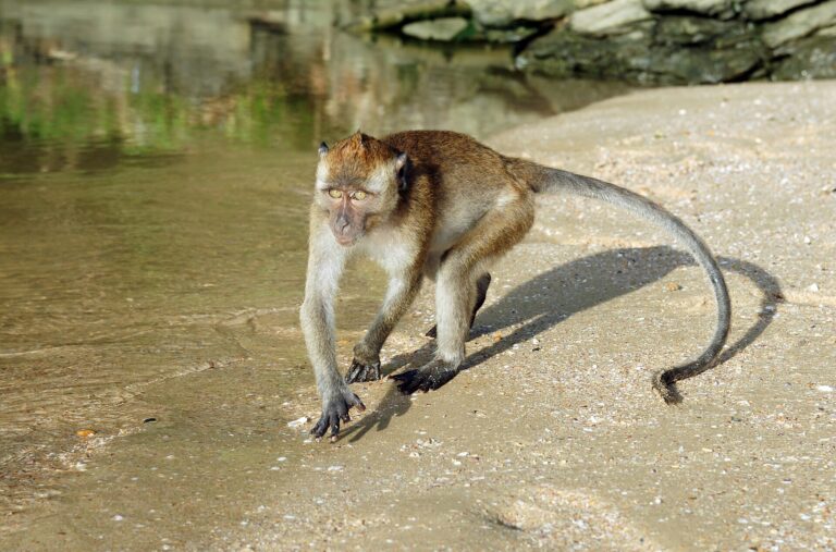
Monkey Trail to Pai Plong Beach
A cliffside walkway to the next cove — watch out for monkeys grabbing things
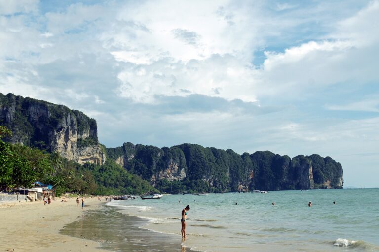
Limestone sea cliffs
Sheer karst cliffs on both sides of the bay form Ao Nang's backdrop
Before you go
Gallery
Get a feel for the place · tap a photo to enlarge
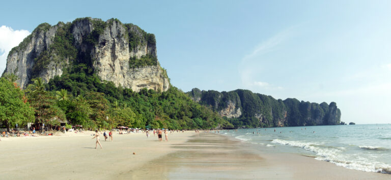 Ao Nang and its karst cliffsLongtail boats lined up on Ao Nang Beach · Photo: kallerna (CC BY-SA 3.0)
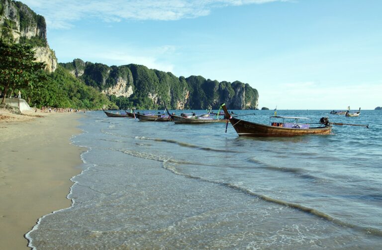 Longtails on the beachAo Nang sand and karst cliffs · Photo: kallerna (CC BY-SA 3.0)Sand and cliffsAo Nang Beach by day · Photo: Jukka from HELSINKI, Finland (CC BY 2.0)
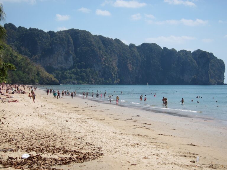 A day on the beachA longtail coming ashore at sunset · Photo: Maksym Kozlenko (CC BY-SA 4.0)
 Boat landing at duskSunset at Ao Nang · Photo: Scorewith German (CC BY 3.0)Sunset at Ao NangLongtails waiting to take visitors to Railay and the islands · Photo: Jukka from HELSINKI, Finland (CC BY 2.0)Longtails waiting to goShady beachfront walkway · Photo: Maksym Kozlenko (CC BY-SA 4.0)Beachfront walkwayLong-tailed macaque at Ao Nang · Photo: kallerna (CC BY-SA 3.0)Long-tailed macaqueLimestone cliffs seen from a boat leaving Ao Nang · Photo: Marcin Konsek (CC BY-SA 4.0)
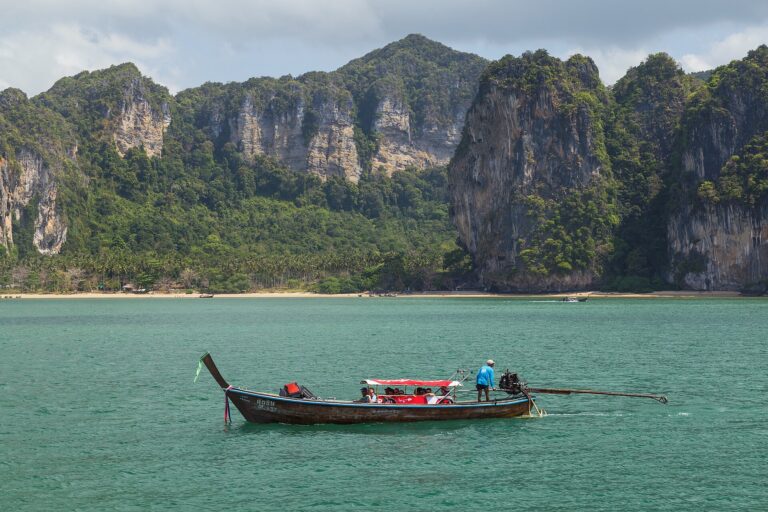 Cliffs from the boat
Photo credits10 photos from Wikimedia Commons
 Ao Nang Beach and its limestone cliffs on the Andaman SeaPhoto: kallerna CC BY-SA 3.0
 Longtail boats lined up on Ao Nang BeachPhoto: kallerna CC BY-SA 3.0
 Ao Nang sand and karst cliffsPhoto: kallerna CC BY-SA 3.0
 Ao Nang Beach by dayPhoto: Jukka from HELSINKI, Finland CC BY 2.0
 A longtail coming ashore at sunsetPhoto: Maksym Kozlenko CC BY-SA 4.0
 Sunset at Ao NangPhoto: Scorewith German CC BY 3.0
 Longtails waiting to take visitors to Railay and the islandsPhoto: Jukka from HELSINKI, Finland CC BY 2.0
 Shady beachfront walkwayPhoto: Maksym Kozlenko CC BY-SA 4.0
 Long-tailed macaque at Ao NangPhoto: kallerna CC BY-SA 3.0
 Limestone cliffs seen from a boat leaving Ao NangPhoto: Marcin Konsek CC BY-SA 4.0
Before you go
Weather, haze and crowds before you set off
Best time of day — hourly
MoreWhat to bring · costs · crowds · travel warnings · detailed weather
What to bring —
Estimated costs
Crowds — estimate
Travel warnings
Best months
Tap a month to see weather, rain, haze and crowds
The Andaman dry season: calm, clear water and blue skies, boats to the islands run almost every day, and the sunsets over the sea are at their best. November and April are still good, with some rain.
May – Oct is the southwest monsoon: strong winds and waves, frequent red flags banning swimming, regular speedboat-tour cancellations and a rough crossing to Railay. Over New Year and Chinese New Year hotels are pricey and the beach is packed.
- Weather
- Rain
- Haze
- Crowds
See 10 years of real weather dataMonthly temperature, rainy days, clear days and haze
Past weather records
Check-ins & visitor photos
Location must be on and within 2 km · you can check in on every visit
History & stories
Legend · history · architecture
Ao Nang is both the name of the beach and a subdistrict of Mueang Krabi, about 18 km west of town. The beach faces west across the Andaman Sea, so in the dry season the sun sets into the sea every evening. According to the Ao Nang Subdistrict Administrative Organization, the subdistrict today has 8 villages, about 126 km² and around 15,971 residents — one of them is Village 7, Ban Ko Phi Phi, so the famous Phi Phi Islands belong to the same subdistrict as Ao Nang.
People have lived along this coast for a very long time. In Krabi Province, the Lang Rongrien rock shelter has deposits dated to about 37,000–27,000 years ago, and ancient rock paintings in caves around Phang Nga–Krabi Bay date to roughly 5,000–3,000 years ago. The limestone cliffs framing Ao Nang belong to the region's karst landscape, carved by water and rain over millions of years into cliffs, caves and strange peaks.
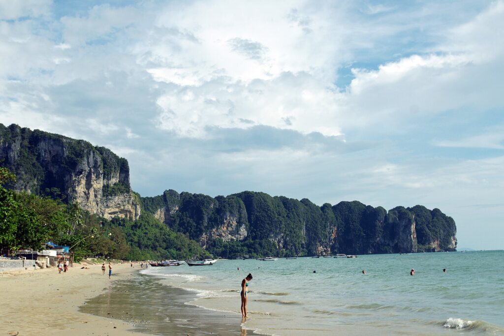 The karst cliffs on both sides of Ao Nang beach · Photo: kallerna
Local coastal communities pass down legends. One tells of the Ta Yom family and their daughter "Nang", who fell in love with a young man named "Boon", until a naga's curse turned everything to stone and islands: the wedding house became Phra Nang Cave, the sweet sticky rice became the Shell Cemetery, their household goods became Koh Mo, and the naga became Khao Hang Nak. Another belief holds that the spirit of a princess whose boat sank off the bay lives in Phra Nang Cave, so fishermen go there to pray and leave offerings before heading out to sea. Phra Nang Cave is at Railay, about 15 minutes by boat from Ao Nang.
Read more history6 more paragraphs
Administratively, Krabi was raised to town status in 1872, came directly under Bangkok in 1875, and in 1900 its governor, Phraya Uttarakit, moved the town to the mouth of the Krabi River. Shortly before, in 1898, Phraya Uttarakit established this area as "Khlong Haeng" subdistrict with six villages — Ban Khlong Haeng, Ban Ao Nang, Ban Chong Phli, Ban Khlong Son, Ban Nong Thale and Ban Khlong Muang — appointing Nai Chi as the first kamnan (subdistrict head) and Muen Chamnan as the first headman of Ban Khlong Haeng, who later became kamnan with the title Khun Chamnan Wari.
In 1943 Khlong Haeng subdistrict was renamed "Ao Nang" after the seaside village of Ban Ao Nang. On 2 March 1995 the Ministry of Interior upgraded the Ao Nang subdistrict council to a Subdistrict Administrative Organization with 8 villages: Ban Chong Phli, Ban Ao Nang, Ban Khlong Haeng, Ban Na Tin, Ban Thung, Ban Khlong Son, Ban Ko Phi Phi and Ban Laem Tong.
Tourism here began with backpackers and hippies heading to Railay Beach in the 1970s. Railay has no road access, so they took boats from Ao Nang, and the fishing village gradually became a stopover and departure point. On 6 October 1983 Hat Noppharat Thara–Mu Ko Phi Phi National Park was established, covering Nopparat Thara Beach just north of Ao Nang and the Phi Phi Islands, and when Krabi International Airport opened in 1999, visitors could fly in directly. Ao Nang grew into Krabi's main resort town, and Krabi now ranks fifth in Thailand for tourism revenue.
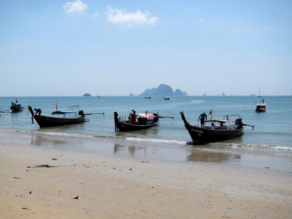 Longtail boats, carrying visitors to Railay and the islands since the backpacker days · Photo: Jukka from HELSINKI, Finland
On 26 December 2004, a tsunami triggered by an earthquake off Sumatra struck the Andaman coast. Krabi was badly damaged — especially Koh Phi Phi, part of Ao Nang subdistrict. Since then the Andaman coast has installed warning towers and evacuation-route signs to higher ground, still visible along the beach road today.
Today Ao Nang is the closest launch point for Railay Beach, Koh Poda, Chicken Island, Talay Waek and the Hong Islands. To the north is the longer, quieter Nopparat Thara Beach, where the sea recedes about 200–300 m at the lowest tides; to the south a cliffside path leads to Pai Plong Beach — known to visitors as the Monkey Trail.
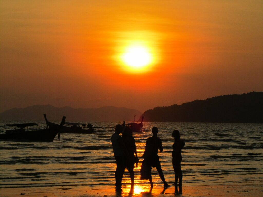 Sunset at Ao Nang · Photo: Scorewith German
Rapid growth has brought challenges. Ao Nang's wastewater treatment handles about 3,000 m³ a day, which the subdistrict's own leadership admits is not enough — so taking your rubbish with you and cutting plastic really matter for keeping this sea clean.
Location & getting there
Map · how to get there · costs
Directions use live traffic to estimate travel time
- Travel timeAbout 25–30 min from Krabi town
- RoadFlat 4-lane paved road from town
- ParkingRoadside parking along the beachfront and private car parks; hard to find in the evening
- FuelFuel stations in Ao Nang and on the way from town
Suggested route
From Krabi town take the Krabi–Ao Nang road (Route 4203) west for about 18 km. The beachfront road at Ao Nang is one-way along the beach.
Krabi Airport is about 30 km away, with airport buses, minivans and taxis running straight to Ao Nang.
Buy longtail tickets to Railay and the islands at the beachfront counters; boats leave once they're full.
5 ways to get there
Route 4203 from town, about 18 km; beachfront parking is scarce in the evening
Rentals everywhere in Ao Nang; flat roads but busy — wear a helmet and carry your licence
White songthaews run between Krabi town and Ao Nang; flag one down by the road
Airport buses or minivans run straight to Ao Nang hotels
Available around Krabi and Ao Nang
Prices and times are estimates and vary with season and traffic
Food nearby
Popular places within 5–10 km