Aiyoeweng Sea of Mist
Thailand's southernmost sea-of-mist viewpoint, on Microwave Hill in Aiyoeweng, Betong, about 620 m up. Mist forms almost year-round, and a glass-floored skywalk over 60 m long looks out over Hala-Bala forest and the Bang Lang reservoir.
Before you goWhich of the next 7 days is best Best dayThursday 15- Severe weatherNone
- EarthquakesNone in 48 h
- Major disastersNone
- Site noticesNone
About
Overview · highlights · who it suits
The Aiyoeweng sea of mist is on Microwave Hill at Ban Than Mali, Aiyoeweng subdistrict, Betong district, Yala, about 2,038 ft (around 620 m) above sea level and some 35–40 km from Betong town. It is billed as the southernmost sea-of-mist viewpoint in Thailand, and mist can be seen almost all year.
Beside the old viewpoint stands a skywalk: a 45 m, six-storey steel tower with a walkway reaching out about 61–63 m and ending in a clear glass floor, looking over the Hala-Bala forest, the Bang Lang reservoir and, on clear days, Malaysia.
The best time is early morning, around 5:30–8:00, when the sun rises over mist filling the valleys and the air is about 20°C.
Don't-miss highlights
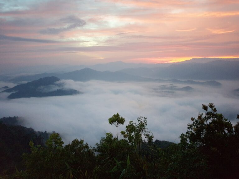
Sunrise over the mist
The sun rising over mist that fills the valleys all around
Glass-floored skywalk
A walkway reaching out from a 45 m tower, ending in clear glass
Hala-Bala forest and Bang Lang reservoir
On clear days, rainforest and reservoir views all the way to Malaysia
Cool all year
About 20°C at dawn, even at Thailand's southern tip
Before you go
Gallery
Get a feel for the place · tap a photo to enlarge
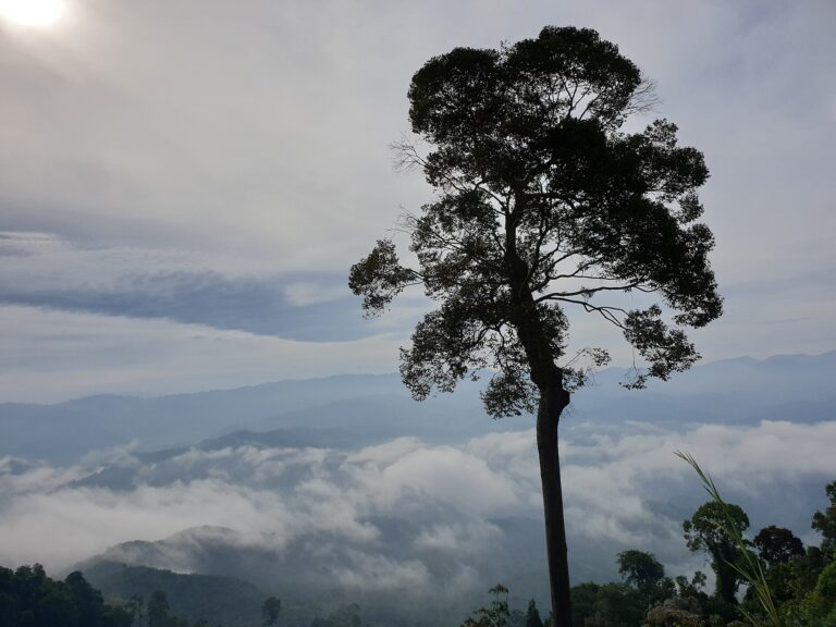
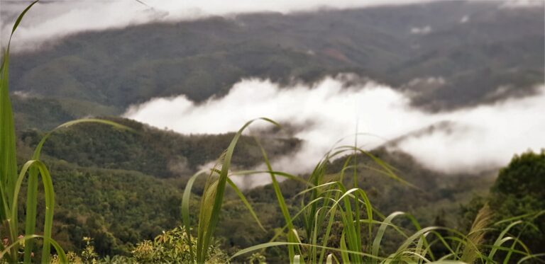
Sunrise over the mistBig tree on the ridge above the Aiyoeweng sea of mist · Photo: Aoeinista (CC BY-SA 4.0)Big tree and the sea of mistMist drifting over the forest around Betong · Photo: Lx Rei (CC BY-SA 4.0)Mist over the forest
Before you go
Weather, haze and crowds before you set off
Best time of day — hourly
MoreWhat to bring · costs · crowds · travel warnings · detailed weather
What to bring —
Estimated costs
Crowds — estimate
Travel warnings
Best months
Tap a month to see weather, rain, haze and crowds
January to March is the driest time of year, so skies often clear for sunrise over the mist, with mornings around 19–20°C. Mist forms in almost every month, especially on mornings after overnight rain.
November–December is the northeast monsoon: rain almost daily, heavy cloud that often hides the sunrise, and landslide risk on the mountain road. Long holidays and Chinese New Year are very crowded, with queues for the skywalk.
- Weather
- Rain
- Haze
- Crowds
See 10 years of real weather dataMonthly temperature, rainy days, clear days and haze
Past weather records
Check-ins & visitor photos
Location must be on and within 2 km · you can check in on every visit
History & stories
Legend · history · architecture
Betong is Thailand's southernmost district, set in a valley of the Sankalakhiri range that forms the Thai–Malaysian border. The district was once called "Yarom", a Malay word for a sewing needle; in 1930 the district chief moved the office from Ban Hangus to Ban Kampong Masjid in Betong subdistrict and renamed the district Betong, from the Malay "betung", a giant bamboo — the local "phai tong".
Malay Muslims are the original inhabitants; Chinese migrants later arrived in such numbers that the two groups became roughly equal. Betong was a small, remote mountain town, some 140 km from Yala town along a road winding through forest, so from 1 April 1926 it was allowed to register vehicles itself — which is why Betong is still the only district in Thailand whose number plates show the district rather than the province.
The little town has its own landmarks. The postbox at the clock-tower crossroads was built in 1924 by Sanguan Chirachinda, a former postmaster who later became mayor: a concrete cylinder about 3.2 m tall with a radio on top to broadcast news to townspeople, and still in use for mail today. The municipality later built a new, roughly 9 m postbox that is often called the largest in the country. The town's slogan is "City in the mist, beautiful flowers, the southern tip of Siam, the lovely border town".
Read more history 17 more paragraphs
Betong's Chinese went through hard times in the Second World War: historians record the "Betong Incident" of 1–6 November 1942, when the Japanese army cracked down on the Chinese of this Thai–Malayan border town. Today Betong district has more than 60,000 people — Buddhist, Muslim and Chinese — and near Aiyoeweng there is a Hakka community more than 150 years old.
Aiyoeweng subdistrict lies northeast of Betong town, about 32–40 km away. Its name mixes two languages: "Aiyoe" is Yawi for water or a stream running through the area, and "Weng" is the family name of an early Chinese settler. The subdistrict covers about 818 km², mostly forested mountains, in 11 villages, with about 11,700 people in 2017 — Malays, Thai-Chinese and forest-dwelling indigenous people.
The forests around Aiyoeweng have a long history of conflict. After the British declared the Malayan Emergency in 1948, the Communist Party of Malaya (CPM), whose members were mostly Chinese, was hit hard; some evidence places it in Thailand from 1949 at Betong and Sadao, and after a phased withdrawal from 1952 it used southern Thailand as a safe haven from the early 1960s.
When the CPM launched a new armed struggle in 1968, the forests of the "Betong Salient" became permanent bases for training, recruitment and cross-border operations into Malaysia; locals called the fighters "Jor Kor Mor". The conflict dragged on for more than 20 years, while Thailand under Gen Prem Tinsulanonda adopted Order 66/2523 (1980), putting "politics before the military", followed by the "Tai Rom Yen" peace policy.
In 1987 Thailand offered CPM members a choice: return to Malaysia, or join the "Thai National Development" programme, with 15 rai of land per family and Thai citizenship after five years. Three-way talks between the CPM, Malaysia and Thailand began in Phuket in February 1989 and ended with the Hat Yai Peace Agreement, signed on 2 December 1989. The CPM agreed to disband its armed units and destroy its weapons — the word "surrender" was deliberately left out — and about 700 members chose to settle in Thailand while about 400 returned to Malaysia.
Former CPM members were given land in new villages under the Fourth Army Area, such as the Piyamit villages, named by King Rama IX, and Chulabhorn Pattana 10 village in Aiyoeweng, where most residents are former party members of Chinese descent and relatives from Malaysia still come to visit. Today some old strongholds, such as the Piyamit Tunnel, have become Betong attractions.
Traces of that era are all over Betong, such as the Piyamit Tunnel at Ban Piyamit 1 in Tano Maero subdistrict, dug by the CPM's District 2 in 1976 over about three months. About 1 km long, it has several entrances so fighters could scatter if attacked; it is now open to visitors every day.
Chulabhorn Pattana 10 has a "Heroes" museum about the CPM's former operations base, and in the forest nearby stands a giant samphong tree that takes about 38 people to encircle — villagers call it the thousand-year-old giant and believe it is the largest in the South. The community now runs community-based tourism, with overnight treks to the giant tree, old jungle camps and the Asli way of life, and in February 2023 these forests hosted the "Amazean Jungle Thailand by UTMB" trail race.
Other "Chulabhorn Pattana" villages along the border share similar roots — for example Chulabhorn Pattana 12 in Narathiwat, home to former members of the CPM's 10th Regiment. Those who stayed in Thailand received 540 baht a month for three years plus a house and land, while those who returned to Malaysia received RM300 a month for three years; that village was under the patronage of Princess Chulabhorn from 1993 to 2004, which brought electricity and piped water.
Deep in the Hala-Bala forest live some 80–90 Asli people — known in Thai as "Sakai" — who once worked alongside the CPM in the jungle. The Asli traditionally had no new-year day of their own, so since 1995 the Chulabhorn Pattana 10 community, through the Aiyoeweng Subdistrict Administrative Organization, has held an Asli New Year two or three days from Chinese New Year and celebrated the two together every year.
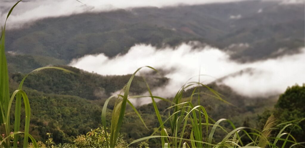 The Hala-Bala forest around Betong, once a jungle stronghold of the CPM · Photo: Lx Rei
The forests around Aiyoeweng are part of Hala-Bala, declared a wildlife sanctuary in 1996. Covering about 391,689 rai on the Titiwangsa Range and continuous with Malaysia's Belum-Temengor forest, it is nicknamed "the Amazon of Thailand" and is home to up to 10 of Thailand's 13 hornbill species. It takes its name from Khlong Bala, which flows into the Bang Lang reservoir, and is a source of the Pattani River.
The sea-of-mist viewpoint is on Microwave Hill at Ban Than Mali, about 2,038 ft (around 620 m) above sea level. The valleys wrapped in tropical rainforest make mist possible almost all year, earning it the title of Thailand's southernmost sea of mist; from here you can see the Hala-Bala forest, the reservoir behind Bang Lang Dam and, on clear days, Malaysia.
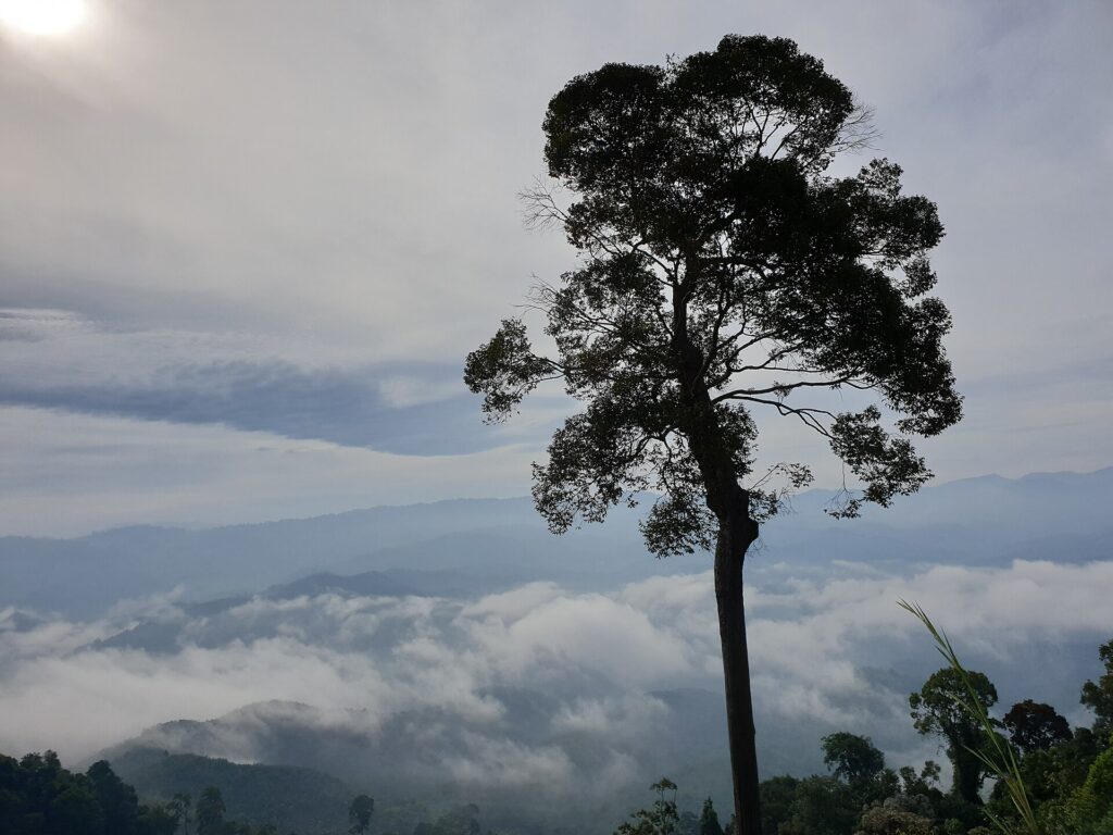 The sea of mist villagers were already taking visitors to before the skywalk was built · Photo: Aoeinista
Before the skywalk, villagers took visitors up to the old viewpoint by motorbike taxi as a source of community income. The state then built a skywalk beside it for more than 90 million baht: a 45 m, six-storey steel tower with stairs and a lift for disabled and elderly visitors, and a walkway reaching out about 61–63 m from the third floor, ending in 4 cm-thick glass — promoted as the longest skywalk in ASEAN.
Construction was delayed when COVID-19 stopped materials ordered from China; by June 2020 it was about 77% complete. On 25 September 2020 the skywalk opened informally every morning from 5:30 to 9:30, free of charge and capped at 360 people at a time. The first weekend drew 2,000–3,000 visitors, causing traffic jams and queue tickets in rounds of 70–100 people; Betong received more than 76,000 visitors that October, mostly from the three southern border provinces, Songkhla, Phatthalung and Phuket.
After closing during the pandemic, the skywalk reopened on trial on 1 December 2021, for visitors with two vaccine doses and an ATK test within 72 hours, in rounds of up to 50 people every 15 minutes. The Aiyoeweng community ran the shuttle service and sold locally made shoe covers at 30 baht a pair, and officials hoped the skywalk would draw Malaysian visitors once the border reopened.
Getting to Betong became easier when Betong Airport received its first flight on 14 March 2022, as Nok Air opened a Bangkok–Betong route. It is the Department of Airports' 29th airport, with an 1,800 m runway for aircraft of about 80 seats and plans to extend it to 2,500 m for jets.
Today private cars park below and community songthaews or motorbikes take visitors up for about 30 baht; shoes are not allowed on the glass, and on busy days the walkway runs in rounds of about 10 minutes. On a good morning it is around 20–21°C, the sun rises at about 6:00–7:30 and the mist often lingers until nearly 8:00. Once a jungle battleground, Aiyoeweng has become a dawn destination where people travel far to see Thailand's southernmost sea of mist.
Location & getting there
Map · how to get there · costs
Directions use live traffic to estimate travel time
- Travel timeAbout 1 hour from Betong town
- RoadWinding mountain road; the last stretch is by shuttle
- ParkingCar park below — private cars cannot drive up to the viewpoint
- FuelPetrol stations in Betong town
Suggested route
From Betong town take Highway 410 (Betong–Yala), then branch off toward Aiyoeweng subdistrict following signs for the sea of mist / skywalk. It is about 35–40 km and roughly an hour on paved but very winding mountain roads; leave town by about 4:30–5:00 for sunrise.
Private cars park at the lot below; from there community songthaews or motorbike taxis take you up (about 30 THB, under 5 minutes).
Without a car, book a van or taxi from Betong — many hotels arrange early-morning trips — or stay in Aiyoeweng close to the viewpoint.
3 ways to get there
Highway 410, then the road into Aiyoeweng; very winding; park below and take the community shuttle
Hire for the early-morning round trip; many hotels can arrange it
Songthaew or motorbike taxi from the car park
Prices and times are estimates and vary with season and traffic
Food nearby
Popular places within 5–10 km